Travel blog
Last article
TOGO: Curiosities
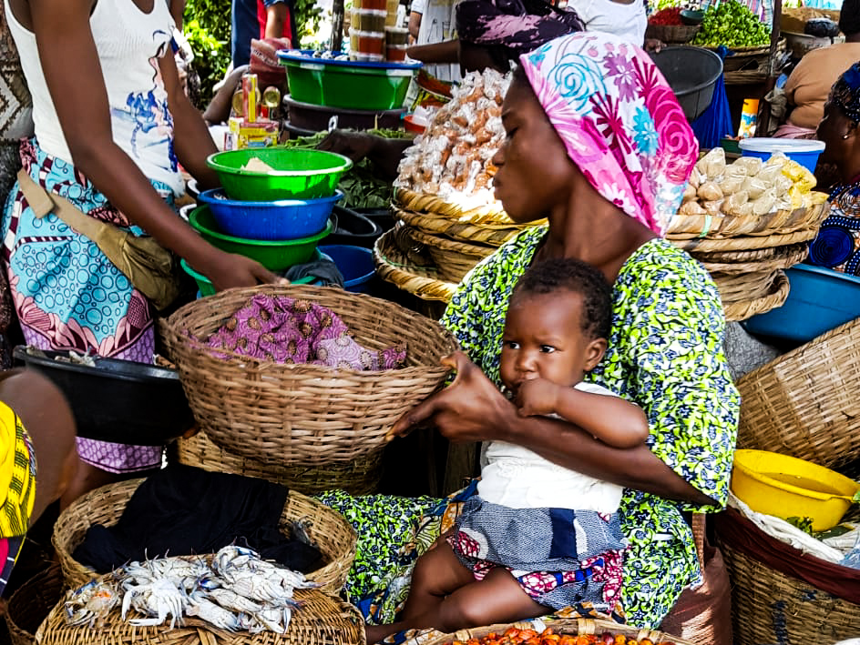
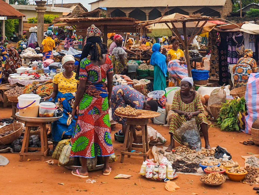
In the Lomé market you will find saleswomen known as Mama Benz. Do you know why? Lomé (if you want to know more, click here), the capital of Togo, has one of the largest markets in West Africa. The Grand Marché is characterized by being located right next to its cathedral, and a few meters from the beach and the old quay of the Germans. It is an immense market where you can find many different products. If you can, go up to one of the first floors to see the market in perspective. But one of the most interesting curiosities you can find in the Grand Marché are the ones known as Mama Benz. Do you know who they are? The saleswomen at many of the fabric stalls that we find in the Grand Marché are known as Mama Benz, a name that was given to all those merchants who became rich by selling fabric and who today are considered the biggest entrepreneurs in the market. It is said that these...

MOST POPULAR ARTICLES

TOGO: Curiosities
In the Lomé market you will find saleswomen known as Mama Benz. Do you know...
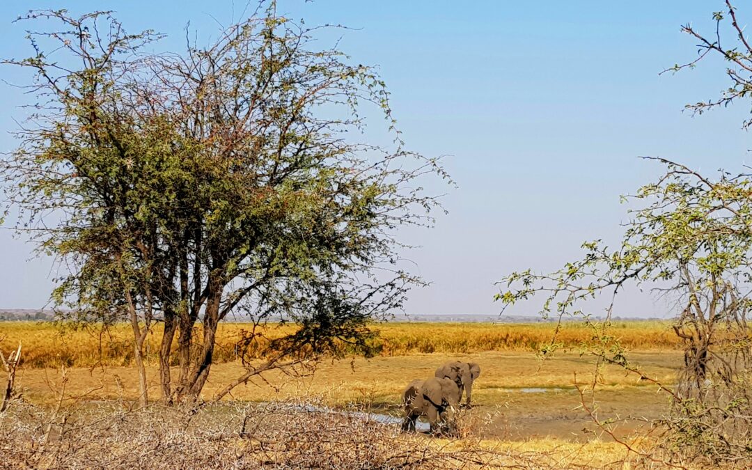
BOTSWANA: The elephants
The first time you meet an elephant on one of your trips to Africa does not...
ALL ARTICLES
TOGO: Curiosities
In the Lomé market you will find saleswomen known as Mama Benz. Do you know why? Lomé (if you want to know more, click here), the capital of Togo, has one of the largest markets in West Africa. The Grand Marché is characterized by being located right next to its...

TOGO: Practical information and its essentials
Capital: Lomé Area: 56.790 km2 Inhabitants: 8.849.000 inhabitants (2022) Population density: 155,82 inhabitants per km2. Languages: Togo is a country where French is the most spoken language. Although it was a German protectorate until the First World War,...

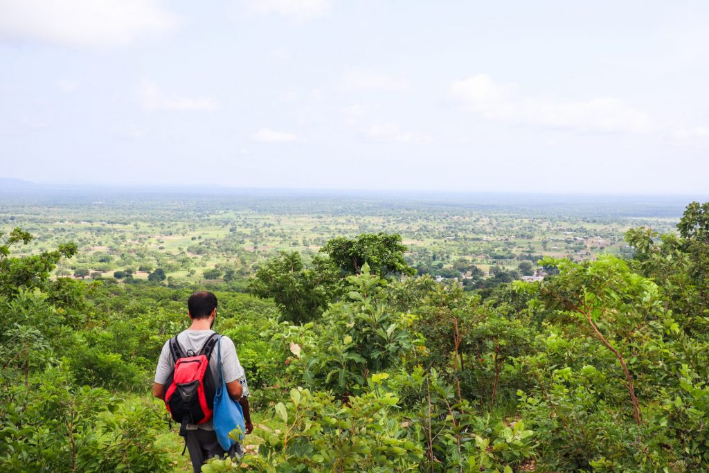
TOGO: Kpalimé, a green and rural paradise of Togo
Kpalimé is the hiking area par excellence in Togo. Located right next to the Ghanaian border, it is an area full of rural villages between mountains, waterfalls, rivers and a green landscape that forms one of the most visited places in the country by nature lovers....

TOGO: Lomé, the strategic center of Togo
Lomé is the capital of Togo and the main city of the country. This country was mainly inhabited by the Ewé tribe, a tribe that was forced to sign an agreement with the Germans in 1884 for their territory to become part of their protectorate. The Germans imported...

TOGO: Kara and northern Togo
Kara is one of the most important cities in Togo. In fact, we could say that it is the most important city in the central and northern part of the country. With a population of around 100,000, it is a city where mostly people of Kabyé origin live. This is one of...
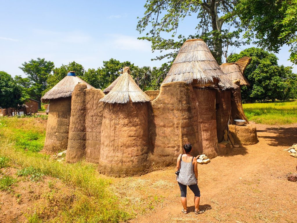
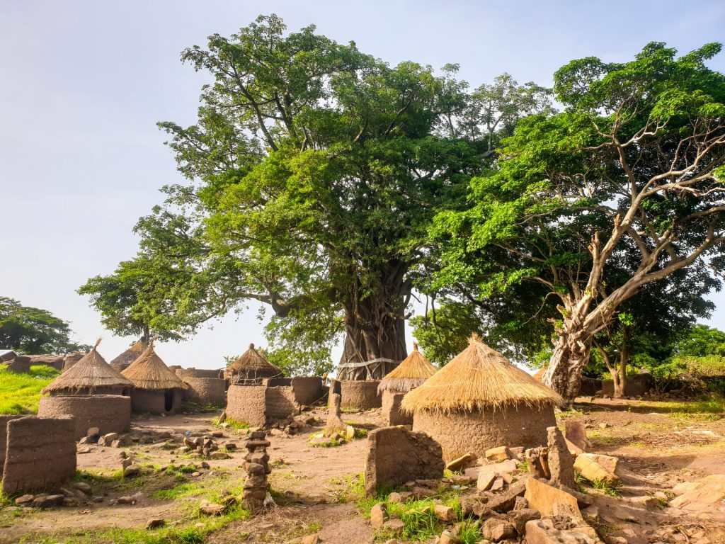
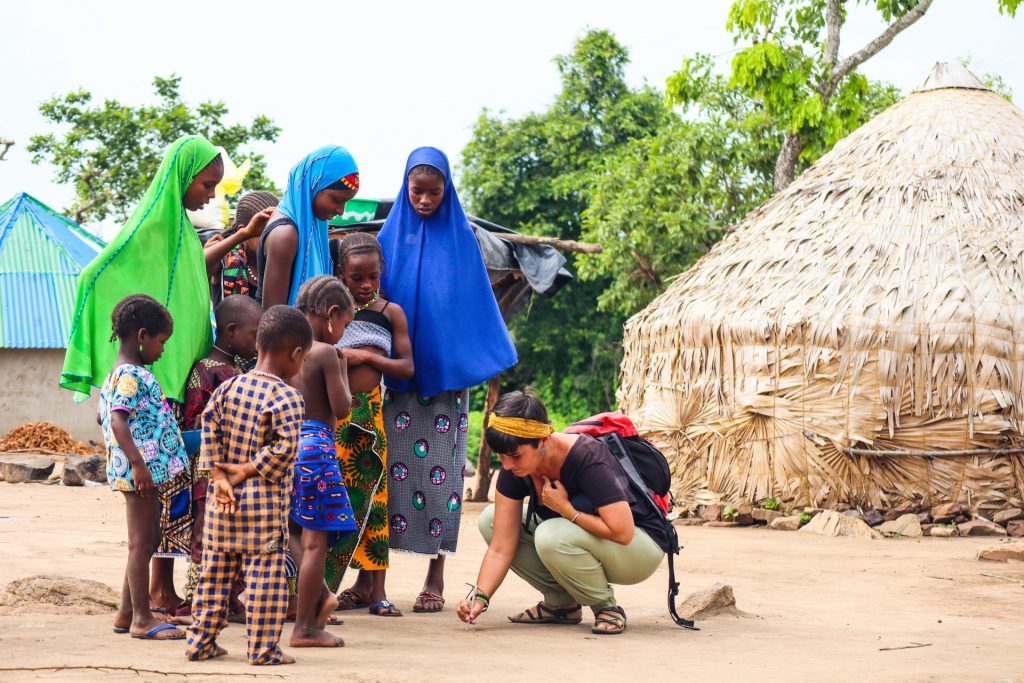
BENIN AND TOGO: Pays Betammaribè and Pays Tamberma, a tribal group with unique constructions
If there is an ethnic group that stands out in the north of Benin and Togo this way, it is, without a doubt, the people known as the Batammariba, the Tammari or the Otomari, a village of farmers who have maintained until today, many of their traditions and customs...

BENIN: Practical information and its essentials
Capital: Porto-Novo Area: 114.763 km2 Inhabitants: 12.996.895 inhabitants (2021) Population density: 113,25 inhabitants per km2. Languages: Benin is a country with great linguistic diversity. We can find up to 55 languages, although the official language of...
BENIN: How to organize a travel around the country?
Benin is a country located on the coast of Guinea that has around 12 million inhabitants. It is an elongated country with an area of 114,763 km2. A former French colony, today this small country stands out for its great cultural diversity and for having voodoo as...
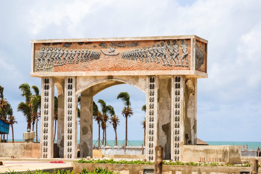
BENIN: Ouidah, the last stop for the slaves before crossing the door of no return
Ouidah is one of the cities with the most history in Benin. In a relaxed and peaceful atmosphere, there we find a great cultural history that explores everything related to voodoo and the history of the first inhabitants of this country. However, this city also has...
BENIN: Cotonou, the city of the Zems
Cotonou is the largest and most important city in Benin. It is where we find the international airport, our first point of arrival in the city that will surely surprise you. Despite being the most populated city, it is not the official capital of Benin. This is...
BENIN: Pays Taneka, the town hidden between mountains
The Pays Taneka is one of the areas we liked the most from our trip to Benin. Located between the cities of Djougou and Natitingou, this ethnic group has lived as refugees in the mountains called Taneka for thousands of years in order to hide from attacks by other...
BENIN: Abomey, one of the most important historical cities in West Africa
The city known today as Abomey and located in south-central Benin was the capital of the ancient Kingdom of Dahomey, one of the most important kingdoms in West African history. This kingdom was established in these lands in 1625 by the Fon tribe. Quickly, it became...
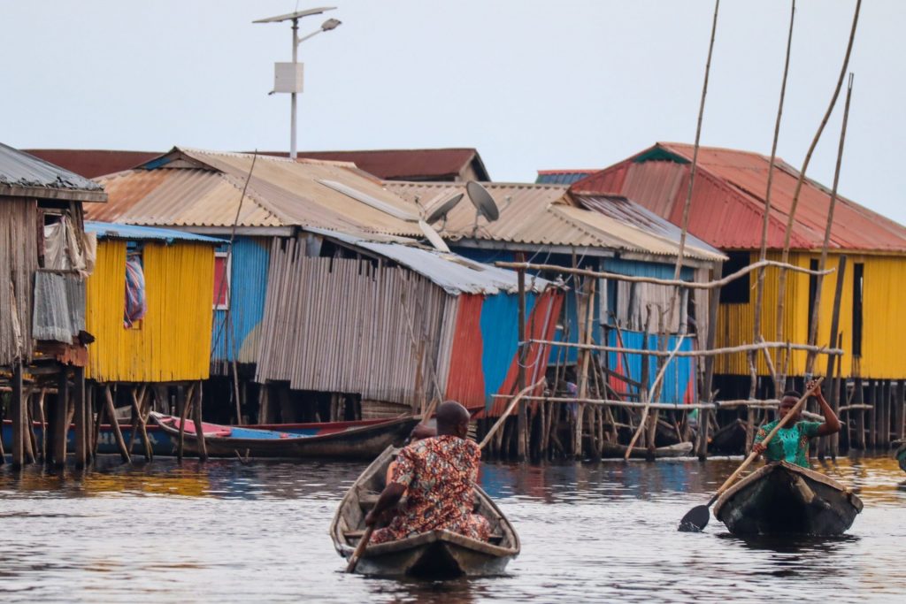
BENIN: Ganvié, the African Venice
Ganvié is one of the most iconic towns in Benin. The reason? Well, it is a floating town built on the waters of Lake Nokoué, a short distance from Cotonou. They say that Ganvié is the African Venice, although we dissertate and we could say that Venice is the...
BENIN: Porto Novo, the capital with Brazilian airs of the country
Porto Novo is the current capital of Benin. Despite having only 250,000 inhabitants and a much more relaxed atmosphere than Cotonou, it has always had an important weight in history. Today, it is a city that houses the main museums of the country such as the...
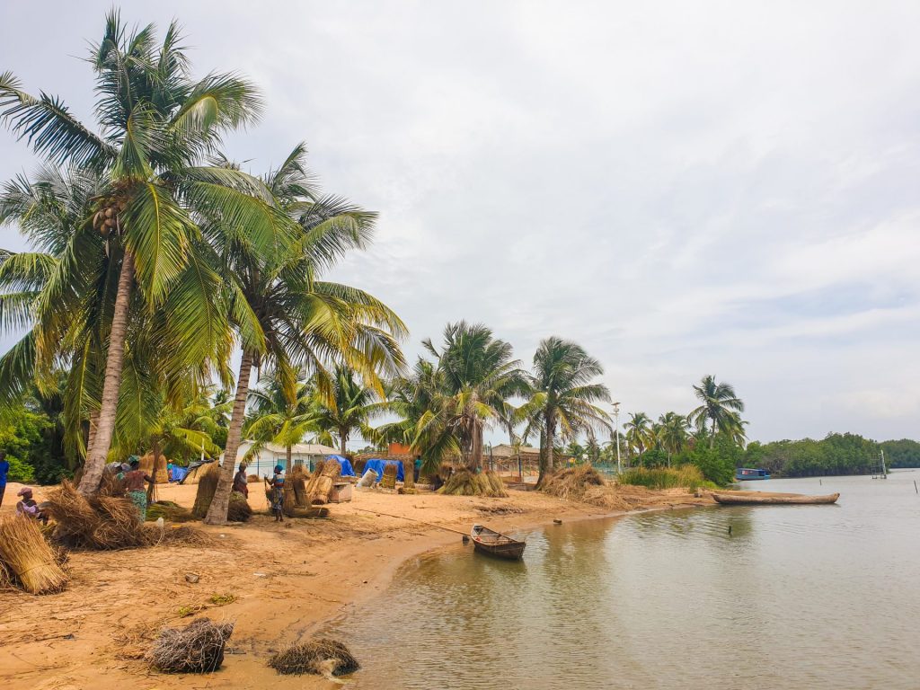
BENIN: Grand Popo, the paradisiacal beaches of Benin
Grand Popo is a tourist region that is approximately two hours from Cotonou and is just below Togo. It is an area that stands out for its beaches, and is located on an arm of land between the Atlantic Ocean and the marshes of the Mono River. A region that will...
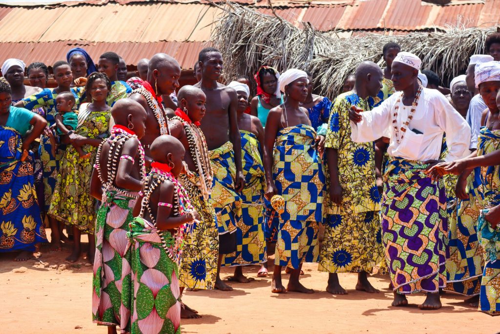
BENIN: The ethnic diversity of the tribal groups found in the center of the country. The Holi, the Geledé dance, the Fulani and Dassa
Benin is a country noted for the presence of different tribal groups. During its history, probably the one that stood out the most was the kingdom of Dahomey (formed in the current Abomey and where we find the different royal palaces. If you want to know more, you...
LESOTHO: Curiosities
Lesotho is also known as "the kingdom of the sky". Do you know why? Lesotho is a paradise. It is a mountainous country that is located more than 1,000 meters high. In fact, it is the country that has the lowest level at the highest altitude in the world. Its...
LESOTHO: Practical information and its essentials
Capital: Maseru Area: 30.355 km2 Inhabitants: 2.125.268 inhabitants (2019) Population density: 70,01 inhabitants per km2. Languages: The official languages of the country are Sesotho and English. In fact, Lesotho is one of the few African countries where only...
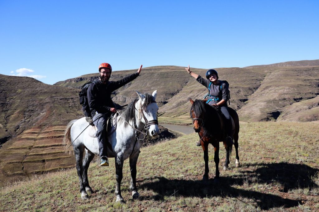
LESOTHO: The Mokhotlong region and our two-day horseback ride through the Lesotho Highlands
Mokhotlong is a city and district at the same time, in the northeastern part of the country. It's the first major city with an airport that you'll find if you pass through the Sani Pass, an all-terrain vehicle-only mountain pass that challenges all road and 4WD...
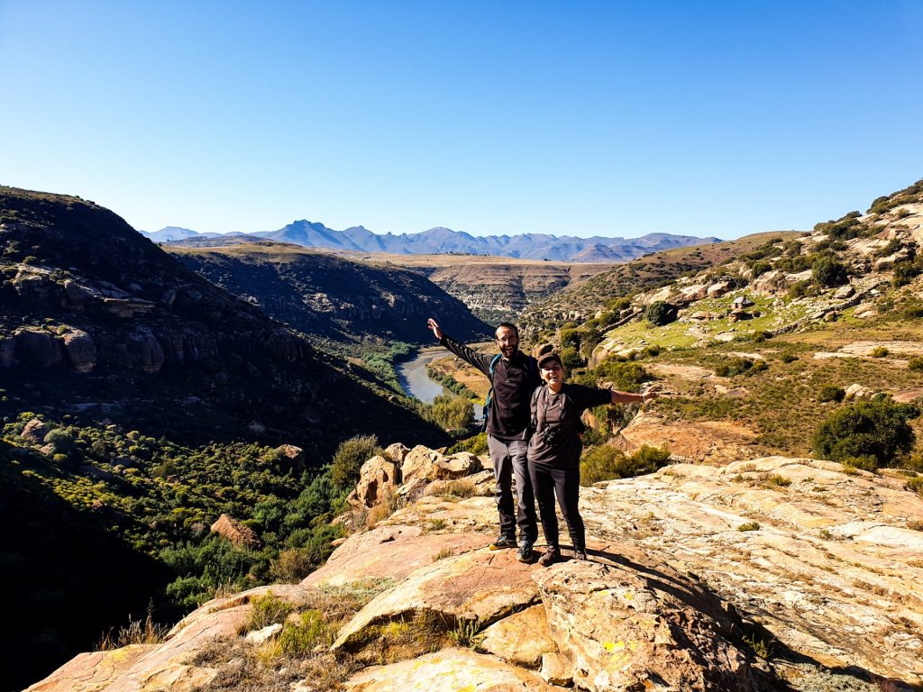
LESOTHO: Malealea, the Makhomalong valley and the gates of paradise
In the west of the country, there is a small paradise surrounded by mountains: the Makhomalong valley. This green valley surrounded by the Maloti Mountains is well sheltered from the neighboring and bustling Maseru, some 80 km away. Here the sound of horns, the...

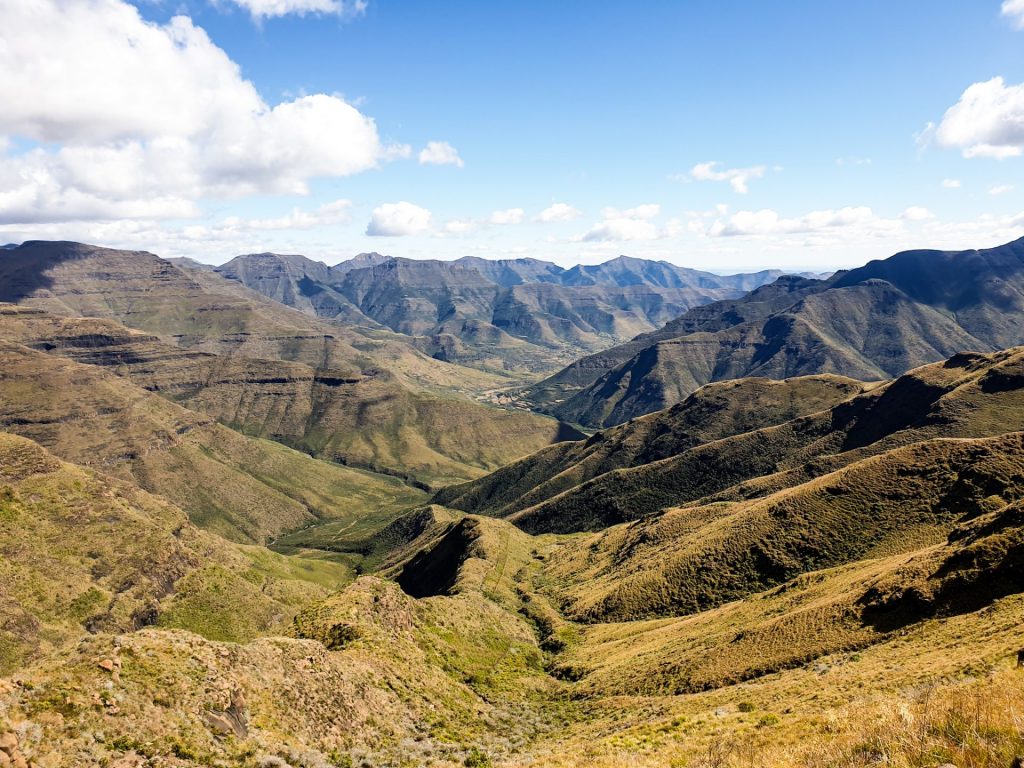
LESOTHO: From the Highlands to the Lowlands of Lesotho: a route through the north of the country
One of the most beautiful routes in the country in terms of landscape, is the Northern route that follows the country's A1 road. This route passes through some of the highest points in the country, known as the Highlands, and then descends into the lowlands known...
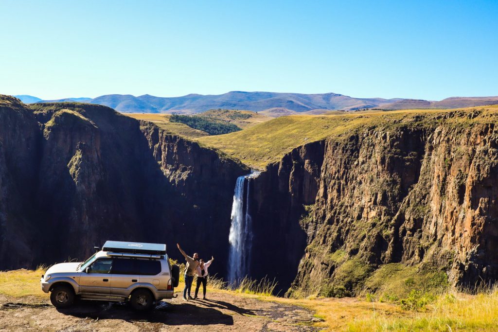
LESOTHO: Semonkong and Maletsunyane Falls
Semonkong, or place of smoke, is a village located in the south-west of the country, in the Maseru region. The name "place of smoke" is due to the nearby Maletsunyane Falls which are the highest single jump falls in southern Africa at 192 meters and which create a...
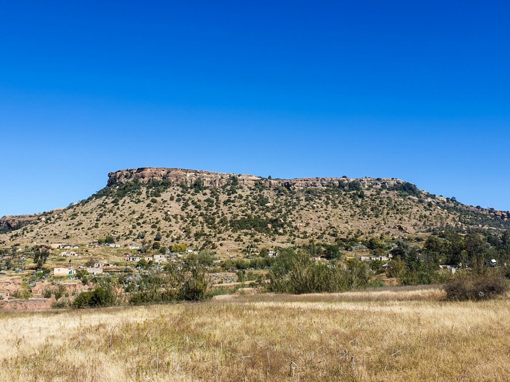
LESOTHO: Thaba Bosiu, the most important mountain of the country
Thaba Bosiu is one of the most special places to visit during your Lesotho tour. It is considered the birthplace of the Basotho nation, and the country's major historical events have taken place there, and you can also find the country's major kings buried there....
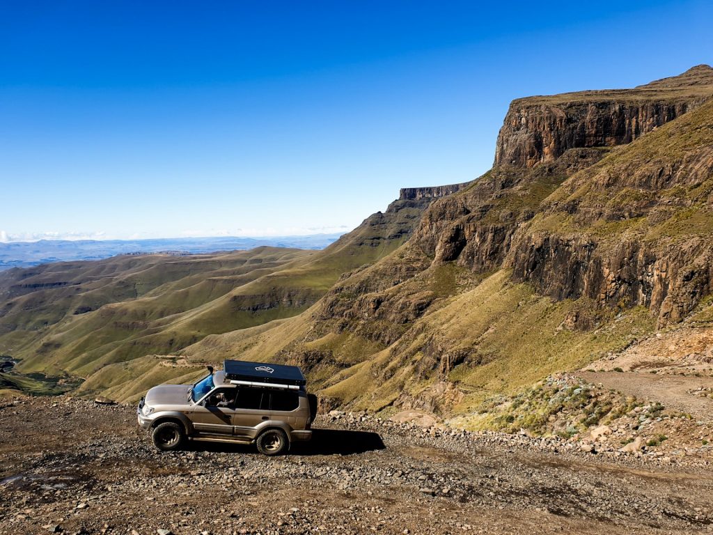
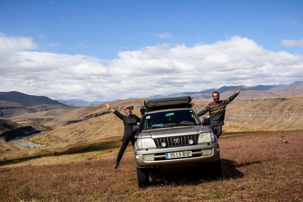
LESOTHO: Sani Pass
One of the most iconic ways to enter or leave Lesotho is through the Sani Pass. The Sani Pass is a mountain pass suitable only for off-road vehicles that is a challenge for all those who love road routes and that connects South Africa with the Kingdom of Lesotho....
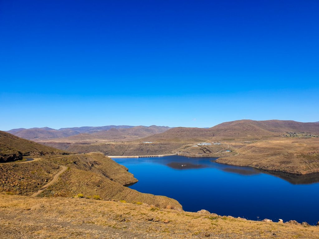
LESOTHO: Katse Dam
The Katse Dam is an engineering spectacle, a human attempt to control the water, which in this area, is plentiful. By visiting this architectural spectacle you can understand, without much knowledge, how colossal this work is and the advantages and disadvantages...
LESOTHO: Ts’ehlanyane NP
Ts’ehlanyane National Park is the largest national park in Lesotho. In fact, it is one of the two national parks that we find in the country, along with the more inaccessible Sehlabathebe, which is located south of the Sani Pass. The Ts'ehlanyane is part of the...
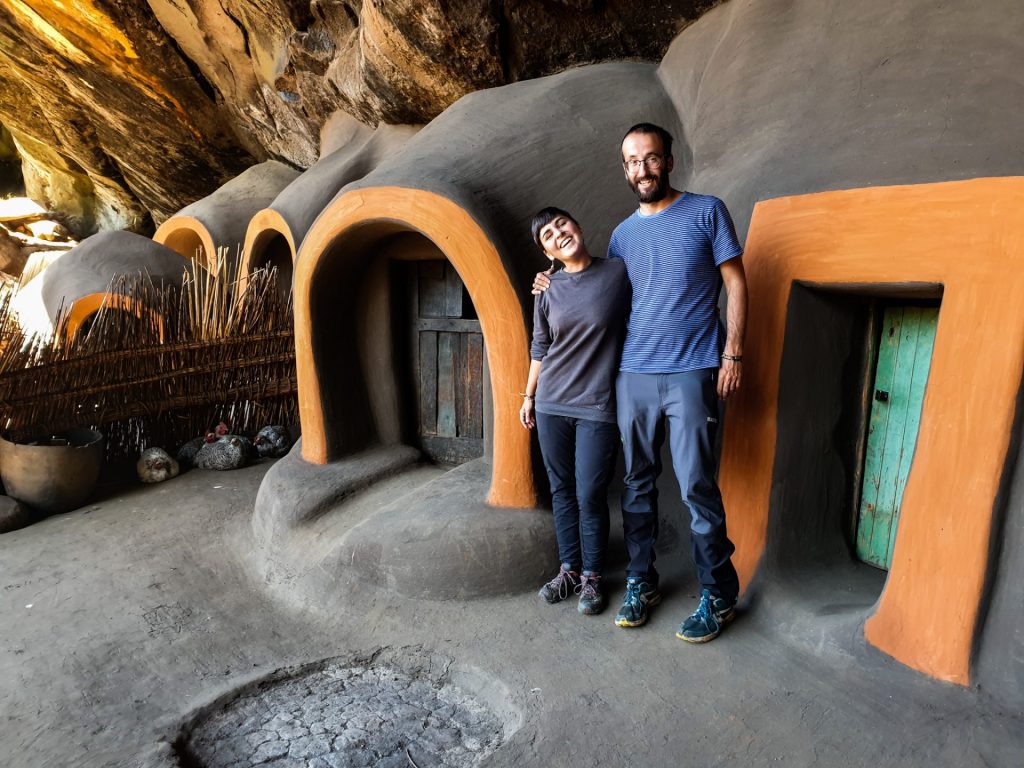
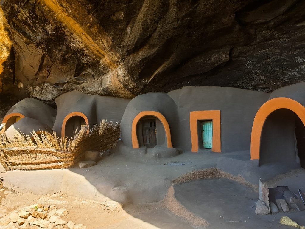
LESOTHO: Ha Kome caves
The Ha Kome Caves are one of the most curious places you can visit in Lesotho and have been classified as a World Heritage Site. These caves consist of five cave houses made of mud built inside a large cavern. Kome Caves are also known as Komaisa Caves or "the...
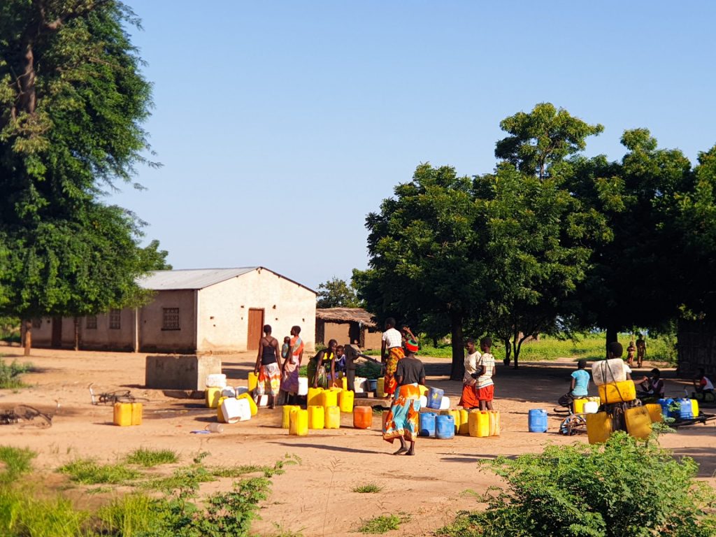
MALAWI: Curiosities
Malawi and its people are known as the "warm heart of Africa". Do you know why? Malawi is known internationally as "the warm heart of Africa". The reason? His people. When you travel this country, you will be surprised by the kindness and hospitality of its...
MALAWI: Practical information and its essentials
Capital: Lilongwe Area: 118.484 km2 Inhabitants: 18.628.747 inhabitants (2019) Population density: 157,23 inhabitants per km2. Languages: The official language of Malawi is English, as this country was a British colony. Chichewa is the principal language...
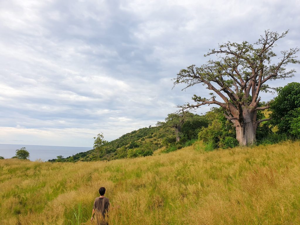
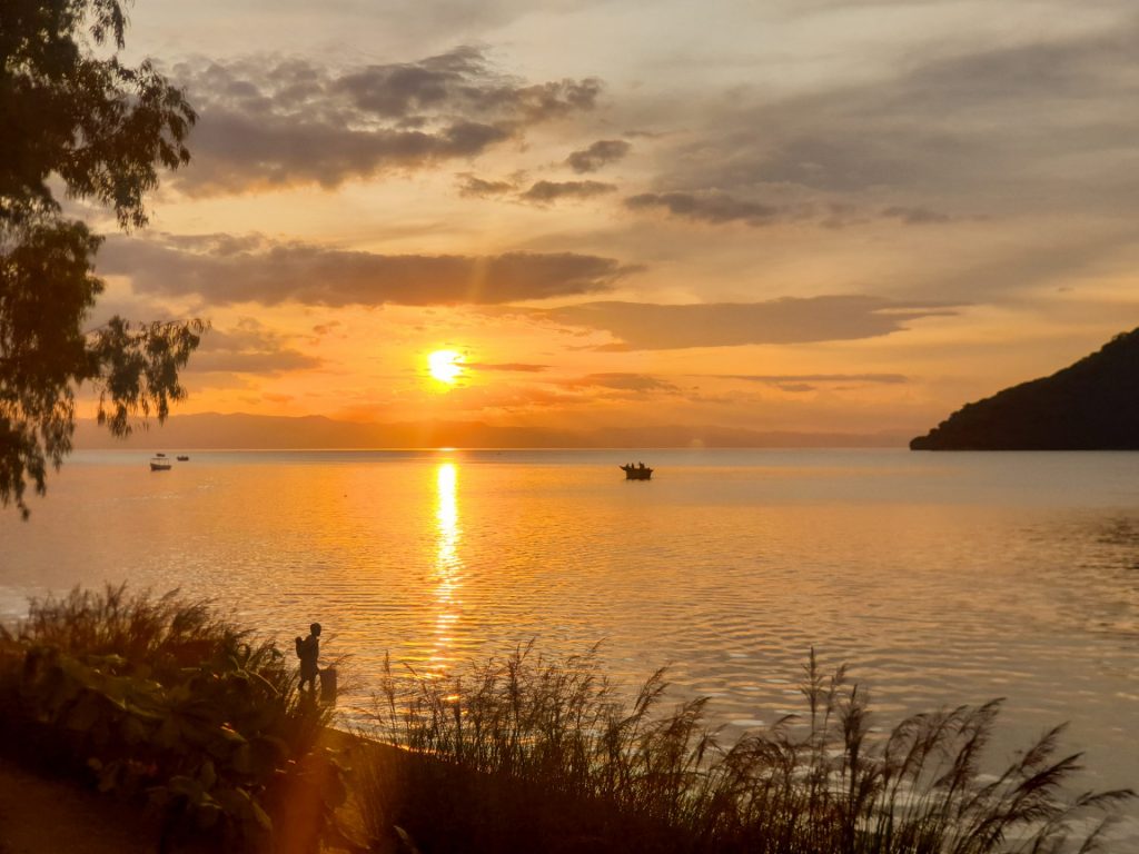
MALAWI: Likoma Island
Likoma Island is one of the places we liked the most during our trip to Malawi. It is a small island located in the center of Lake Malawi, very few kilometers from the Mozambican coast of the lake. In fact, together with the island of Chizumulu, these two small...