


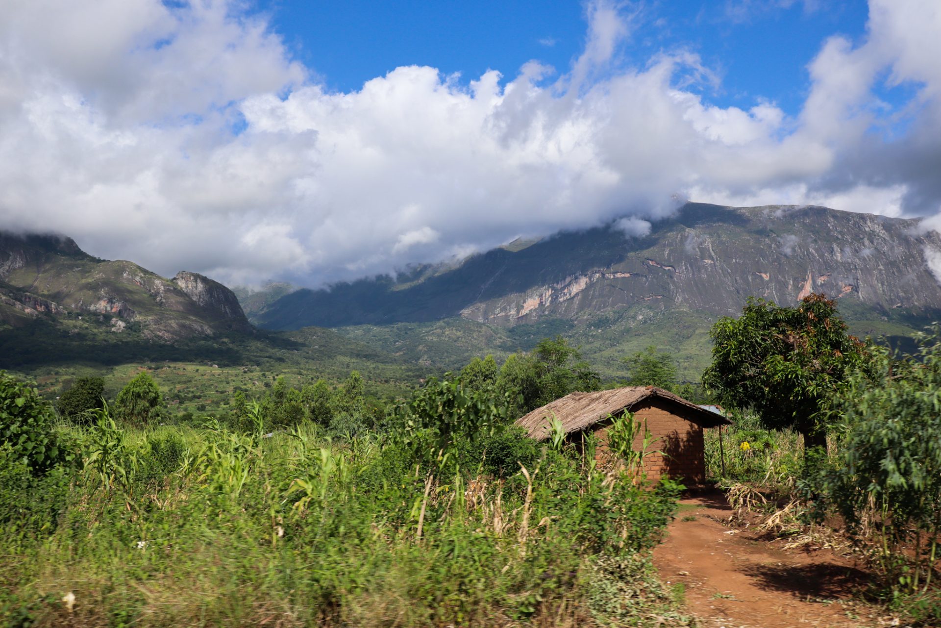
The Mulanje area is where we find the highest peaks in Malawi. Located between Blantyre and Zomba, and very close to the border with Mozambique, we find this massif that majestically imposes itself in the south of the country. A rural area, which stands out for its tea plantations and for the different hiking routes that you can do around the different mountains of the Mulanje massif.
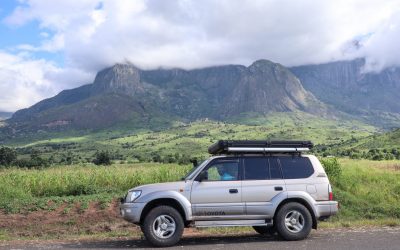
The highest mountain in Malawi is Mount Mulanje, with an altitude of 3,002 meters above sea level. This peak is surrounded by other mountains of similar height that form a massif that was once a volcano. There are different routes to do, with various levels of difficulty and route days; and where you can climb the highest peak and also some of the surrounding mountains. You can visit different waterfalls and, if you are a climbing lover and expert, climb one of the highest vertical rock walls in Africa: the Chambe Peak.
Due to the amount of water and the climate that prevails in this area, during colonial times, when Malawi was known as Nyasaland and was part of the British, they began to grow tea in the area of Blantyre and Mulanje. Today, the plantations are still maintained where you can see the whole process of picking the tea (mostly done by hand and with scissors) and an environment that we are not at all used to.
If you are mountain and nature lovers, a visit to Mulanje is a must. Not only will you find a very beautiful landscape, but you will also get to know a rural area of the country with a very simple and hospitable local population and where you will understand why Malawi is known as “the warm heart of Africa”.
How to get there?
The Mulanje massif is located in the south-east of the country, very close to the border with Mozambique. Its main town is Mulanje which is located on the M2 road, a paved road in good condition. This area is relatively close to Zomba and Blantyre.
If you are coming from Blantyre, the most important economic city in the country, you will have to exit south, and just after the Limbe Country Club golf club, continue on the M4 towards Thuchila. From Blantyre to Mulanje there is a distance of 69 kilometers that you can do in a journey of approximately 60-75 minutes, depending on the traffic you encounter when leaving Blantyre.
If you are coming from Zomba, you will have to take the M3 towards Liwonde, and just after leaving Zomba take a right junction onto the S143 (which turns into the S144). You will pass by the military airport, on a 67 kilometer paved road that ends in the town of Phalombe, just north of the Mulanje massif. This road passes through different towns, and from there you can see how you approach the highest mountains in the country. Once you arrive at Phalombe, you will have to turn to your right on the S147 road, following the entire massif, until you reach the town of Mulanje after 45 kilometers via the M2. Doing this whole route (from Zomba to Mulanje), it takes approximately 2 hours to travel.
Consider that there are different entrances to access the Mulanje massif. On this map, you can see the different towns at the foot of Mount Mulanje:
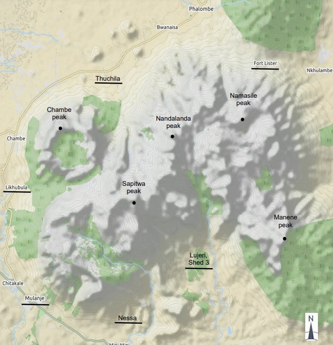
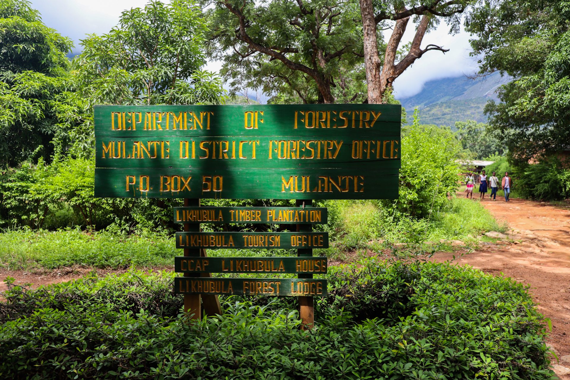
We accessed it through Likhubula, which is 13 kilometers before the town of Mulanje. As you can see, there are different access points marked depending on which hiking route you want to do and which area you want to visit. Remember that to do the routes it is mandatory to go with a guide, and if it is for more than one day, with porters. An entrance fee of 1,000 MWK per person per day must be paid to access there. Next, we’ll explain the different hiking options in the area.
What to do in Mulanje?
The main activities to do in the Mulanje area have to do with nature and the mountains. We will highlight some of the routes we did and those that were recommended to us, but we recommend that you look at this link where you will find all the possible routes to do detailed with differences in elevation, route, duration, number of kilometers… It is a very interesting document from 2017 made by the Mountain Club of Malawi.
Walk to some of the waterfalls of the Mount Mulanje, such as the Likhubula Falls
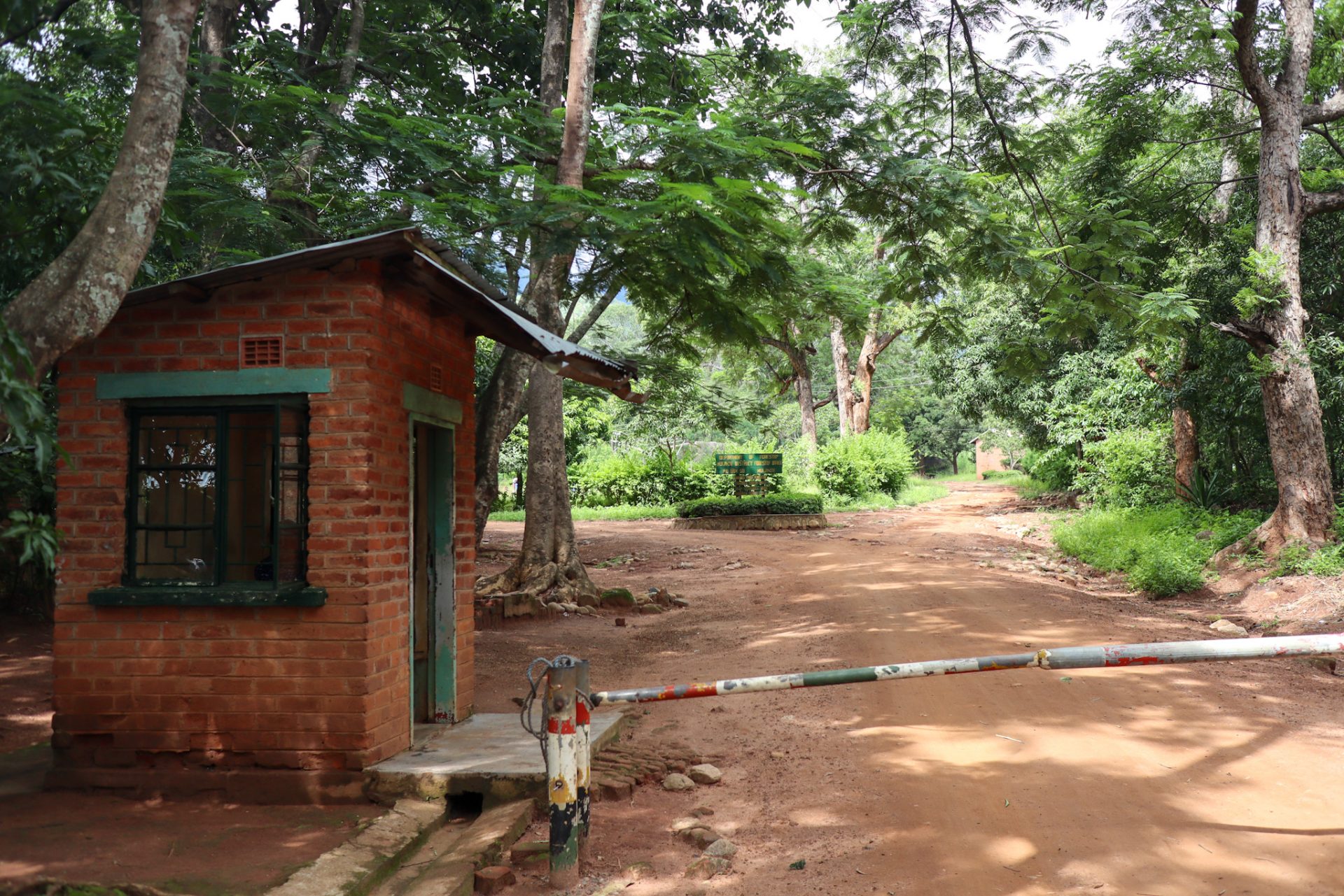
Next to the town of Likhubula, we will find one of the access gates to the Mulanje massif where you will have to pay 1,000 MWK per person per day. Just before reaching the access, you will find different people who will insist on accompanying you as a guide, as it is mandatory. We recommend that you contact Francis, who is a very nice guy who lives in the area and knows very well all the routes in Mulanje. His telephone number is +265884406058.
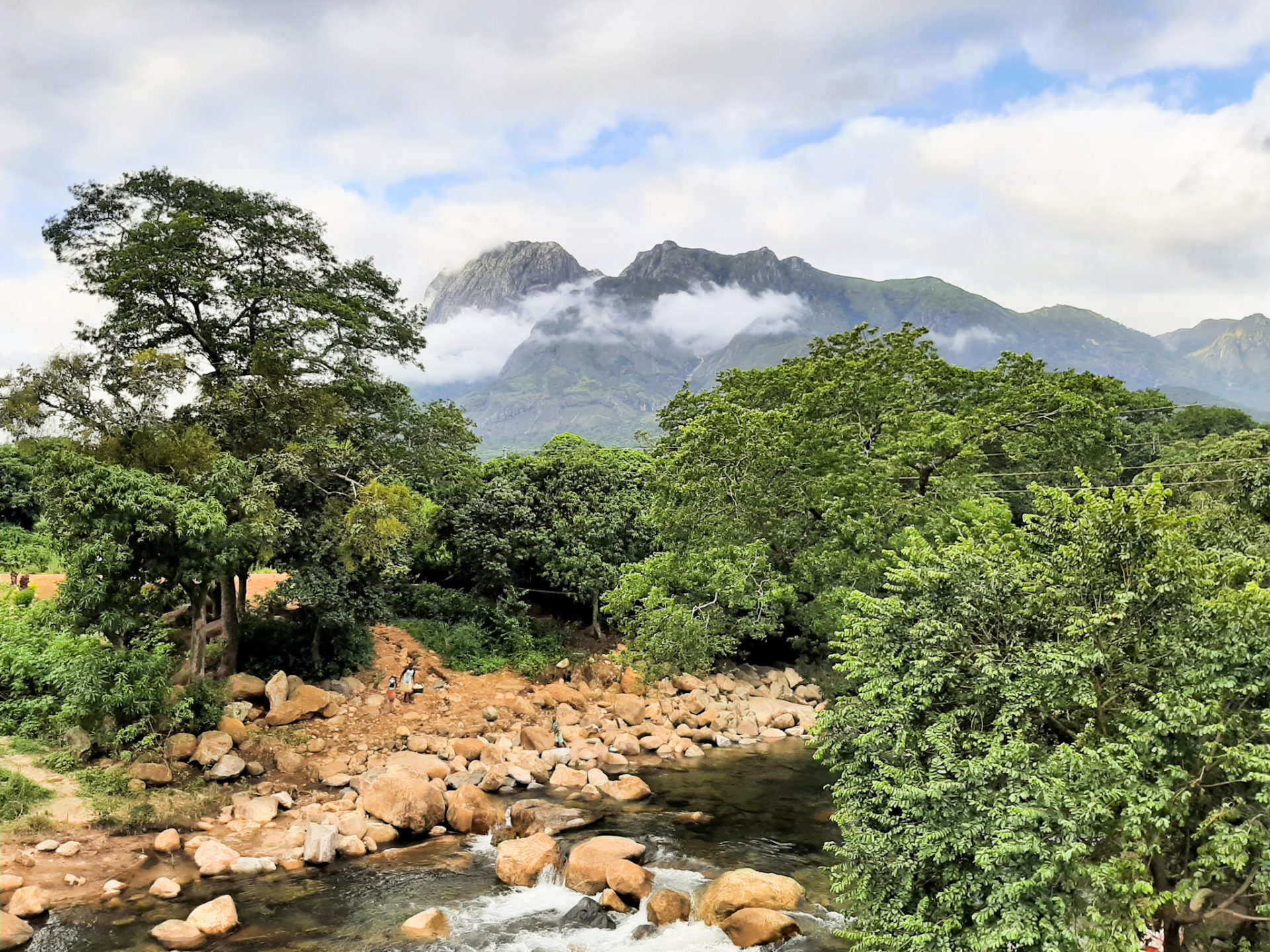
Once you have paid the entrance fee at the Likhubula access gate, one of the shortest and easiest routes is the one that goes to the Likhubula Falls. The fact that these mountains suddenly rise in a plain causes rain clouds to form that create different rivers and, consequently, different waterfalls. Apart from those of Likhubula, the Thuchila Falls or the Madzeka Falls are also known.
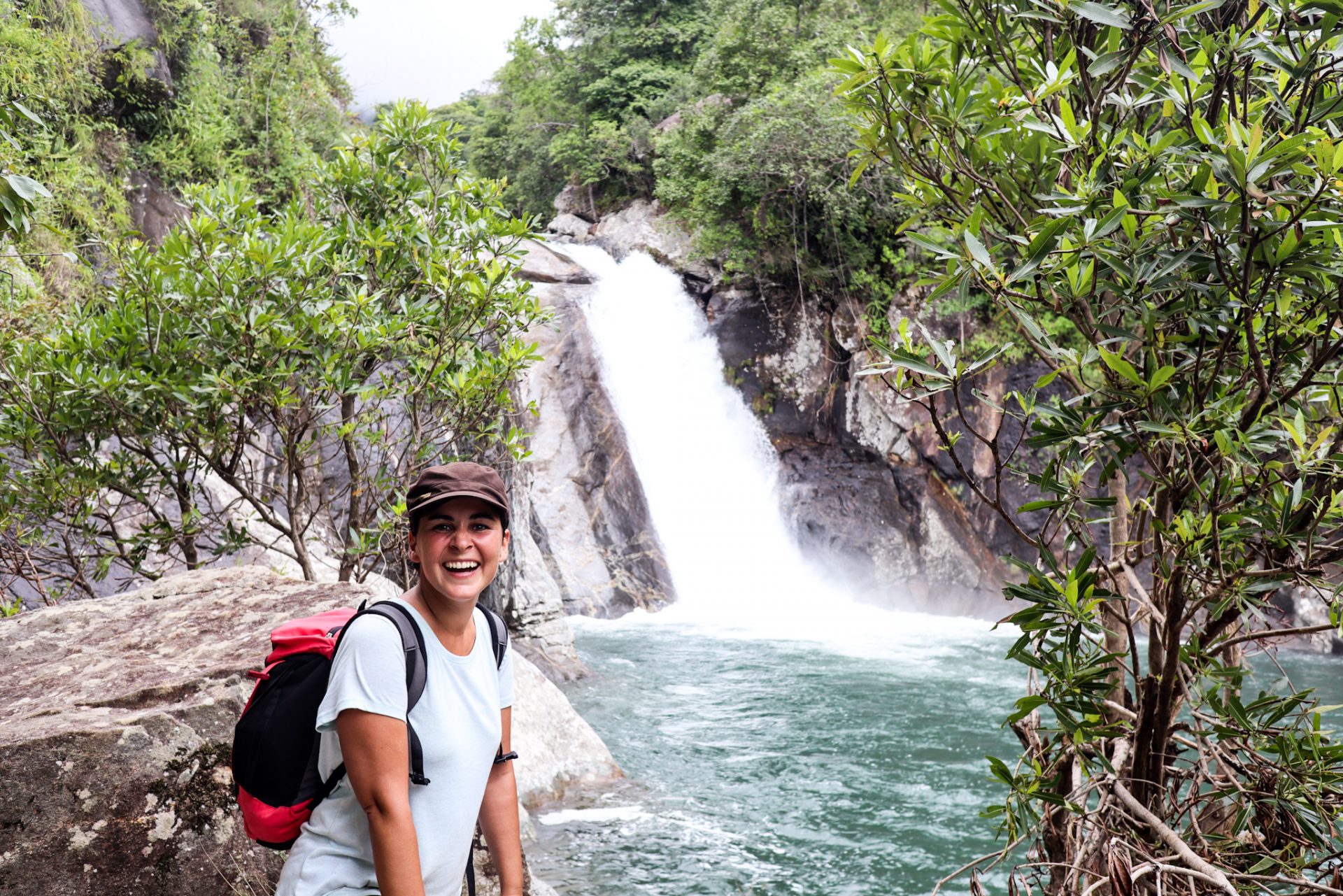
The journey to the Likhubula waterfalls takes about two hours, passing through a wooded area at the beginning of the massif. An easy route to do with children. We visited the Likhubula Falls when we were coming down from the Chambe Basin, one of the most popular routes to do in Mulanje.
Go hiking to one of the famous trails next to the highest mountains in the country: the Chambe Basin trail
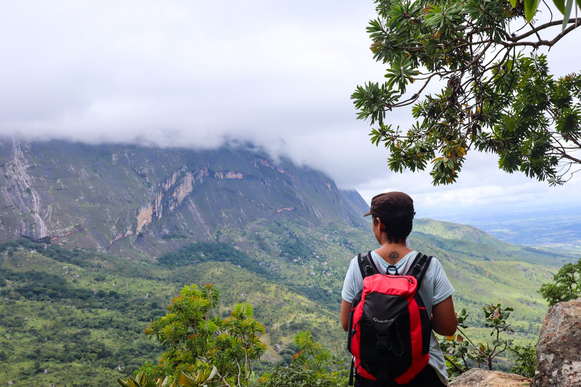
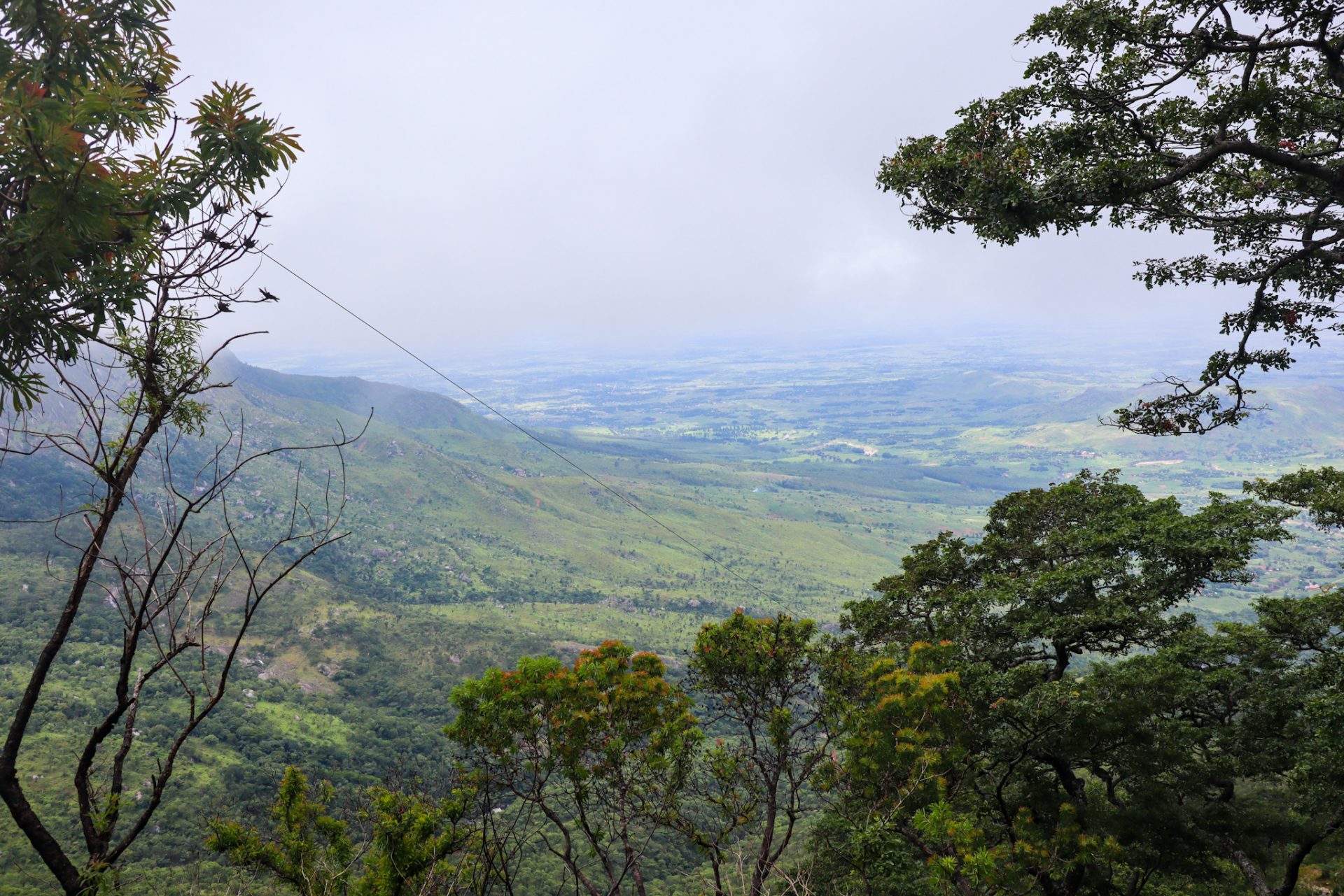
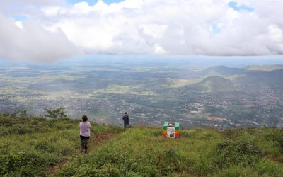
Also from Likhubula, one of the best-known excursions to discover the Mount Mulanje is the Chambe Basin, where, according to Francis, you can have spectacular views of the mountains and the entire plateau. When we did it, in the last part a series of gray clouds began to appear, covering all our views.
This route of around 12 kilometers is quite demanding as there is a positive difference of 1,000 meters in the first 3 hours of the route. You just go up and up, and you get a perspective on your whole environment.
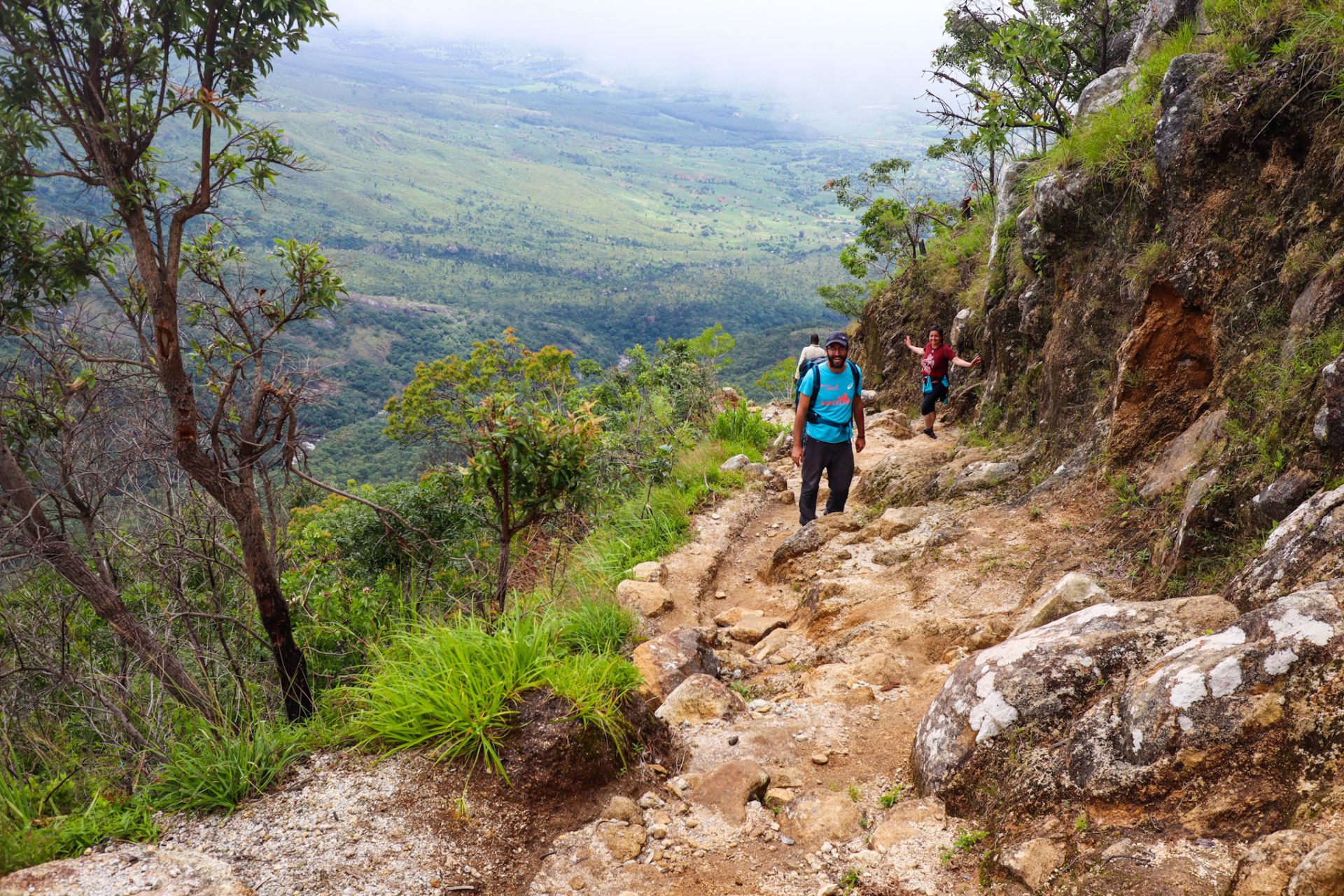
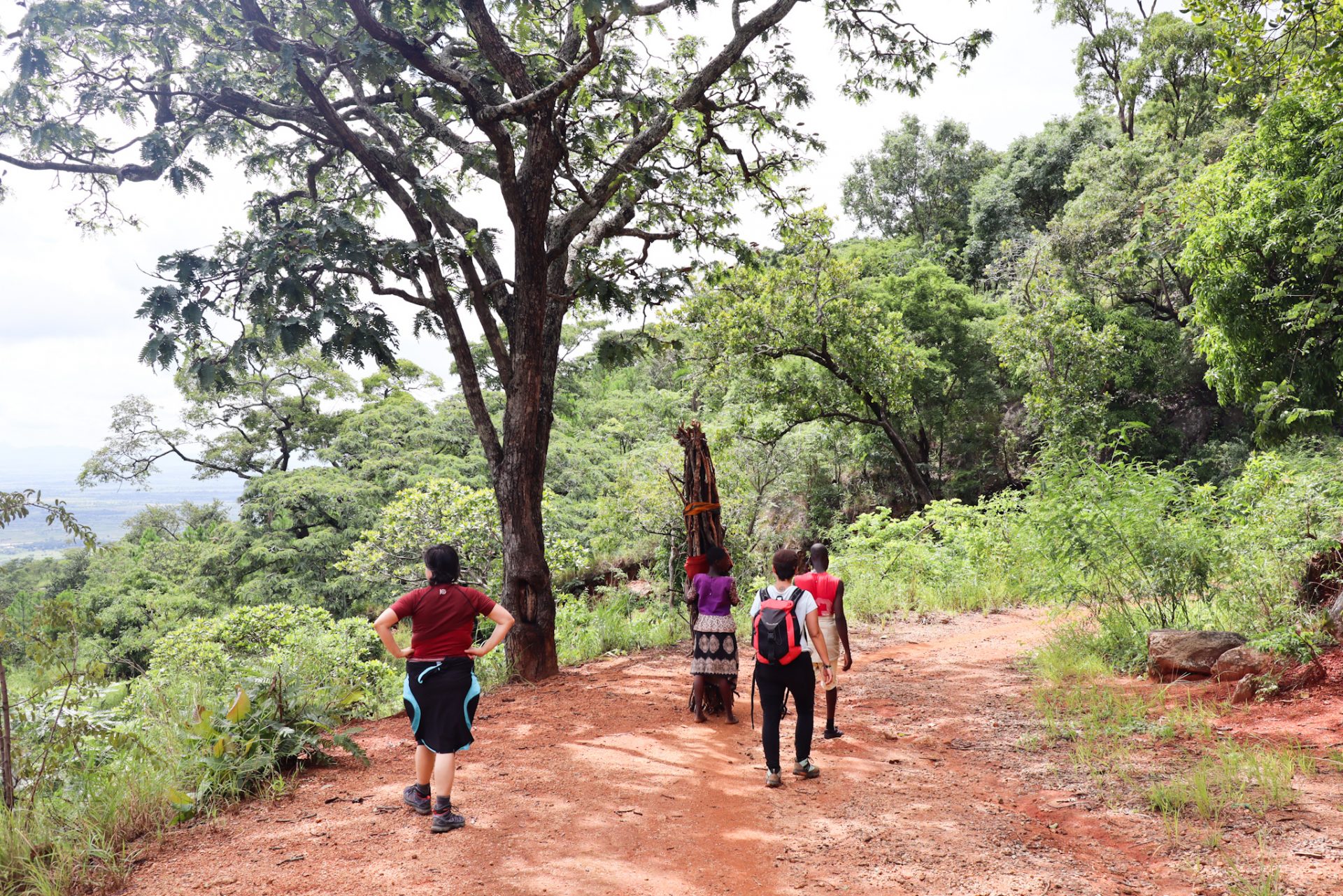
You’ll pass through different forests where you’ll meet locals carrying tree trunks on their heads, while you gasp looking up. But the landscape and views are very beautiful. We were unlucky that it got cloudy at the end because it would have been very nice to have a view of the old crater that forms the Mulanje massif.
On our way back, we decided to stop at Likhubula Falls as it was close to our route, and returned after 6-7 hours of route to the Likhubula gateway. A tough route if you are not used to walking in the mountains, but with a very beautiful landscape.
Climb one of the most vertical walls on the African continent
In Mulanje, we find Chambe Peak, considered one of the highest vertical rock walls on the African continent. If you are a climbing lover and you are in Malawi, you will surely not want to miss this ascent.
With a route of 650 vertical meters, you will find two climbing options to do. In this link you will find a description of the route. It is essential to do this activity with a local guide, which you can find for example on the website of the Mountain Club of Mulanje.
Do a hiking route for different days in the Mulanje area
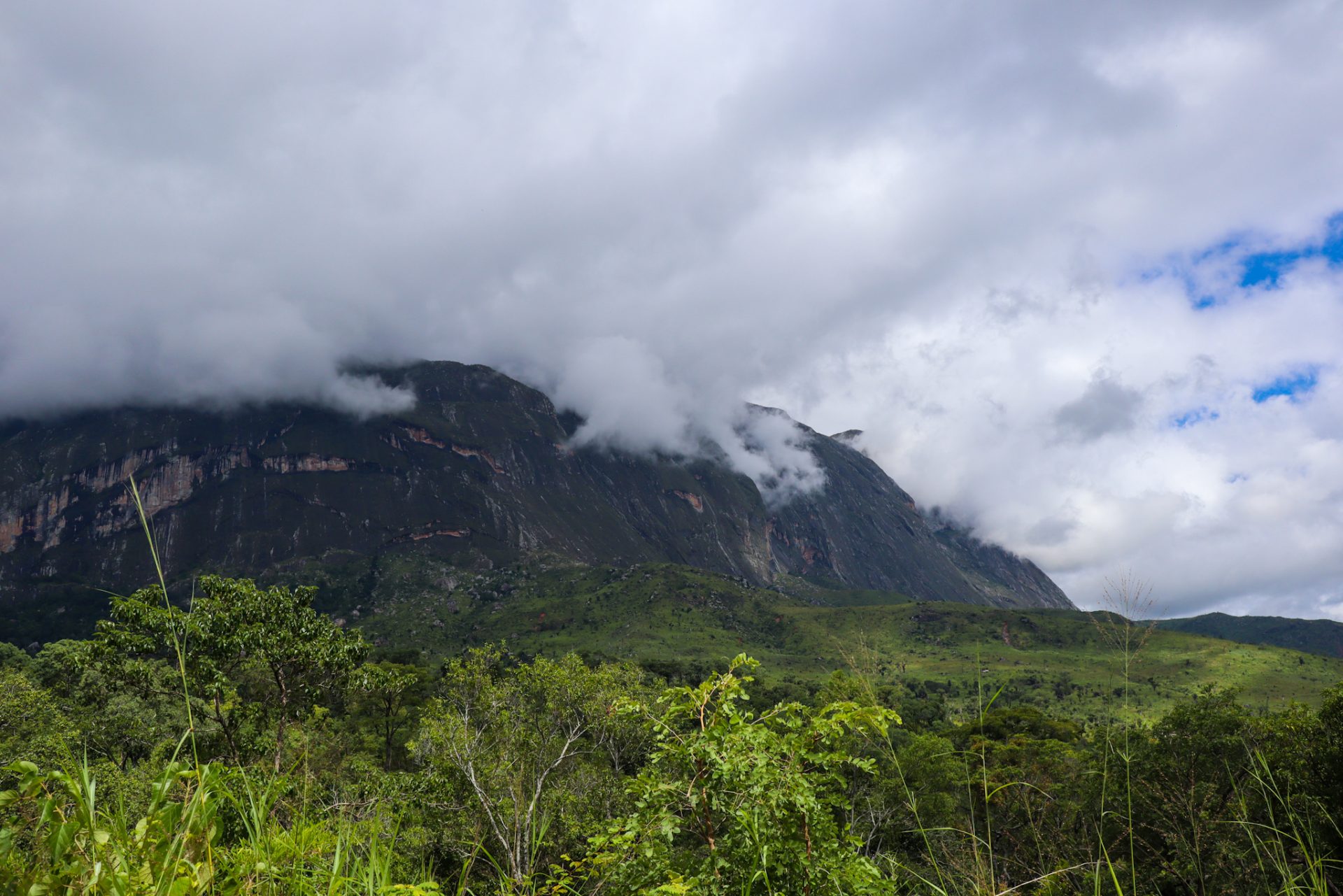
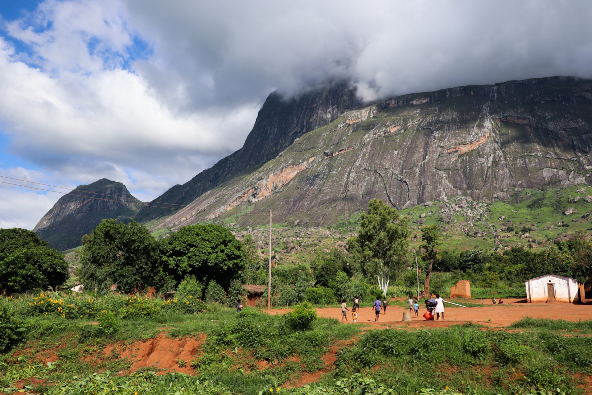
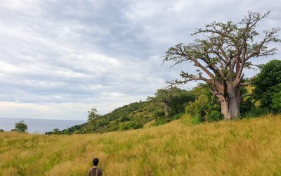
The Mount Mulanje, which rises sharply from the Phalombe plain at an altitude of 3,002 meters, is the highest area in Malawi. It is characterized by being a densely wooded area (you will find many locals carrying firewood that they chop by hand), with a unique species of tree known as the Mulanje cedar. The highest point, Sapitwa Peak, favors the formation of rain clouds, making it an important source of rainwater for all the rivers that originate at the foot of the hill. As well as being home to numerous plant and animal species, the Massif is also a popular place for hiking and climbing.
In fact, this Sapitwa peak is shrouded in mystery because in its local language, this word means “the place where people must not go”. They say that the spirits live there and that whoever goes up there, no longer returns to earth. But, nowadays, it is a hiking route that you can do in 3 days.
Some of the most popular excursions in the Mulanje area can be found on this link from the Mountain Club of Malawi where all the possible routes are very well explained. Think you’ll need to contact a guide. We recommend that you contact Francis (+265884406058) who lives in the area and knows very well the different hiking routes you can do.
Walk next to the tea plantations you will find in Malawi
Tea cultivation in Africa began around the 1850s in Natal, South Africa, where it was later abandoned for sugar. The British influence in Africa caused many explorers to bring tea plants to try this crop in the new lands they were beginning to discover during the 19th century, such as Kericho (Kenya). After South Africa, Malawi (formerly known as Nyasaland) is considered the oldest tea producer on the continent.
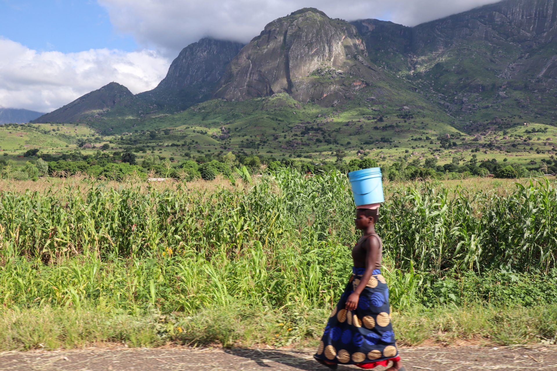
In the Mulanje area, you will find a large part of the country’s tea plantations, where approximately 20% of these are taken by small farmers. If you walk around, you can visit some of the plantations and see how the locals grow the tea, how they harvest their leaves with scissors and how they collect it in a very beautiful setting, with the mountains of the massif very close by. A very enriching experience and, more so, if you are not used to seeing this type of cultivation.
Where to sleep in Mulanje?
If you take a route of more than one day inside the Mulanje massif, you will find ten huts to sleep in, nine of which are managed by the Mountain Club of Malawi. In this link you can see the different accommodations within the massif. On the other hand, if you want to sleep outside, you will find other accommodations, among which we highlight:
– Likhubula Hiker’s Nest: Located just a few meters from the Likhubula gateway, this accommodation is one of the best value for money options when visiting the Mulanje area. It has rooms and also a camping space. For more information you can contact them on +265881915825 or +265881487678 (Stanley).
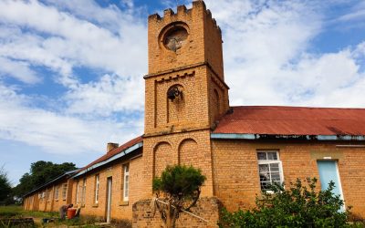
– CCAP Likhubula House: This accommodation is located inside the Mount Mulanje Area, just after the Likhubula access gate. It is a quiet hostel that has different types of rooms (dormitories, apartments with kitchen…) and from where different routes start to explore the Mulanje massif. For more information, you can contact them at +265888863632.
– Thuchila Tourist Lodge: This accommodation is near the access to Thuchila. It has rooms, a bar and different services to access the Mount Mulanje. For more information, you can contact them at +265888874500.
– Nalipiri Eco Resort: This accommodation located in the town of Mulanje is of a higher category than all the others. It has a swimming pool, parking, restaurant and different types of rooms with prices around 35,000 MWK for a double room. For more information you can contact them on +265992073399.
Our route
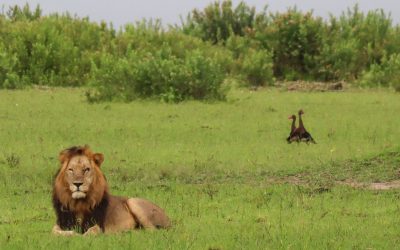
DAY 1: After getting up early to enjoy an early morning game drive in Liwonde NP and seeing different animals such as lions, elephants, hippos and antelopes, we drove the almost three hours to reach the gates of Likhubula.
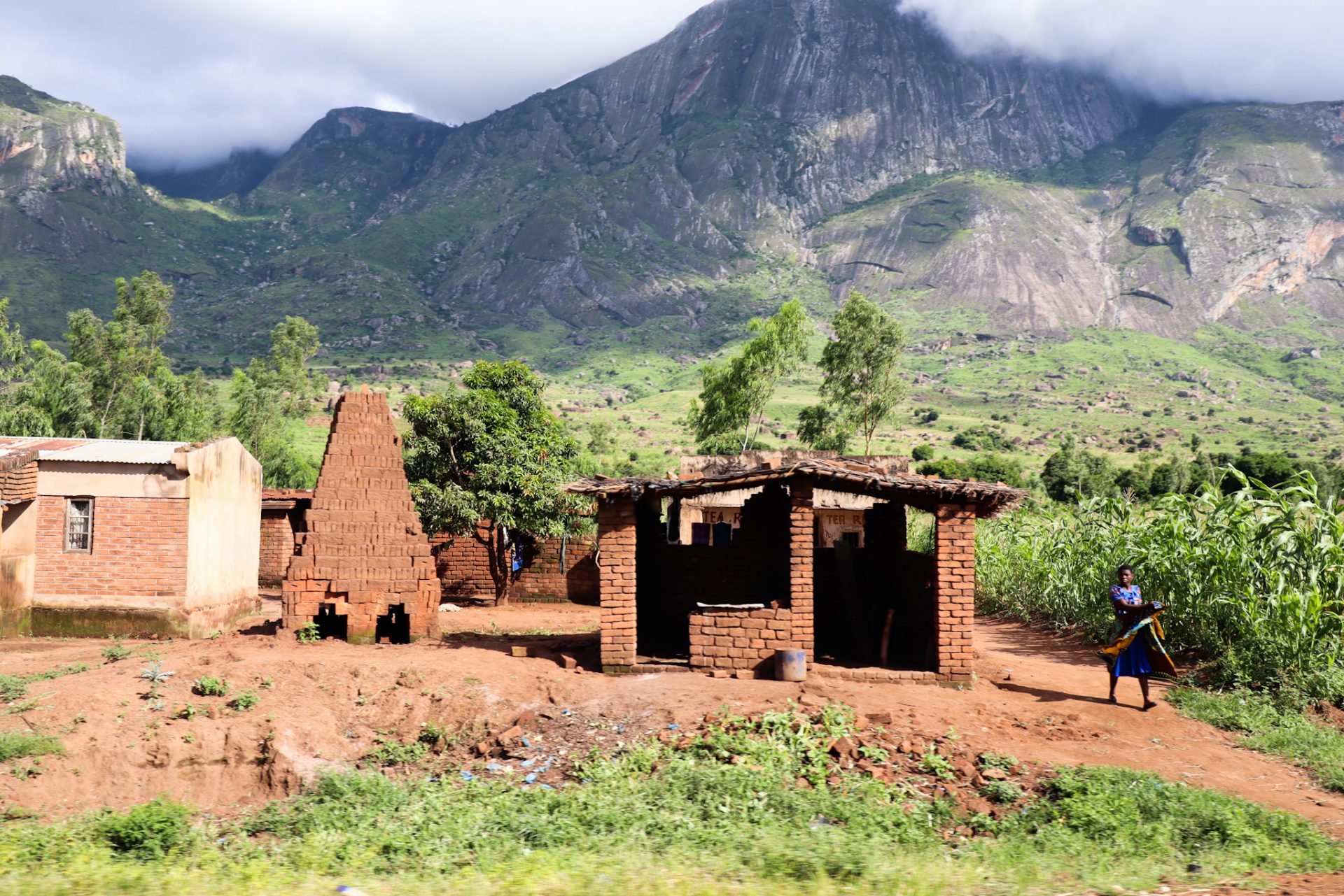
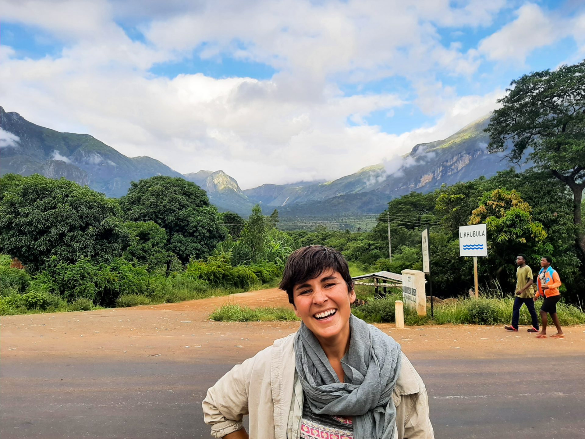
We got as far as Zomba, but instead of entering the city we took the junction through the military airport and went straight to the Mulanje region. As we approached, we could see how a massif jutted out from the whole plain, the massif where the highest mountains of Malawi are. The road was very beautiful as it passed through different rural villages and very beautiful scenery.

We didn’t have any accommodation booked, so our first mission was to find a place to sleep for the two of us and Susanna. Through the iOverlander app, we saw the Likhubula Hiker’s Nest. Before we got there, we met several people on the way who wanted to stop us and who told us they were official guides to access the Mulanje mountains. Since a mandatory guide is needed, there are many who offer themselves and live off tourists who want to do some of the hiking routes in the massif.
We rejected all the guides, as we first wanted to find accommodation and then we would have the whole afternoon to see who we would be walking with the next day. So we arrived at the Likhubula Hiker’s Nest, and there was no one there because due to Covid and the time we were traveling (March), there was not much tourism. We only found Stanley, who was in charge of the place, and he let the two of us slept in our rooftent of the car and Susanna was able to have a room. First mission complete!

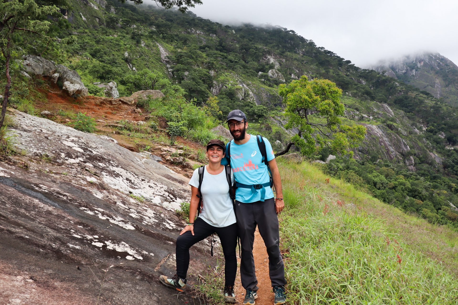
After we had lunch under the porch of the accommodation and with different guides wandering around, a friend of Stanley’s, Francis, came in. He was a boy who had been born there and lived with his wife and son, and he was dedicated to various trades: he was a guide but he also had his own crafts that he made with the wood of the area. We hit it off well. We talked about the different route options, and we agreed that the next day we would go with him to do the Chambe Basin for a price of around 13 euros for the three of us for the whole day. We already had another mission done!
In the afternoon, we took the opportunity to rest, check on Esteve’s nail issue from the little accident he had in Nkhata Bay and walk around the area as we passed children returning from school and various workers who came from the tea plantations and forested areas of the Mulanje massif.
We went to sleep under the stars of the Mulanje mountains, enjoying all the experience we had living in this very interesting country on the African continent and, above all, with people who had impressive hospitality. See you tomorrow!
DAY 2: We got up early in order to have a good breakfast and gain strength for the long route that we had to do today through the Mount Mulanje. Francis was waiting for us at 8am outside the accommodation with a plastic bag in which he carried some water, and some shoes that for us would not be suitable for going to the mountain; but there, local people are used to walking even barefoot.
We walked the few meters we had until we reached the entrance gate of Likhubula where we paid the corresponding fee of 1,000 MWK per person to be able to access the Mulanje massif. The first section of the route goes up next to different houses where we find hostels for tourists who want to do different long hiking routes, such as the CCAP Likhubula House, which is also the starting point of one of the most famous mountain races in Malawi 25 kilometers and which takes place during July: the Porters Race.
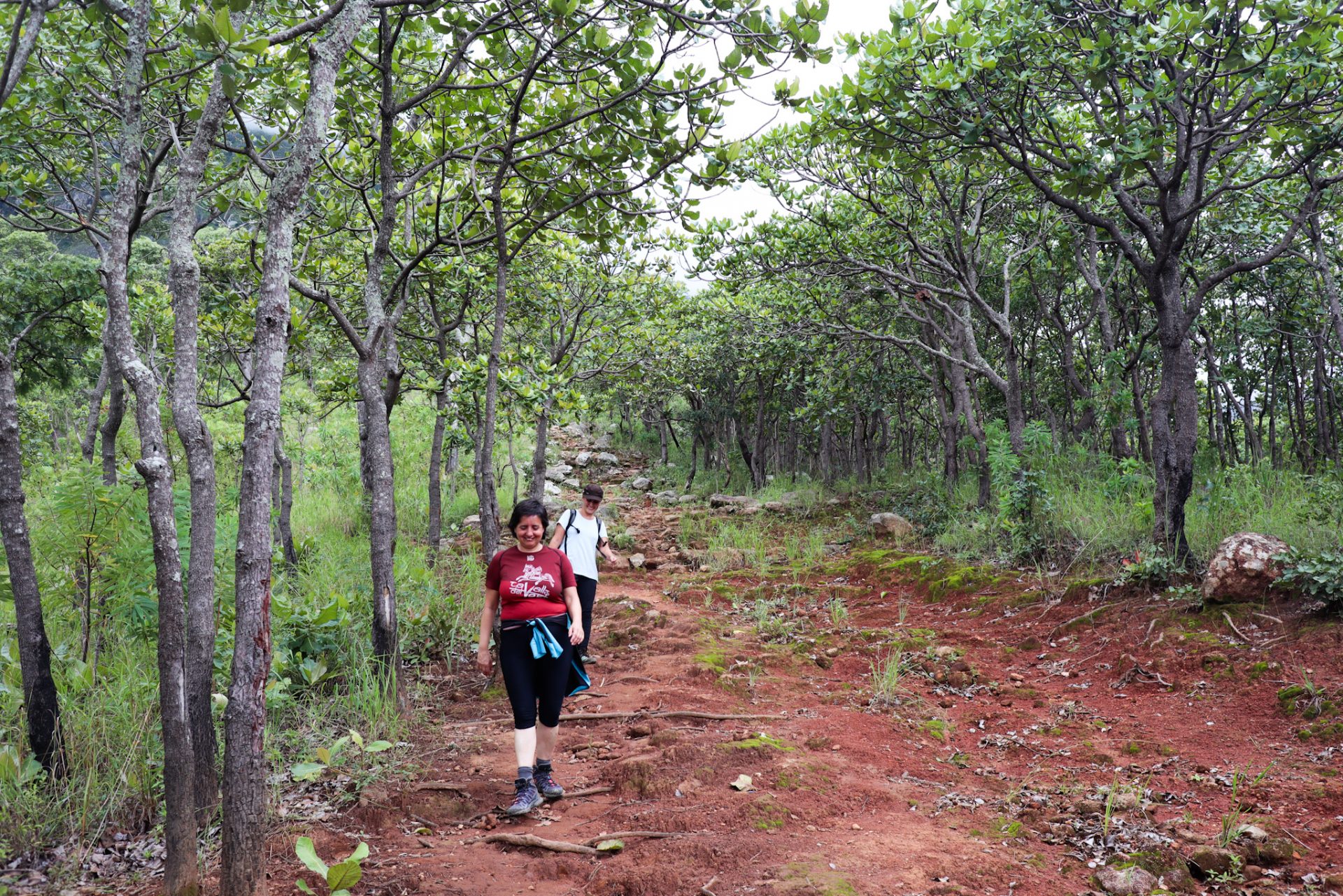
After passing the school, we followed a path that had a steep slope. Francis already warned us. The Chambe Basin route goes up, but we didn’t think it would be so straight… We didn’t have a flat route at any point, so we stopped to rest in different places as we had uphill and uphill ahead of us.
We passed through different forests where we could hear the ax blows of people cutting wood, and while Francis set the pace, we sputtered and went to our own pace. We were trying to talk and joke about what Francis should think of us: I’ve had the slowest ones all year!
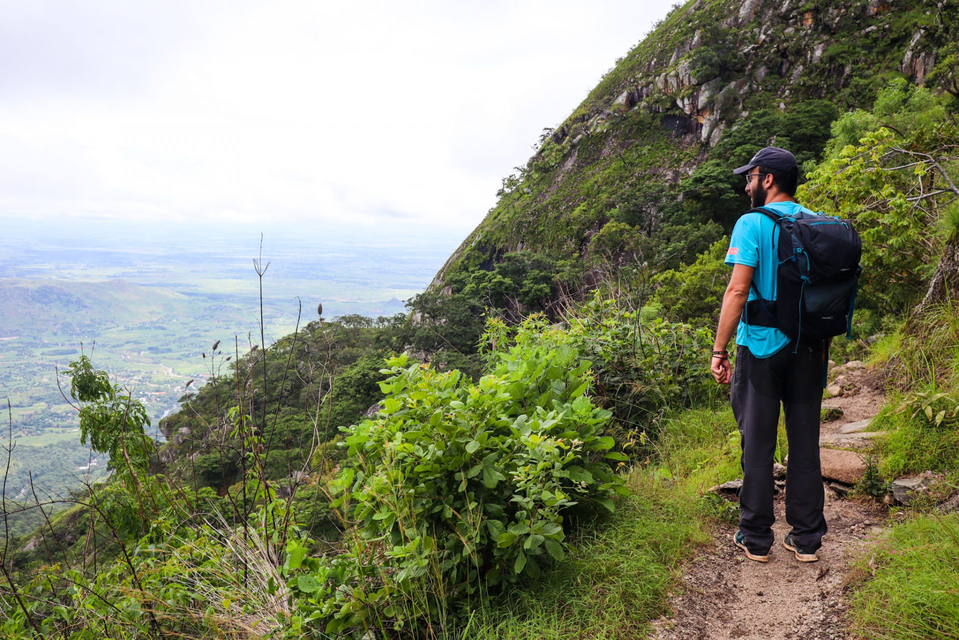
The road kept going up, zigzagging and only up. We left behind the plain that we saw every time with a more panoramic view, while in front of us the clouds gained ground and covered, from time to time, the views of the highest mountains.
We reached some rocks where we could drink water and rest for a few minutes, while we tried to relax watching the views and taking some pictures of the landscape. In the distance, we saw two children coming down from above with trees loaded on their heads. We, who were equipped with rucksacks, water and good shoes, had a hard time getting there, while Francis, with a plastic bag and some simple shoes, was walking like a walker.
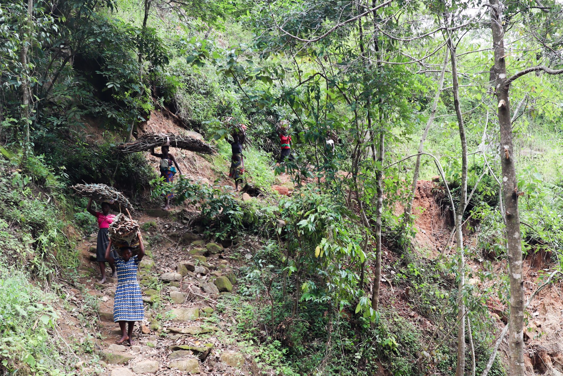
As the children passed us, we could see that they were carrying huge logs on their heads. And, besides, they went barefoot over all the rocks we had just crossed… Surely, their daily routine was to climb to the top of the massif we wanted to reach, cut wood and go back down to the village well loaded.
Every time we gained more height, the weather got worse. We were approaching the clouds and there was a moment when we entered the thick fog of the mountains. Francis, at that moment, was already warning us: we were really close to the base from where you can see the crater of the massif but that day we hadn’t stumbled on the weather, and it would be foggy.
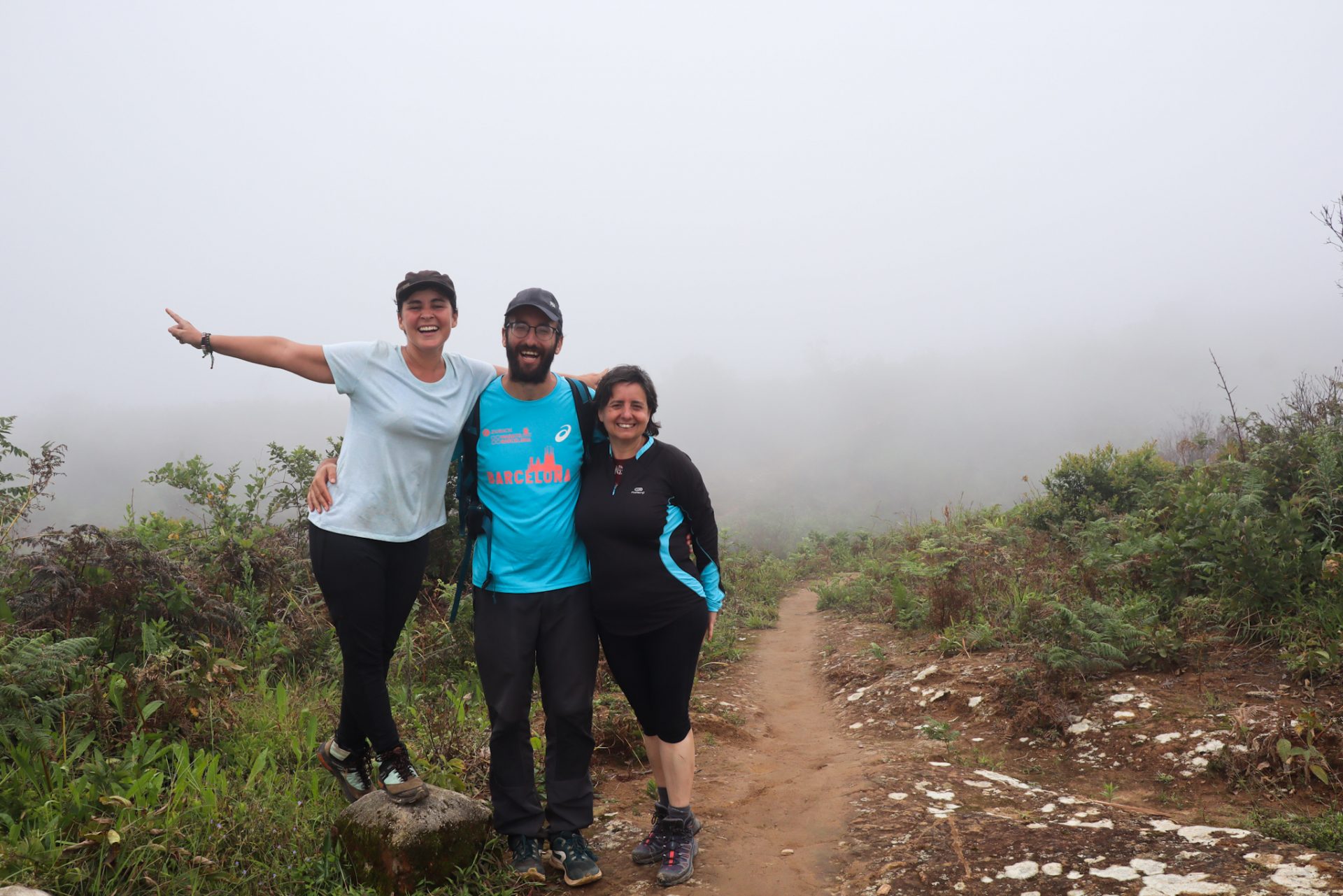
We arrived after walking almost more than 3 hours just climbing meters of altitude, and we sat down while we could see below us, between the clouds, the landscape of the plain of the Mulanje area; while above and in front, where the crater should be, we only saw a very gray day.
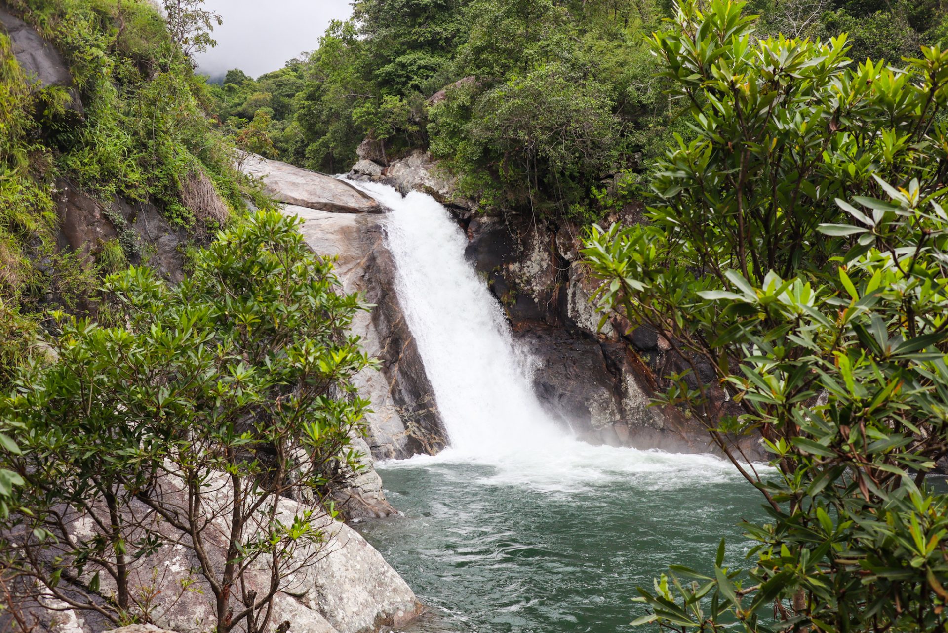
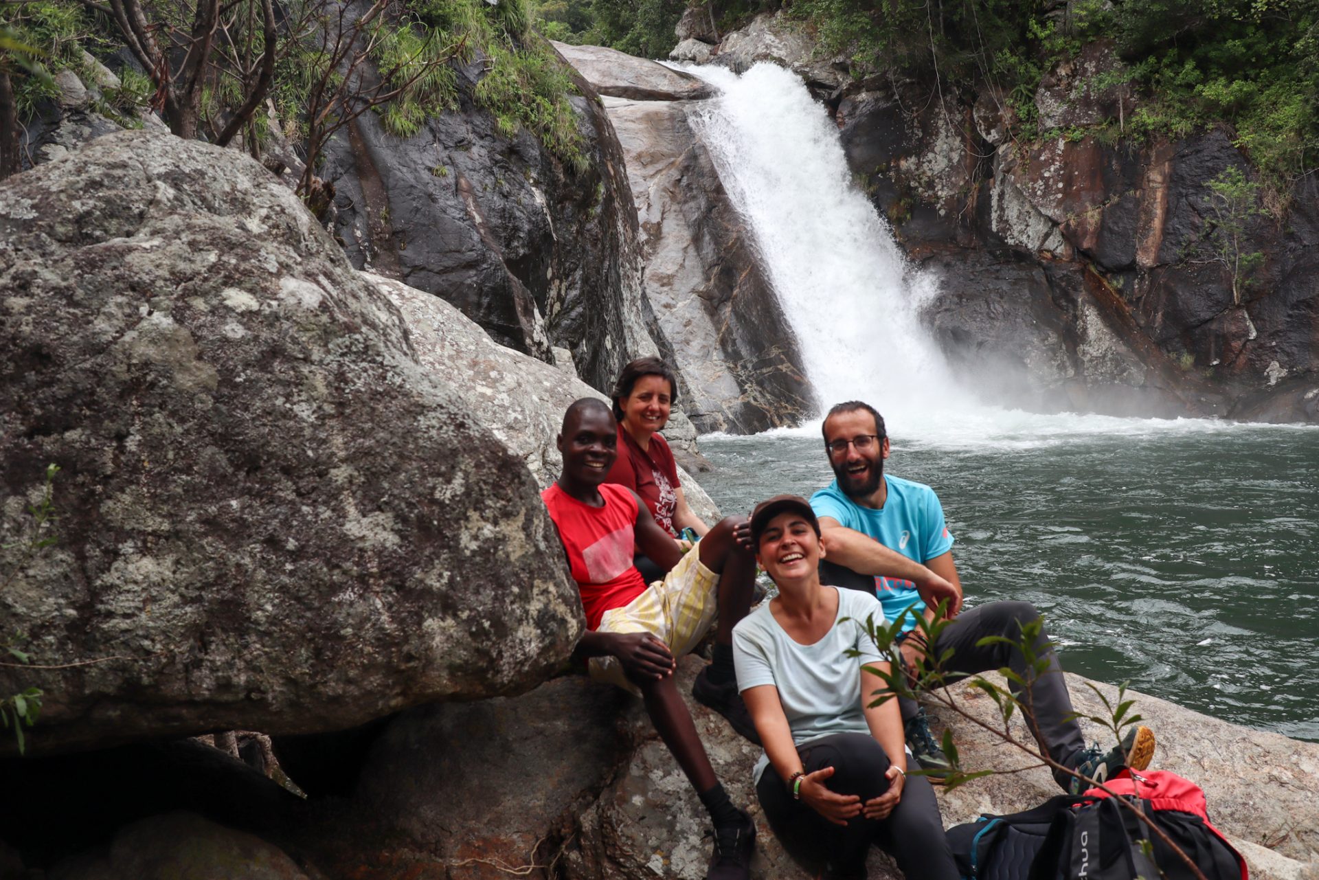
After eating a few nuts and a piece of fruit, it was time to go down, which happened much faster than the ascent. We followed the same path to a point where we turned off to go to Likhubula Falls. The clouds were already behind us and we went back into the forest, while we heard the sound of the water bouncing against the rocks of the river louder and louder.
The Likhubula Falls are not waterfalls like Calandula in Angola, Wli in Ghana or Manchewe Falls in the north of the country; but since we had already been on the route for more than 5 hours and it was downhill, we were very pleased to be able to stop there.
The mountains of the Mulanje Massif were now behind us and we were able to walk the last 2 kilometers before reaching the Likhubula gateway in peace, talking to Francis about his life there, his family, the mountains and rediscovering why Malawi is known as the warm heart of Africa.

Once we arrived at the accommodation, before saying goodbye to Francis, as Esteve was carrying a rucksack that was getting old and wanted to leave on the African continent, he gave it to the guide to use for the next excursions he did, and so instead of going with a plastic bag in his hand, he could go if he wanted to with a rucksack on his back. If he wanted, he could also use it for his children when they went to school, and we explained to him the mark it had with the Catalan flag, our land that we hadn’t set foot in for months and that we felt as close to it as when we Francis was talking about Mulanje.
We had searched for a long and hard hiking route through the mountains, and now it was time to leave for Zomba, our next destination. Just as we were putting all the things in our car, Francis appeared again with some wooden boxes that he made by hand and that he gave us for free to take this souvenir of the highest lands of Malawi. But, for us, the most important thing was not this material memory, but the experience we had lived that day in that rural area of the country, with a landscape that despite the clouds was very beautiful, and getting to know one of the lives of a local person from Malawi. This was the best memory of our stay in the Mount Mulanje. Thank you Francis, thank you Malawi!
0 Comments