


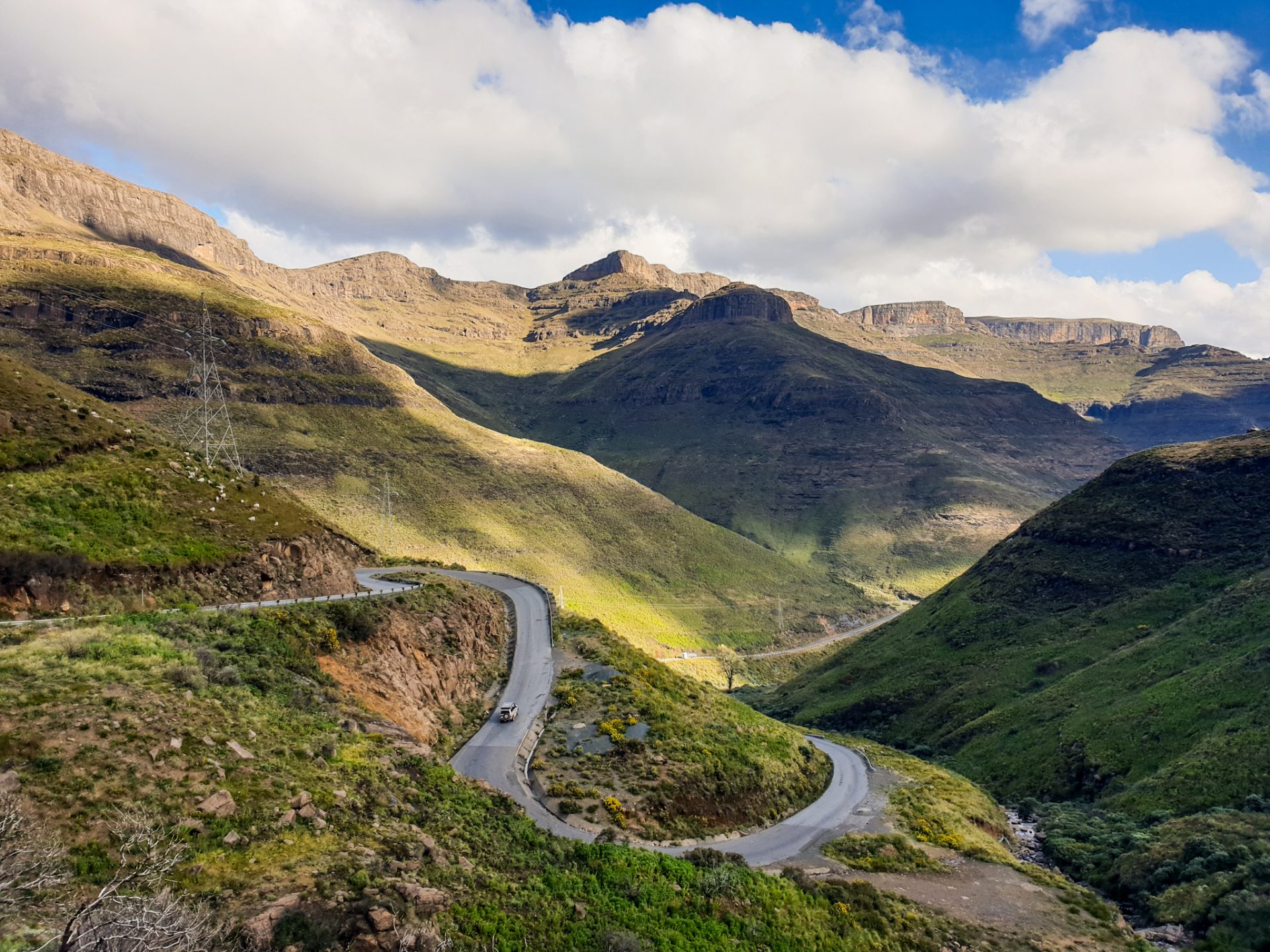
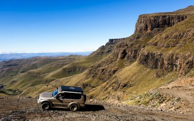
One of the most beautiful routes in the country in terms of landscape, is the Northern route that follows the country’s A1 road. This route passes through some of the highest points in the country, known as the Highlands, and then descends into the lowlands known as the Lowlands. This route is one of the most beautiful routes to take by car from east to west of the country or vice versa.

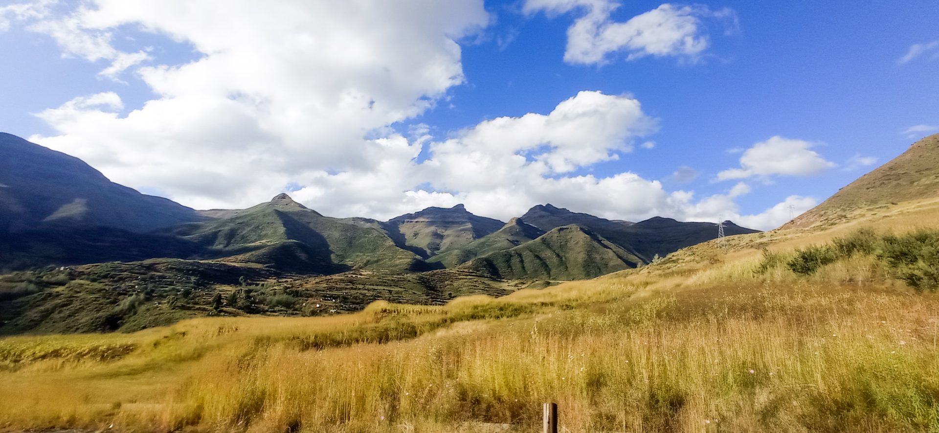
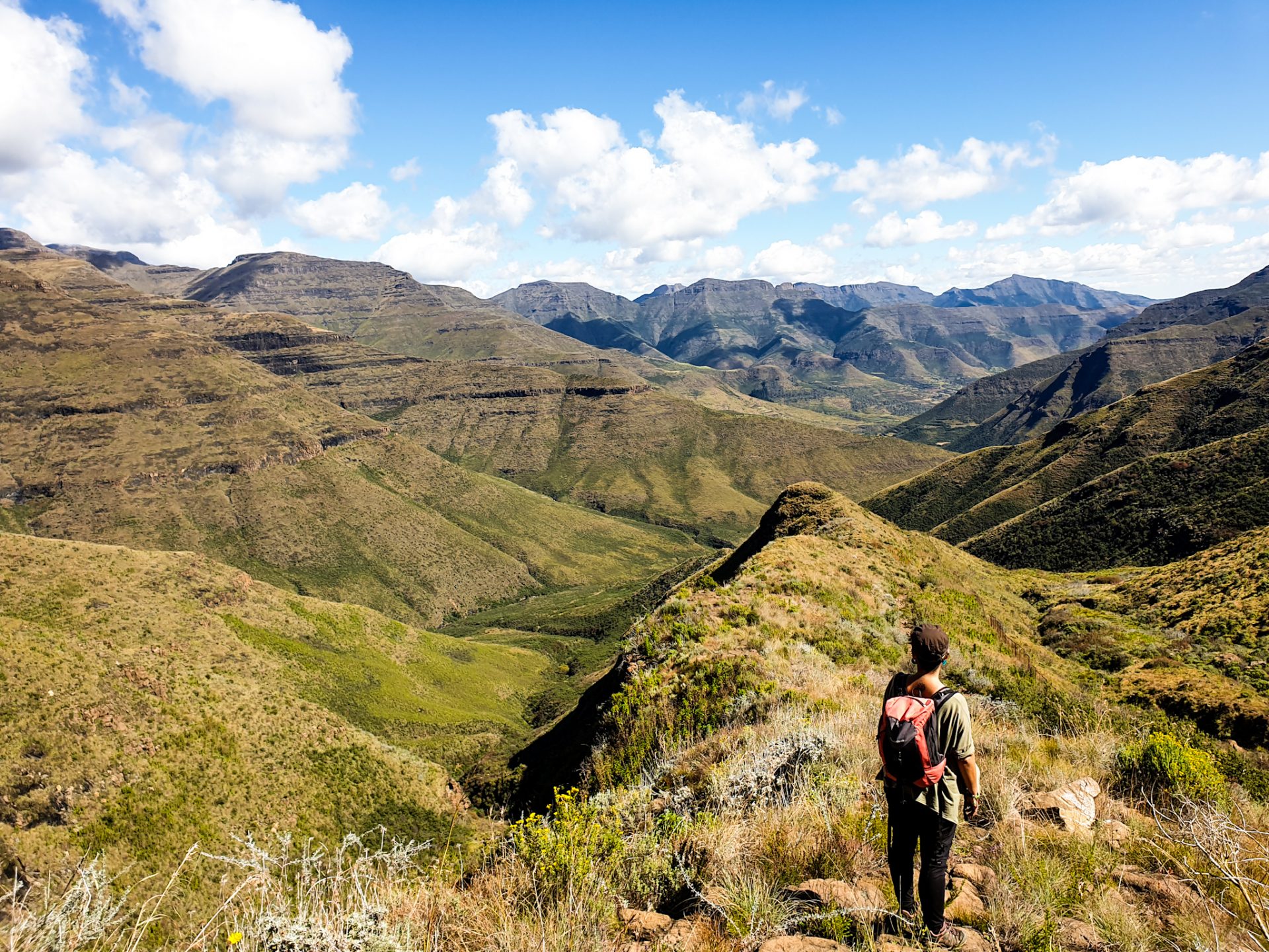
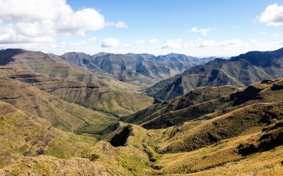
But why do we say that the country is divided into Highlands and Lowlands? Lesotho basically consists of two parts in terms of relief: the Highlands (highlands) and the Lowlands (lowlands). The Highlands are located in the south-east of the country, covering almost the entire eastern part of Lesotho, between the famous Drakensberg and Maloti mountains. These highlands once formed by a layer of lava have been eroded over thousands of years by the Senqu River (or Orange River to South Africans) and its tributaries, which drain these highlands to the southwest through different deep and green valleys. These lands have a rough relief, with ups and downs of great slopes but they also have an indescribable beauty that we want you to discover.
The highlands of Lesotho are the catchment for most of the major rivers that supply water and electricity to South Africa. This fact causes a curious situation of dependence of the South African giant with this small country that lives in the heart of its lands and the creation of a large hydroelectric project (which mainly benefits South Africa) with the creation of many dams ‘water and hydroelectric plants in Lesotho. If you want to know more about this topic you can check here the article about our visit to the Katse Dam, the second largest concrete arch dam in Africa which is part of the Lesotho Highlands Water Project, which will include in the future 5 large dams in remote rural regions of the country.
On the other hand, the lowlands or Lowlands, are those lands that are below 2,000m, between 1,500 and 1,800m, and it is there that the majority of the Basotho population and the country’s arable land are concentrated (only a 11% are).

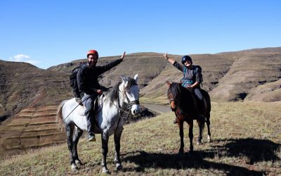
The route we propose starts in Mokhotlong, where we were able to live one of the best experiences we had in Lesotho, the pony trekking with the Ntlhoki family and where we were able to get to know the most remote villages and landscapes of the Highlands for two days living with local people (if you want to know more about this experience click here). Afterwards, it passes through the Letseng Diamond Mine known for having the highest percentage of the largest diamonds in the world and also traverses towering mountain passes next to the Africaski Mountains, the ski resort of Lesotho is one of the few that exist on the African continent. Further on, the route continues through the Liphofung Caves, where you can see San cave paintings and through the Ts’ehlanyane Nature Park where you can do very beautiful hiking trails. Finally the route ends in the city of Leribe (also known as Hlotse).
This route can be from east to west as we describe, since we entered the country through the Sani Pass (if you want to know more information about this mountain pass, click here) or the other way around starting from the city of Leribe.

How to get there?
One of the best ways to reach Lesotho’s highlands, known as the Highlands, is via the Sani Pass mountain pass that separates South Africa from Lesotho. This pass climbs 1,332 meters in just 9 kilometers, and will allow you to reach the border with Lesotho, at an altitude of 2,874 meters. From there, you will have to drive about 45 kilometers until you reach the A1, in the area of Mokhotlong, from where you can do this route that we propose from east to west. The road from the border to the A1 is in very good condition and already runs through the high mountains of this country, also known as the kingdom of heaven.
On the other hand, if you are coming from the Lowlands, that is to say from the Leribe area, you will have to pass through the town of Butha-Buthe (we recommend that you fill up with gas here, since later, during your journey through the Highlands, you will not find any more until reach Mokhotlong), and from there take the route in reverse, always following the main road A1, a scenic road in very good condition that will take you to the highest points of the country.
The main points of interest we have marked on this route are located around the main A1 road. This is the case of the Letseng diamond mine, the Africaski ski resort or the various mountain passes. The Liphofung Caves are already located almost in the Lowlands of Lesotho. If you are coming from the Highlands, you will find a signposted break on your right that will direct you to the entrance to the grounds. If, on the other hand, you come from Butha-Buthe, the main town in this area, you will find the breaker about 30 kilometers from the town and on the left hand side. As for Ts’helanyane NP, in the next article you will find the way to get there.
When to visit?
The warm season or summer in Lesotho runs from October to March. The hottest month is January. Temperatures between 10-18ºC can be reached. The winter or cold season in the area runs from March to October, with July being the coldest month of the year. Temperatures usually range from -3ºC to 10ºC (but keep in mind that the higher the altitude, the colder it will be).
The problem, however, is that the rainy seasons coincide with the warm temperature, so we will find more rain when the temperature is better. The month that rains the most is also January and the months that rain the least are June-July.

For us, the most advisable months would be April and May, as it is relatively dry and not too cold, or from September to October, as the summer rains have not yet started.
However, you know that time is relative and changing these days. We visited Lesotho in April, theoretically one of the best months to do it and yet, the week before going up, it had been raining heavy all week.
What to do in the north of Lesotho?
– See the Letseng Diamond Mine from afar
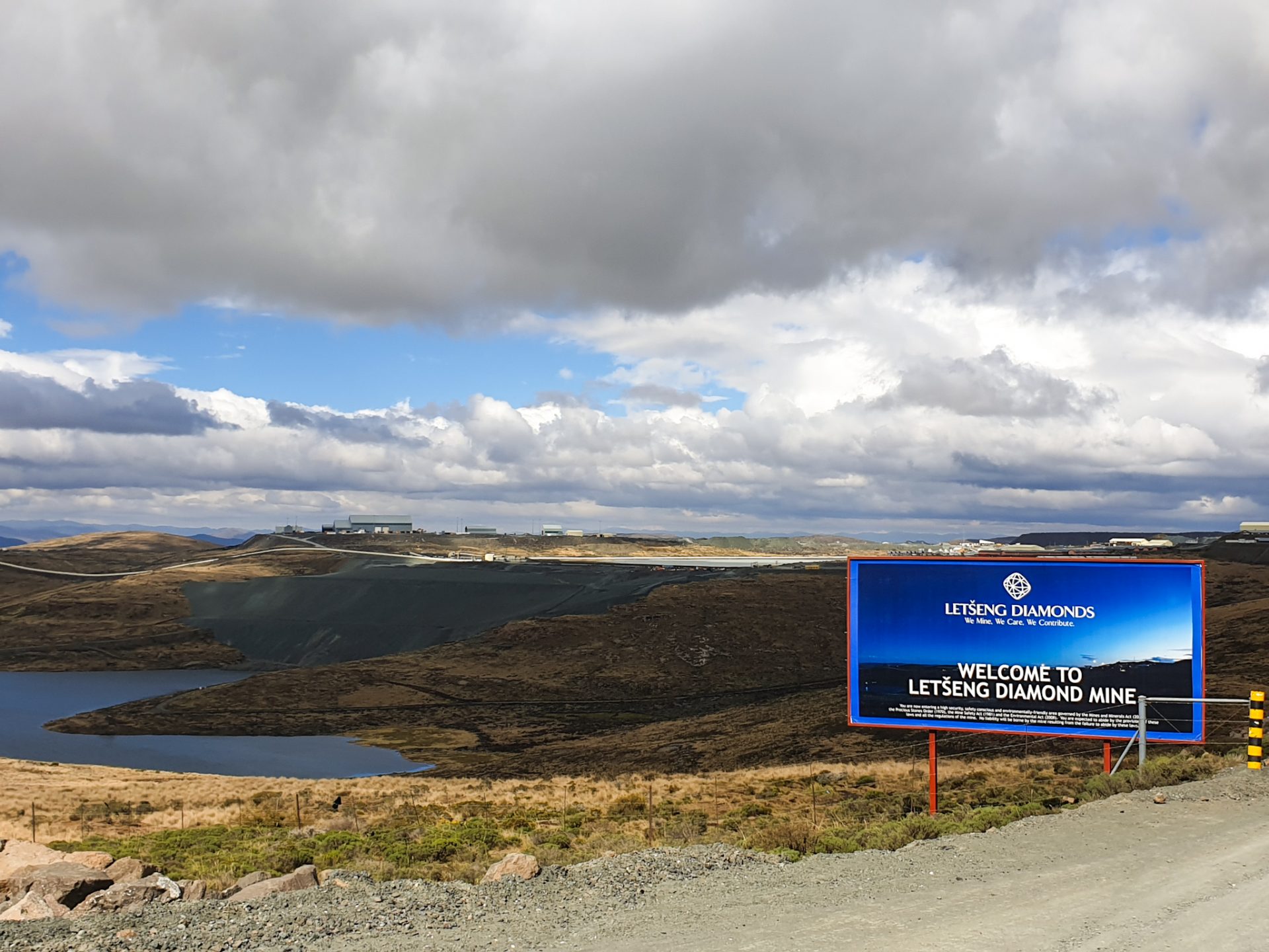
Located in the Maloti Mountains, this mine is the highest in the world as it is located at 3,200 m above sea level in the Lets’eng la Terae area. The Letseng mine produces diamonds that are reputed to sell for the highest price per carat than any other mine. The world average price per carat is approximately 81$, while its average was over 1,894$per carat in the first six months of 2007.
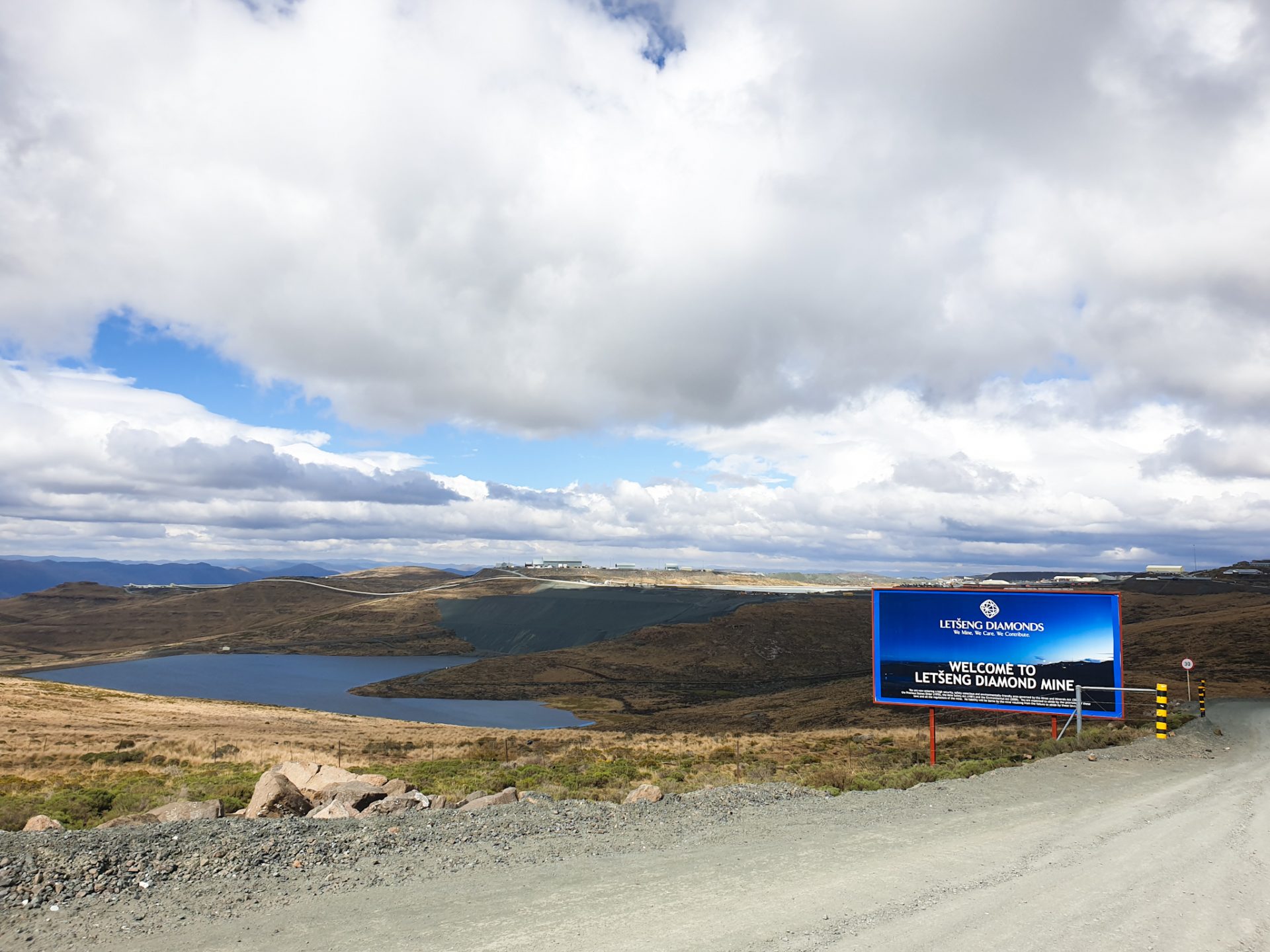
One of the curiosities of this mine has been that in 2018 the fifth largest diamond in the world was found there, of 910 carats with a value of about 40 million dollars, which has impressive qualities due to its purity . A few months ago we also wrote about the Karowe mine in Botswana, where the second largest diamond in the world was found. If you want to know more about this, you can click here.
The South African company that manages the mine is called Gem Diamonds. Yes, as you read correctly, it is not a company in the country. Only 30% of the profits from this mine go directly to the government of Lesotho, the other 70% goes entirely as a profit to this company. As you will see, diamonds and water are the main natural resources of the country, but the benefits for them are small compared to the value they generate.
If you want to visit the Letseng mine, you will need to first go to Maseru and ask for a special permit from the Gem Diamonds headquarters. We tried to enter without permission, and obviously, it was impossible.
– Drive the route known as “The roof of Africa” and its mountain passes
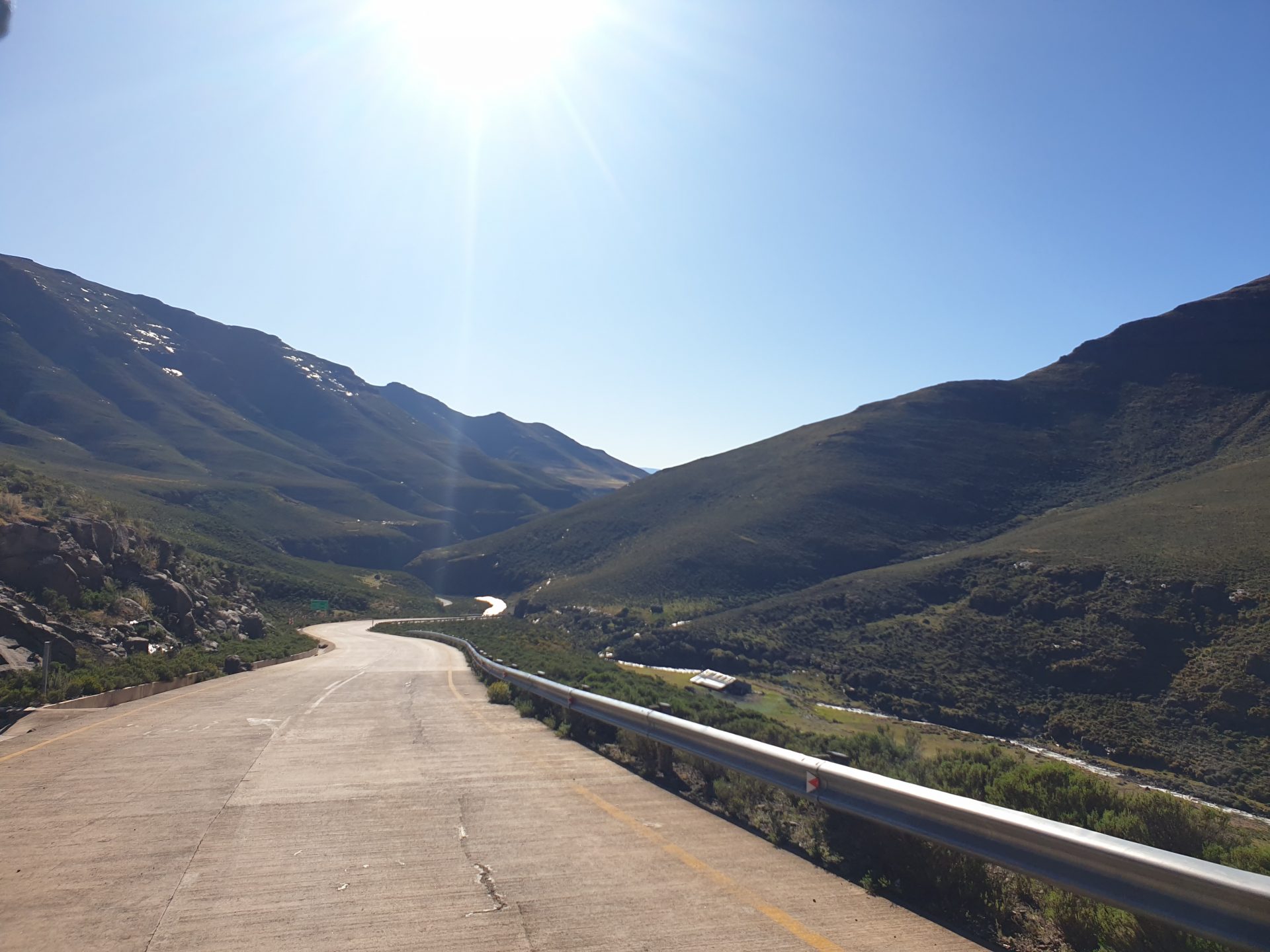
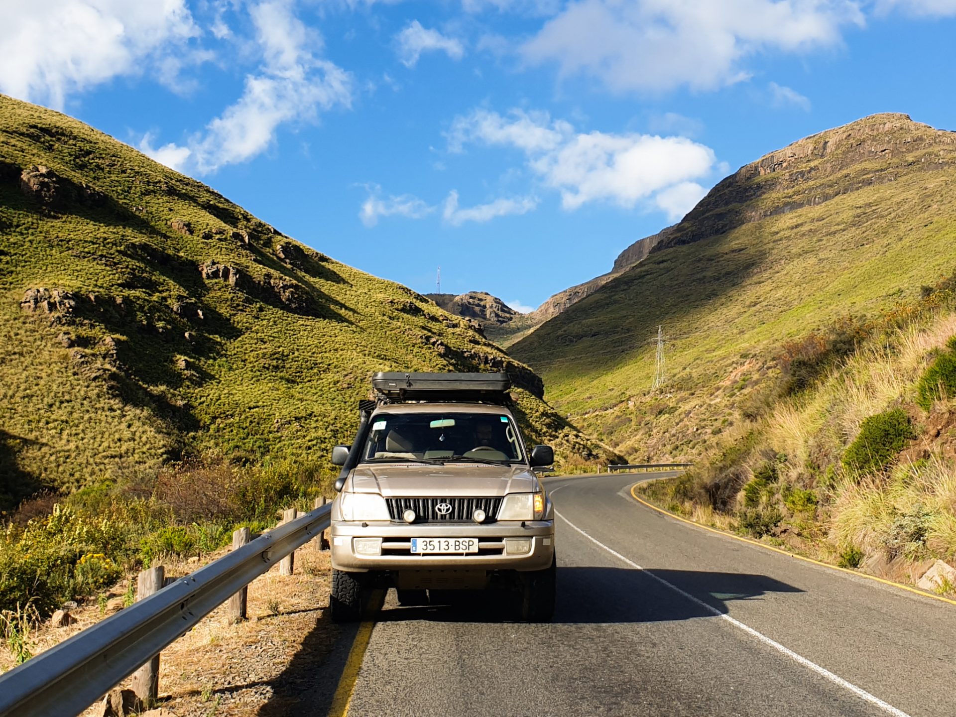
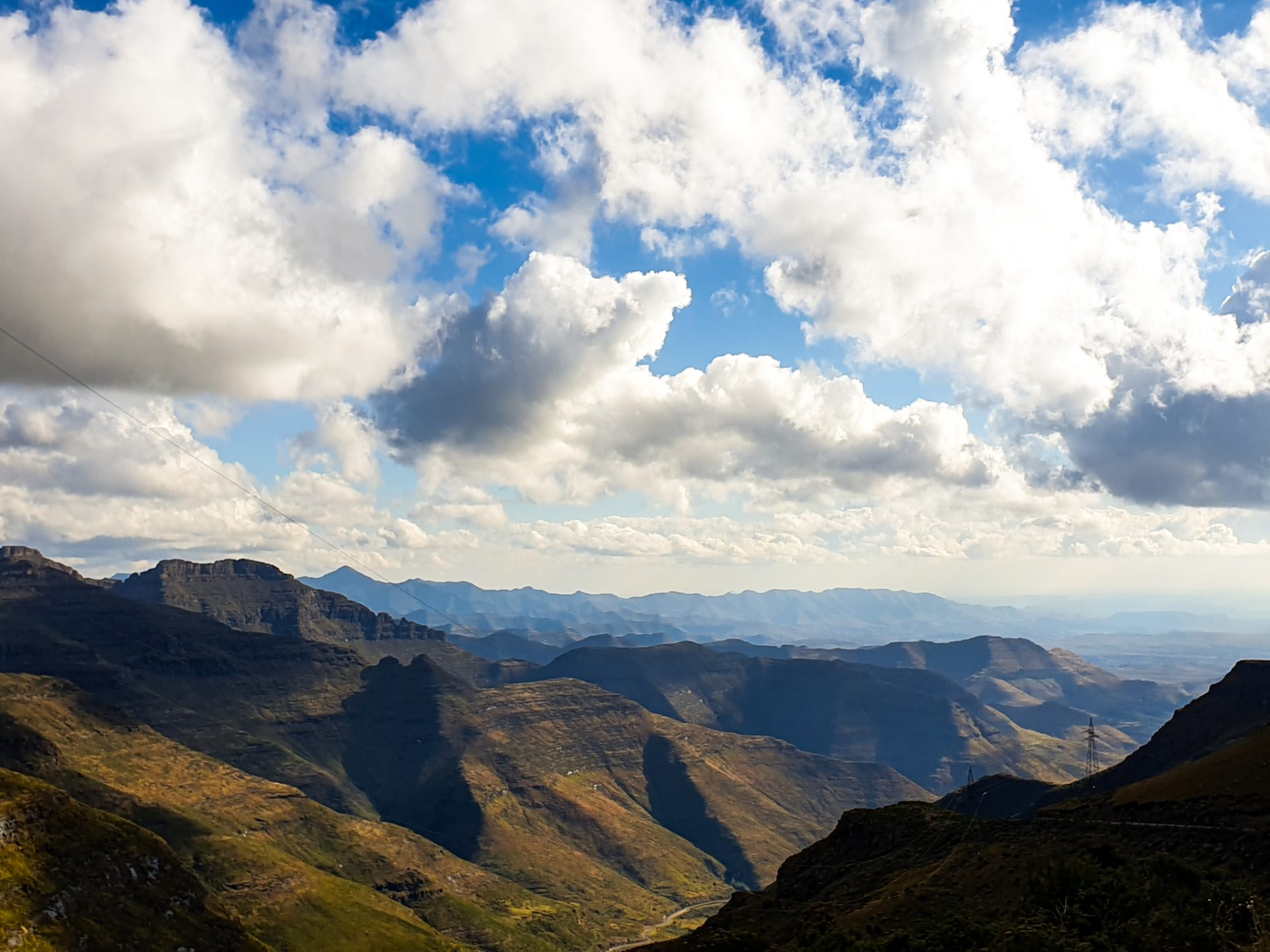
The route from Mokhotlong to Leribe is a road with many of the highest mountain passes in the country. You can’t imagine what views it has! If you’re lucky and it’s a good day for sight-seeing, you’ll be able to spot one of the best views you’ve ever seen on the horizon! The road passes through a spectacular landscape, with impressive views between mountains and cold air that sinks you to the bones. To do this road you need to make sure you go there in good weather, always drive during the day and keep an eye on the dark areas of the road, as ice or snow can often still be found there.
During the A1 route we would like to highlight 3 mountain passes that we think are interesting for you to do:
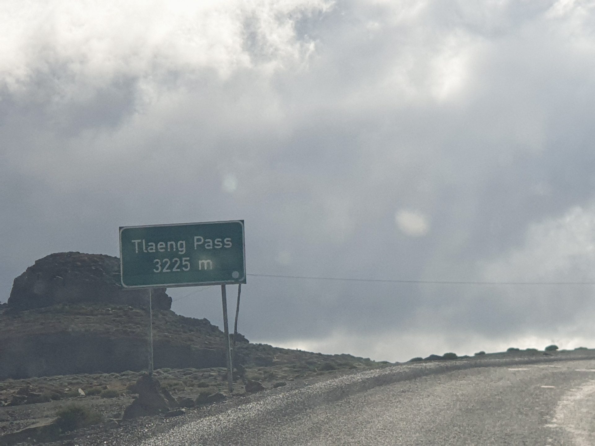
- TLAEENG PASS: it is a high mountain port at an altitude of 3225m above sea level. It is the third highest mountain pass in the country that connects with the other mountain pass, further east, more famous and spectacular: the Sani Pass. Located in the highlands of Lesotho, in the Highlands, the road that runs through it is the A1 but this first stretch is also known as the Oxbow to Mapholaneng road. The road is 102 km long and runs north to south from Oxbow to Mokhotlong.
- MAHLASELA PASS: it is a high mountain port at an altitude of 3,278 m above sea level. Located after the Afriski ski resort, it is the highest mountain pass in Lesotho, and has spectacular views. It is one of the best to drive and to stop on the road to see the fantastic views.
- MOTENG PASS: it is the last mountain pass on this stretch of the A1, it is the tenth highest mountain pass in the country with an altitude of 2,820m. Heavy snowfalls cause them to sometimes close this pass, so you should always ask the locals beforehand. Like the other two, it has great views of the surrounding area.

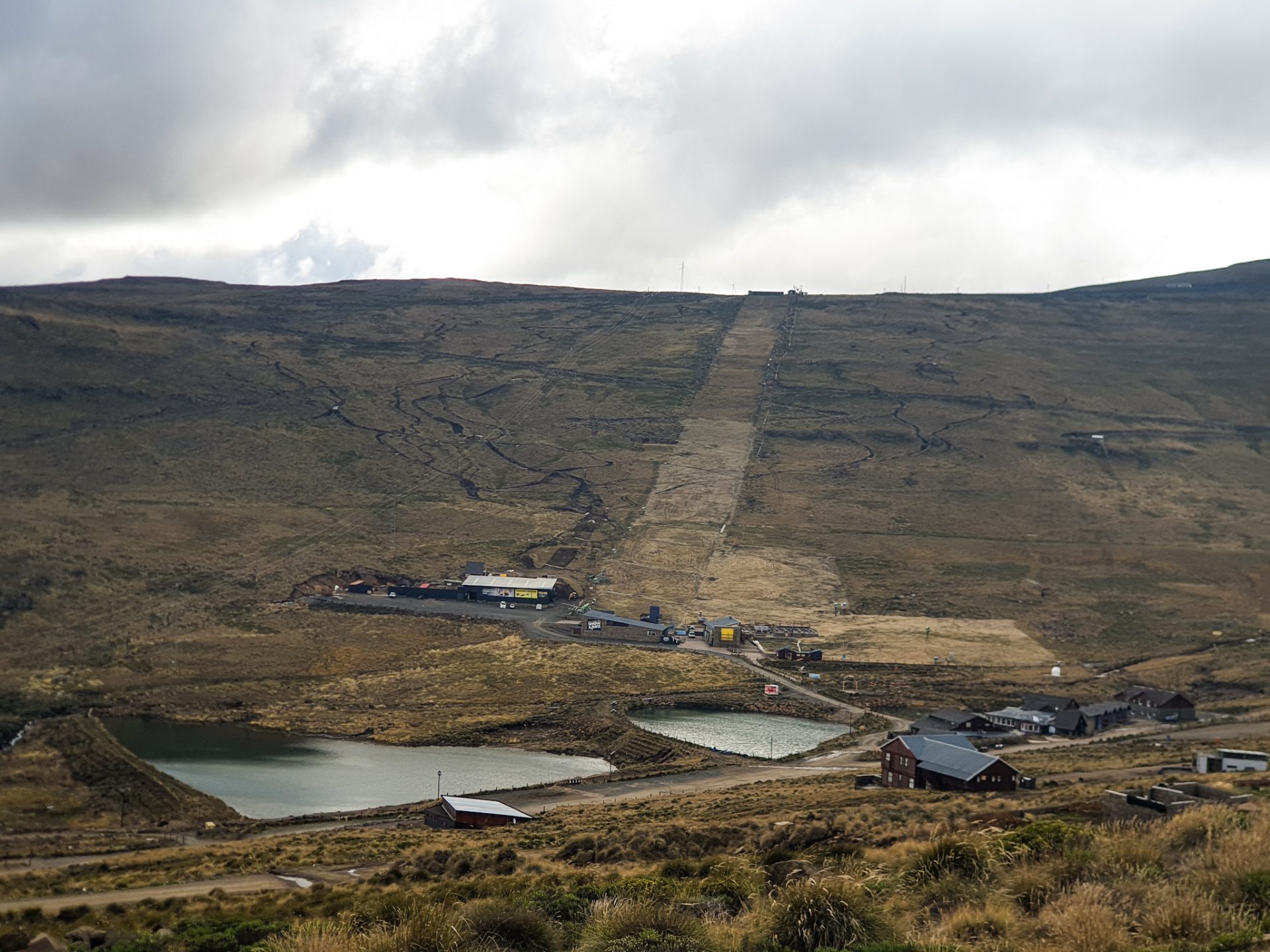
– Visit Lesotho’s ski resort: Africaski
And yes, obviously, in a country with high mountains and very cold weather, there is a ski resort surrounded by a spectacular landscape at an altitude of 3,050m. During the winter months from June to August, temperatures reach below zero, and the only ski slope in the country starts its operation. It has great luxury accommodation especially for South Africans who go there to spend their holidays. Here you will find more information.
It is one of the seven ski resorts that we can find on the African continent. The others can be found in Algeria (2), Morocco (3), and South Africa (1). If you like the world of skiing and you happen to be traveling in the snow season, Lesotho can be a good destination to practice this winter sport!

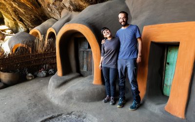
– Admire the fantastic san cave paintings of the Liphofung caves
The Liphofung Caves are half hidden among the immensity of the landscape that surrounds us in this part of Lesotho, coming down from the high mountains of the Highlands. The Liphofung Caves, which means place of the Eland, are named after the paintings of the largest antelope in Africa painted by the San hunter-gatherers (Bushmen) who lived there in prehistoric times. In these caves you can see cave paintings of people hunting, people celebrating the rain ceremony, animals, people fighting… All the paintings are accompanied by informative panels that help you better see the shapes and why they made them that way.
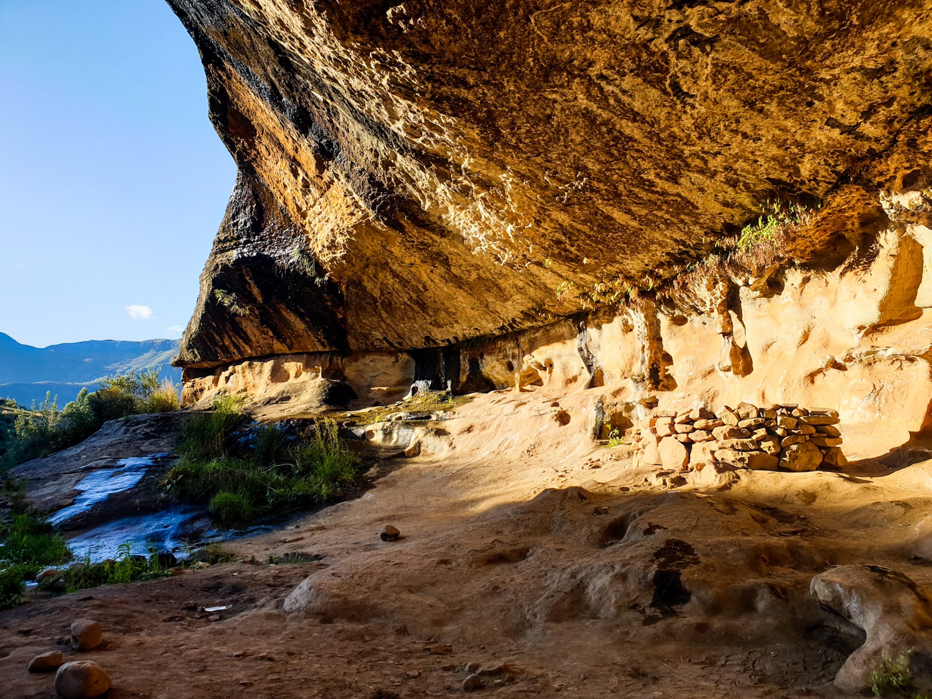
Later in the 19th century, King Moshoeshoe I took refuge there as a young man and later, when he became the founder of the Sotho kingdom, he used it as a natural sanatorium for wounded soldiers during a battle that took place in 1840. If you want to know more about the country’s history, click here.
The Liphofung Caves consist of a visitor center where, apart from the caves and the San paintings, you can visit exhibitions on traditional Basotho culture and history. The entrance fee is 50 malutis per person (about 3€). You can hire the services of a guide, to make the visit more enjoyable at a cost of 50 malutis per visit for two people.
– Do a hiking route through Ts’ehlanyane NP
This national park is located in a mountain range that delimits the Highlands with the Lowlands of the country. It is one of Lesotho’s two national parks and is located about an hour from Butha-Buthe, heading along a well-maintained road that heads into the interior of the country. The park consists of more than 5,600 hectares of valleys, mountains, … and has an altitude that ranges between 1,940m and 3,112m. For this reason, it is an ideal park for doing different hiking routes with a very beautiful landscape. By clicking on this link, you can find out more information about this national park and the hiking routes to do.
Where to sleep in the route through the north of the country?
Throughout this route through the north of the country, you will find few accommodation options, although it is easy to camp freely at different points. However, you must take into account the time you travel, because being the highest part of the country, it is very cold! We highlight the following accommodations:
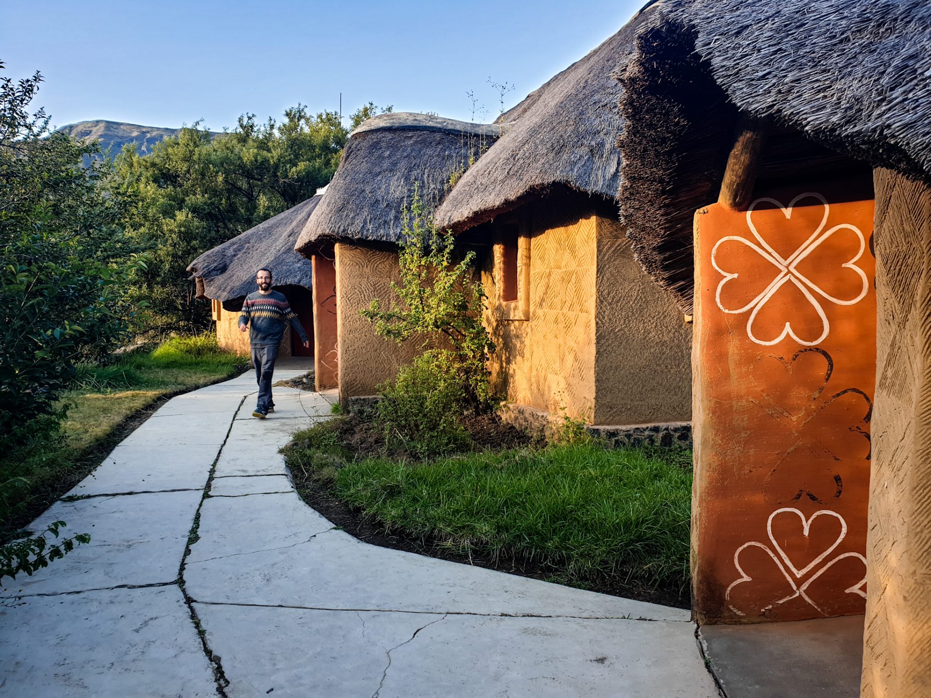
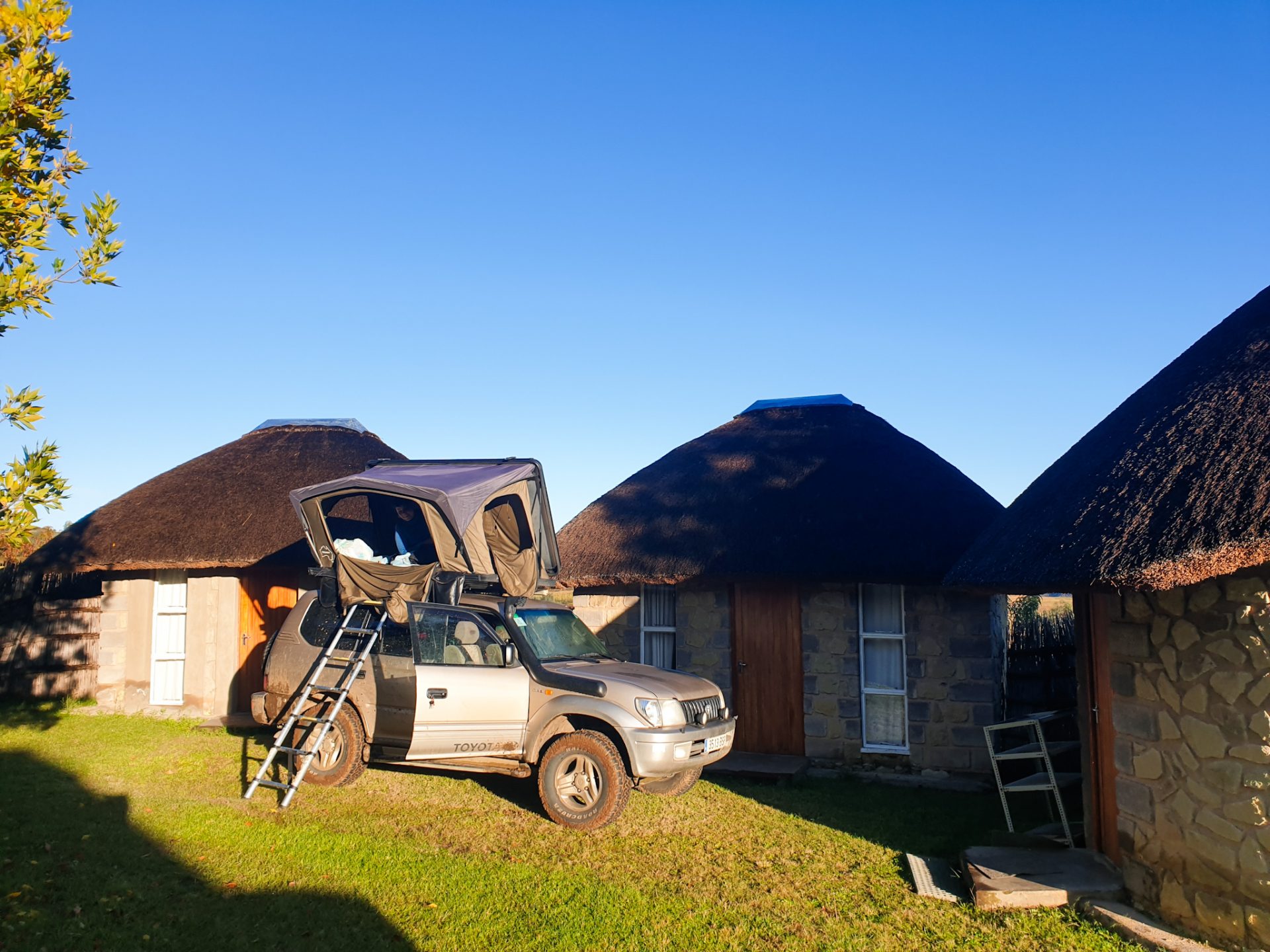
– Mamohase Homestay: This accommodation, brought by Moruti, is located near the Liphofung Caves. It is a good technical stop at the beginning of the Lesotho Lowlands. You can only pay in cash. We camped with our car for 70 malutis per person/night (4.20€). It also has cabins and rooms. For more information you can call +26659047042.
– Maliba Mountain Lodge: For those who like luxury, this five-star accommodation is located at the start of Ts’ehlanyane NP. It has different types of rooms and all possible services. There is no option for camping. Despite being the only accommodation in the park, we decided not to go there because it was too expensive for our budget and we drove another hour to Leribe. For more information, you can click here.
– Bird Haven Guesthouse Leribe: This is one of the accommodations with the best quality-price ratio in the area. It is at the end of this route that follows the A1 through the north of the country. It has different types of rooms with different names of birds with breakfast included and parking. In Leribe (or Hlotse) there are different restaurants to go for a meal or a beer. If you want more information about this accommodation you can click here.

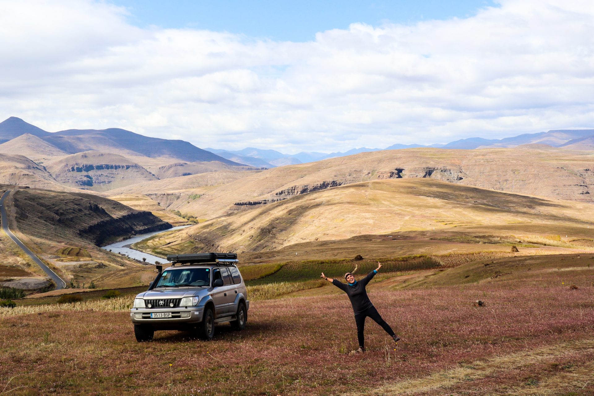
Our route
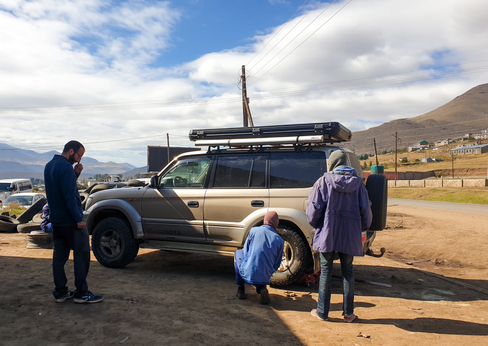
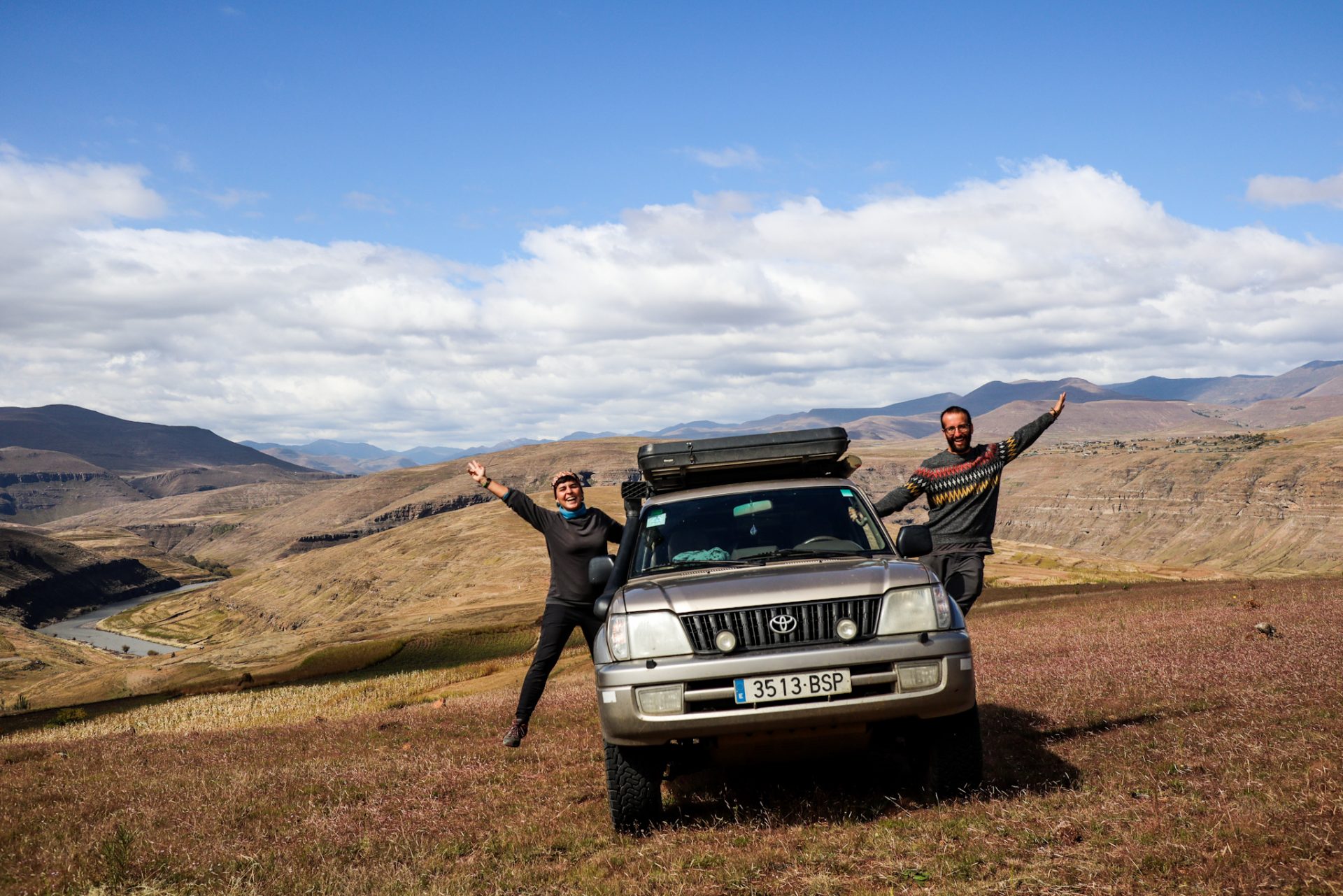
After spending the night with the Nlthoki family in the Mokhotlong region, we woke up with many needles in our asses. It was obvious that we had been riding for two days in the Highlands of Lesotho, and it had taken its toll! We said goodbye to all the family that had hosted us so well those days (these are the experiences you take home when you travel), and headed back to Mokhotlong town to do some shopping and try to sort things out of a tire that was losing air.
Mokhotlong was a former police station that controlled the passage of goods between Lesotho and South Africa and today it has become a town where you can find all services. There were different markets, and also on the side of the road, a wheel shop where a young guy solved the problem for us in a moment. It wasn’t the first time we had holes in the wheel that caused it to lose air… But we were lucky that they were just that: holes, and that we could easily cover without having to change the entire wheel.
Today we would already sleep in the Lowlands. After climbing the Sani Pass, and our experience with the horses touring very rural villages on top of the mountains, we would cross the Highlands to head towards the lower part of the country (which, despite being low, is located further 1,300 meters high!) where most of the population lives.
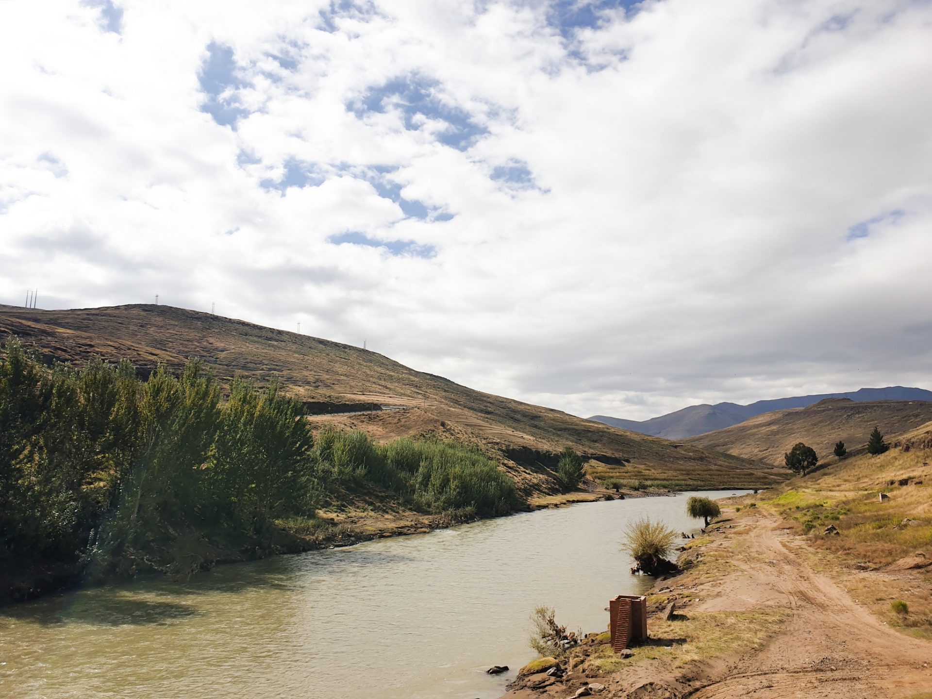
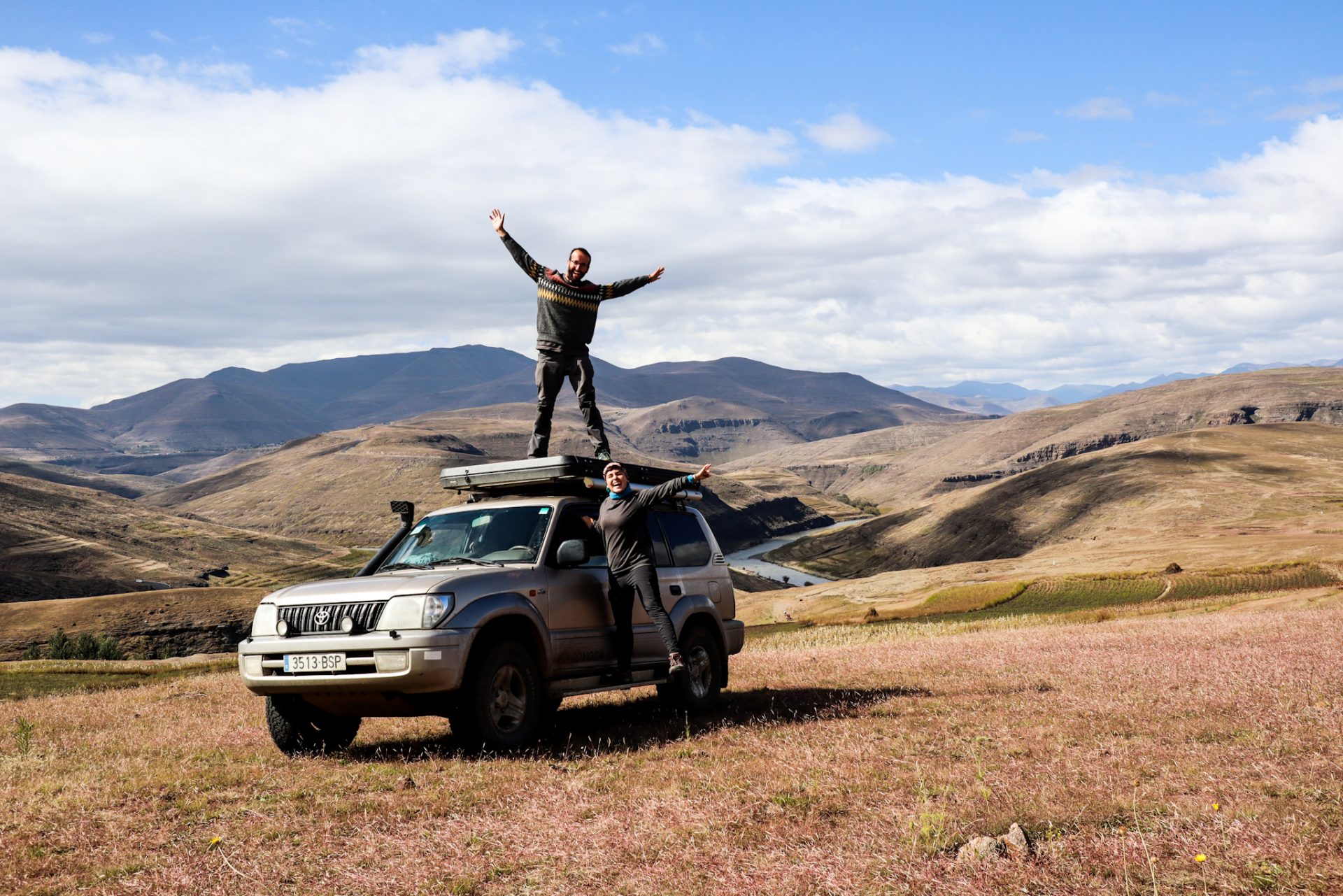
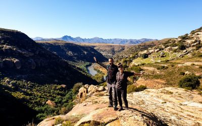
We left Mokhotlong behind, and before long we found a panoramic view point where you could see the river and all the mountains. We detoured and stopped to take more photos for memory. Driving on this road was a blast. Not only because it was in very good condition, and it was all wide bends, but also because of the surrounding landscape.
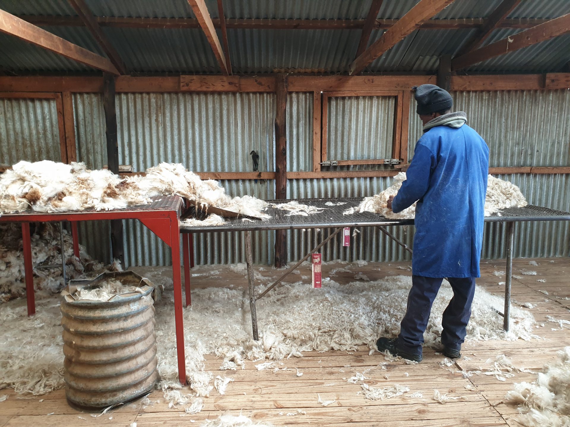
After this first stop, we continued our route with the aim of reaching Africaski, one of the few ski resorts on the African continent. Before, however, at a bend Laia saw some shepherds cleaning some sheep in a large trough with water next to the road, and after a few meters, to our right we saw what looked like a raised fence where there were sheep outside. During the months of April and May, we were told that was the time when they sheared the sheep in order to sell the wool… So that must have been a sheep shearing place.
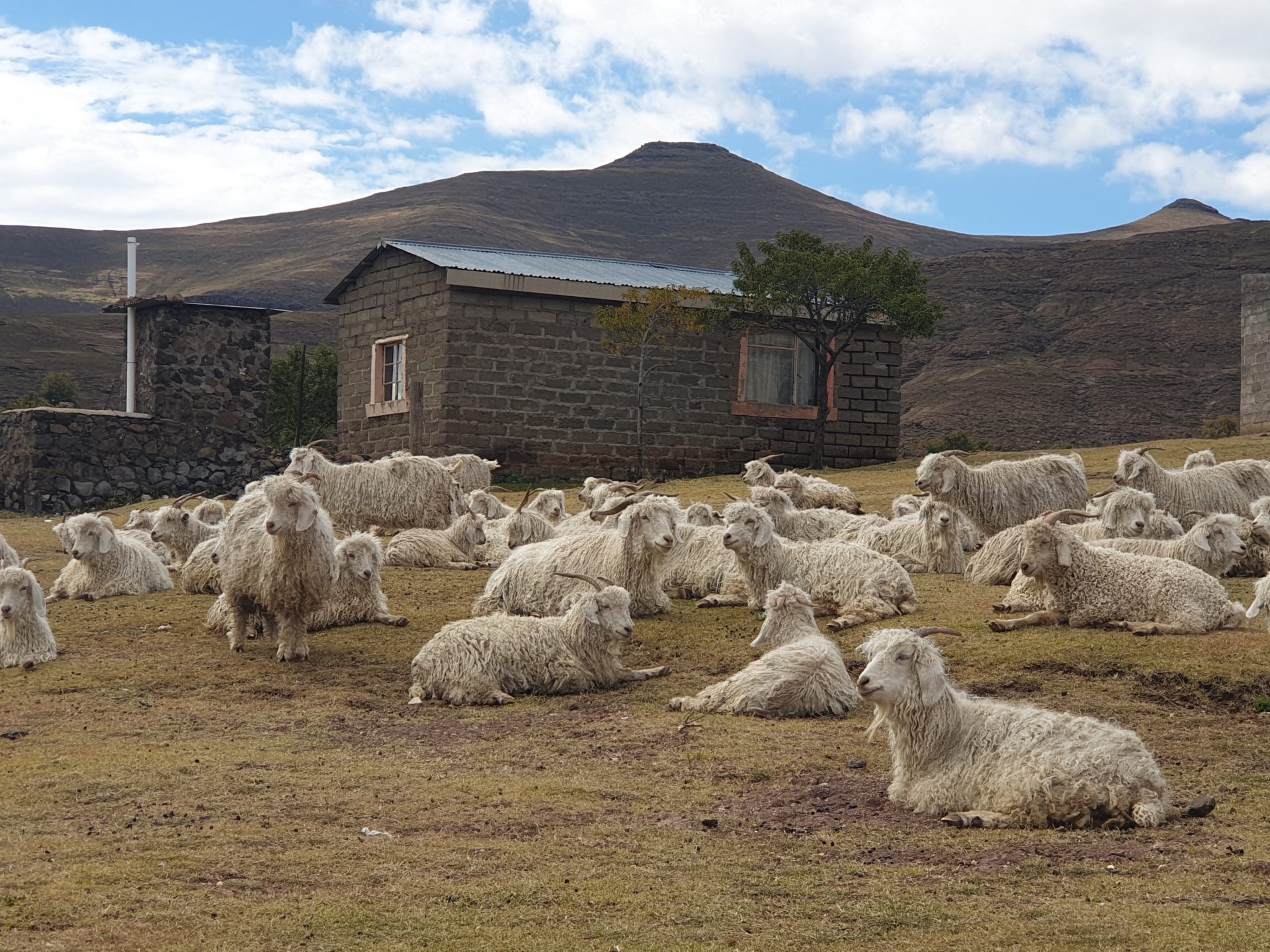
We left the road climbing a small path that took us to the side of the fence where there were different flocks of sheep. We went down and there were different people in there who were shearing the sheep. We also walked to where the shepherds were washing the animals. It can be seen that when winter approaches, many shepherds take their flocks to be sheared. First, they clean the sheep well and then they go to the “hairdresser”, where people with scissors cut the wool. Others put it on the table, sort it and weigh it before putting it in sacks. We were told that this wool mainly went to South Africa and China, and that surely if our fleeces we wore said Made in China, the wool had come from Lesotho! If you want to know more about the process and see some photos, you can click on the following link.
We had been very lucky to coincidentally in this place. Days before we had searched on the Internet and on iOverlander and had not found any information about it, and the locals we had asked if they knew of any place could not tell us either… One of the advantages when you go by car is the freedom to stop where you want and when you want; and this freedom had allowed us to learn about one of the main activities of Lesotho’s shepherds.

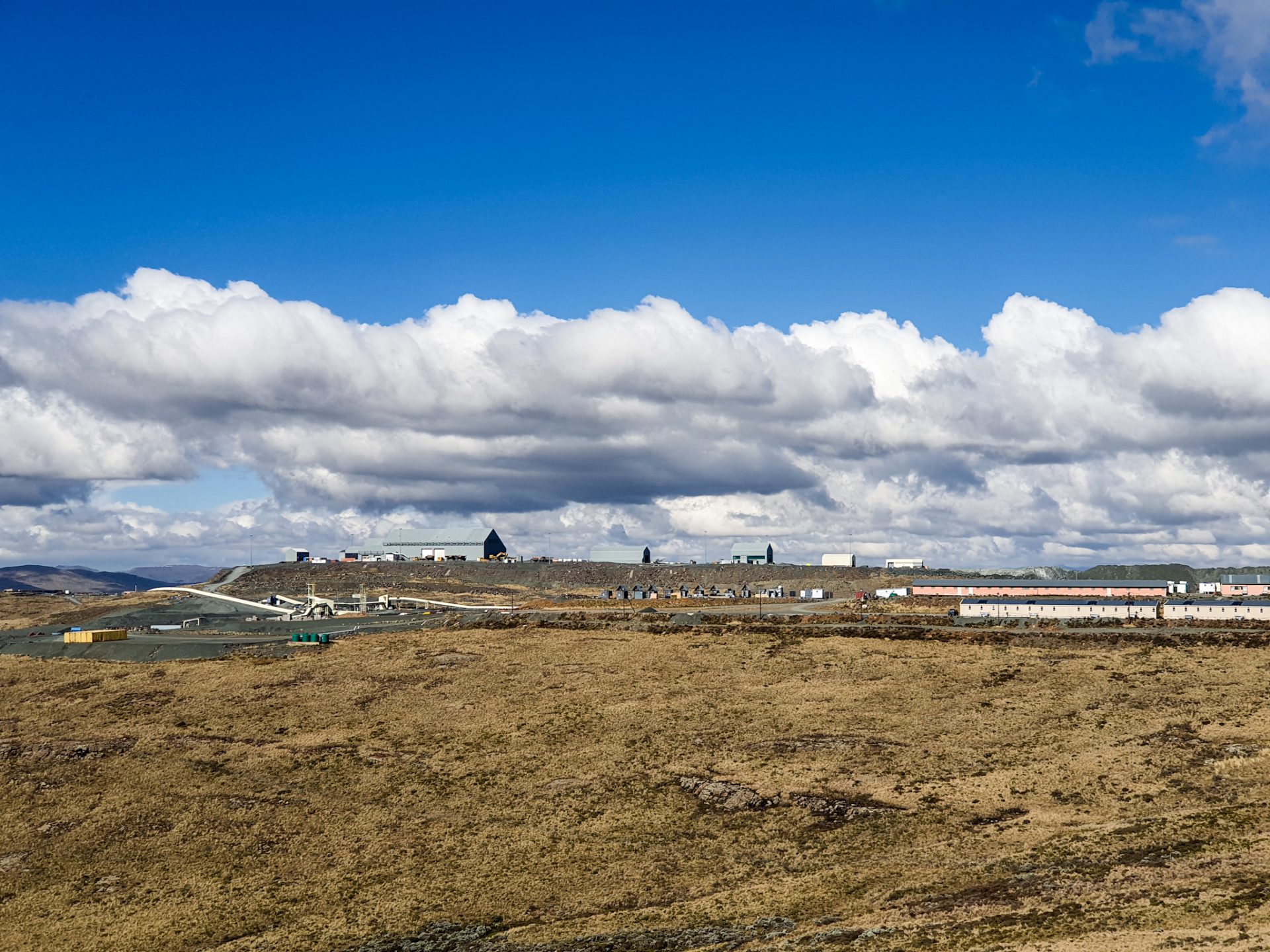
We continued quietly making our way through the Highlands, crossing different mountain passes (some almost 3,000 meters above sea level). The day, in the direction of South Africa, was getting darker and darker; but to our left, in Lesotho, only a few white clouds could be seen. Driving along the A1, we came across a very large sign that read: Letseng mine. And to our right we could see a whole mining construction of one of the most important mines in Africa. We, in our good faith, took this breaker to see if they would let us visit the facilities or explain to us what they were doing there.
We reached the door that was guarded by some guards who looked at us very strangely. From the door, people came in and out who were fully identified. We went to the guards and told them that we really wanted to see the mine, and to see if there was any option to enter because we were fanatics about these subjects… We didn’t know much about mines, but we thought which was the only excuse we could use to get in…
The guard made us wait in the parking lot for a long time, which we used to eat the food we had bought the day before at the Mokhotlong supermarket. And after a while, when a few drops started to fall, he came out and told us what we were already expecting: that no one could enter here without authorization, and that if we wanted to enter, we had to go to the headquarters first , located in Maseru, in order to explain the reason for the visit, and that then, if we had a positive answer, they would give us a piece of paper and a person from the site would accompany us to visit a part of the mine… We were there passing by, so all we could do was take an outside photo (and hidden, because it was forbidden), and get back on the main road to continue our route through northern Lesotho.
After about 25 kilometers from the Letseng mine, we saw in front of us a mountain that had a slope without any kind of vegetation, and some metal points that when we got closer, we saw that they were the chairlifts of the Africaski ski resort. Next to the A1 road was the ski resort that they were fixing up in order to have it up and running in a few months. And you can see that this resort receives a lot of South African tourists who want to ski in Africa! Anyway, it’s a very small station if we compare them to the ones we have here in the Pyrenees. It is quite unlikely to see a ski resort in Africa. In fact, there are only 7 of them in the entire continent! But Lesotho is a good place because it is very cold there in the winter and all the precipitation in the Highlands is in the form of snow.
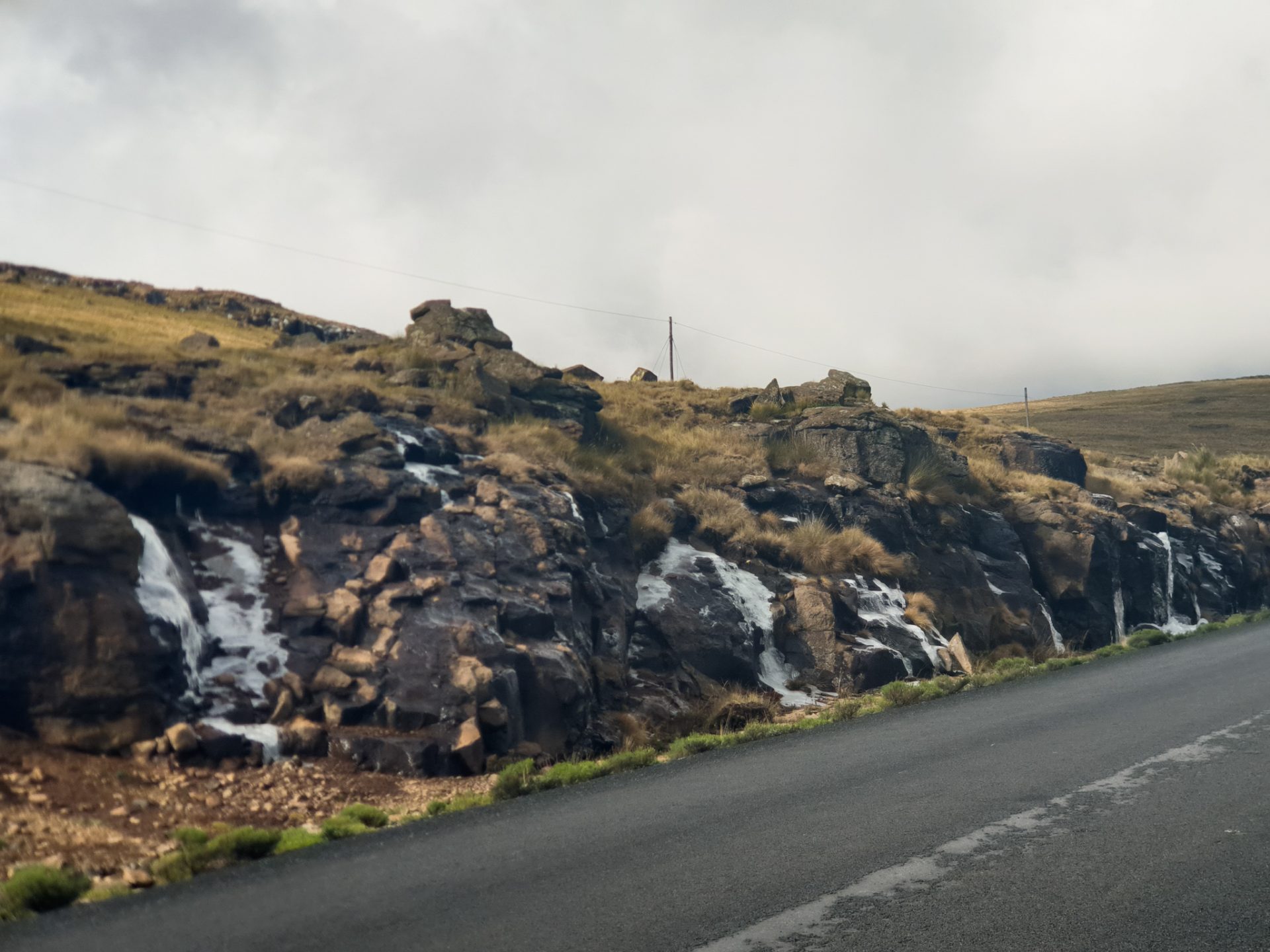
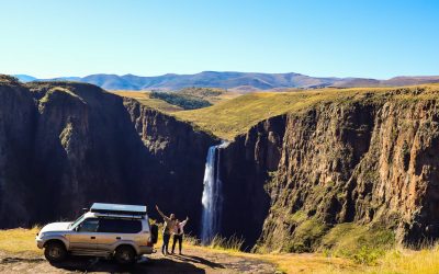
It was getting late and we were getting closer and closer to the Lowlands. After a few kilometers of leaving the ski resort behind, crossing a mountain pass we saw in front of us the road descending steeply and twisting until we reached what appeared, from a distance, to be the lowlands of Lesotho. Right on that descent, we passed by a waterfall that fell off the side of the curb. The scenery, the road and the drive on the A1 was spectacular!
Once we reached the Lowlands we started to see more settlements. Children walking home from school, people outside their houses chatting, more vehicles and the temperature was also higher than in the Highlands. It was a few minutes before 4:30 p.m., when we came across a road sign indicating the direction of the Liphofung Caves. We took a detour and after 5 minutes we were in a parking lot where a bus full of students was leaving from a cultural visit to these caves in Lesotho.
We were among the last to arrive, but they allowed us to enter the grounds. We had to pay the entrance fee and then, with a guide, we walked to some caves full of cave paintings. In fact, Liphofung means the place of the Eland, one of the most important animals that represented the Bushmen. These caves had also been a refuge for King Moshoeshoe I during the union of the different clans of the country, and we were also able to enjoy some exhibits on traditional Basotho culture that we quickly saw because the guide was eager to close the hut.

Now yes, we had already arrived in the Lowlands and it was time to find accommodation in the area. We drove to a campsite that was marked, but when we got there, we opened the gate to the site and found no one. The doors of the houses were completely open, so we left the car in the middle of the garden and decided to set up the tent and wait for someone to come… But, no one passed by, until after a hour came Moruti, who was the owner, with whom we negotiated a price for camping and we were able to spend the first night in the Lowlands, surrounded by a very rural plain and with the mountains behind us. It had been a spectacular day on the road, passing through some very beautiful roads and discovering more details about this country that we were falling in love with!

0 Comments