

Capital: Windhoek
Area: 824.292 km2
Inhabitants: 2.448.000 inhabitants (2018)
Population density: 2,97 inhabitants per km2.
Languages: The official language is English, although much of the black population also speaks Owambo. German and Afrikaans, which were official languages until the independence of Namibia (1990), are also very present. Apart from that, we will find other languages among the population of Namibia such as Nama, Romanian, Oshiwambo, Herero …
Currency: The country’s official currency is the Namibian Dollar (NAD). In exchange, 1 euro is 17 NAD. You can look at the current change, the next link.
Climate:
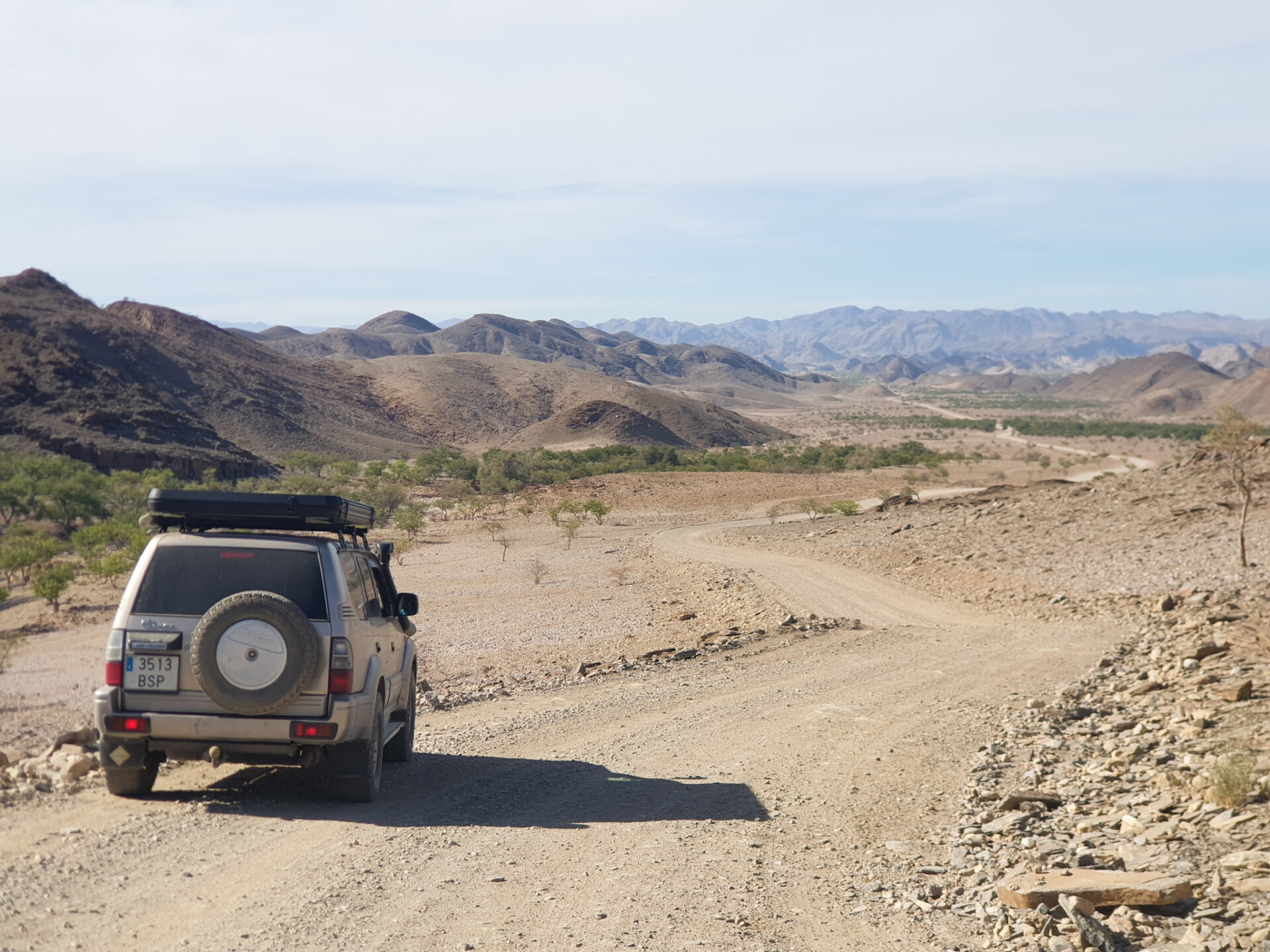
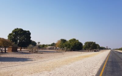
Road driving: With the exception of the northern area of the Skeleton Coast, the western part of Caprivi (Mahango Nationa Park) and the area of Opuwo and Epupa Falls, the rest of the roads (even inside Etosha Park) can be done well in a tourism . There are gravel and dirt road forces, very lonely, but in good condition. With a 4×4 you can always go faster than with a car on the roads of Namibia.
For car rental, here there is an article to assess the different proposals of your renting car. And here you can read the main TIPS for traveling by car to Namibia.
Internet / SIM card: Namibia is a country with an immense expanse of land, and at the same time very depopulated, with only 2.97 inhabitants per km2. In several areas of the country you will not have Internet coverage, such as the entire area of Kaokoland and the Skeleton Coast, located in the north and northwest of Namibia. Therefore, if you want to take a route there, we recommend that you look at all the information beforehand because you will not have internet. During our stay in Namibia, we bought a local card from the MTC company that cost us 67 NAD (about 3.70 euros) and which included 3GB of data and calls for a week (Super Aweh program). You can buy the different programs in the supermarket, although to get the SIM you will have to go to one of the telephone operators’ shops so that they can register you in the system.
Visa: For Spanish passports, it is not necessary to have a visa to enter the country as a tourist. They allow you a maximum stay of 90 days in the country.
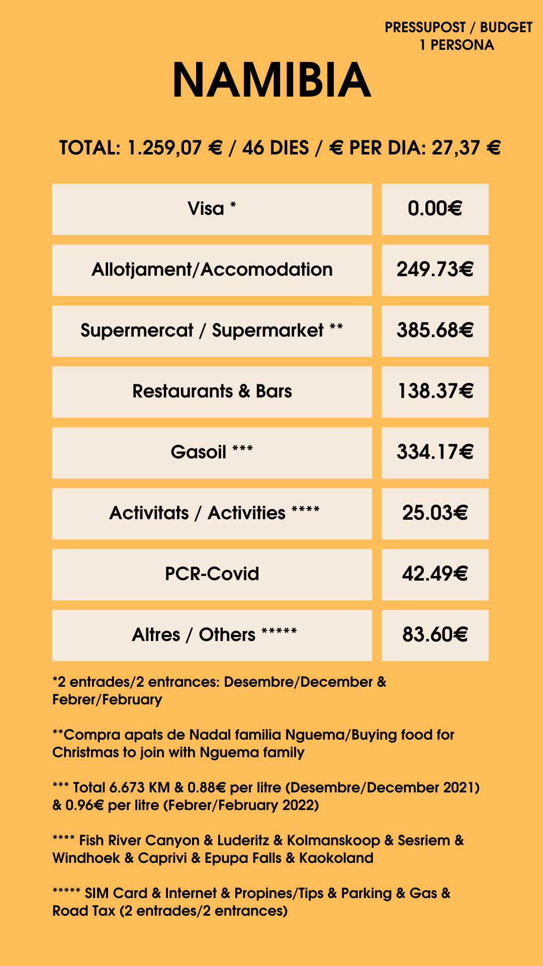
Budget: In total, we were in Namibia for 46 days in two entries we made into the country. The first was in December 2021 where we visited the Fish River Canyon, Lüderitz, went to spend Christmas in the Caprivi strip and did a route through the Kaokoland area and the Epupa Falls. The second was in February 2022 when we returned from Angola to go to Malawi. We spent a total of 1,259.07 euros per person, where we also spent money to celebrate Christmas and cook a Catalan escudella for the whole Nguema family; and also the whole subject of vehicle repairs (wheels, car check…) and a fridge to be able to store the insulins. Here is a breakdown of all the expenses in Namibia:
WHAT TO SEE IN NAMIBIA?
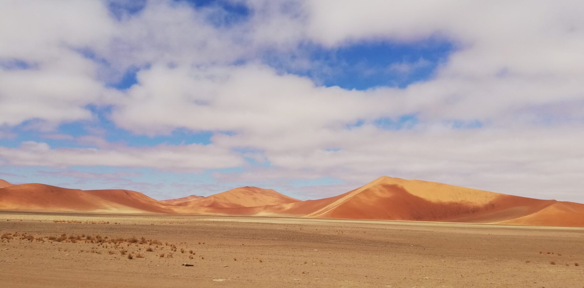
1.- NAMIB DESERT: NAMIB-NAUKLUFT NATIONAL PARK and SESRIEM
Declared a World Heritage Site, the word Namib means “huge” in the Nama language. It has an area of 162,000 km2 that surrounds the entire Atlantic coast, from the Orange River (natural border with South Africa) to the border with Angola. It is considered the oldest desert in the world. Sesriem is the entrance to the National Park where you can see the famous petrified trees of Sossuvlei.
A day trip visiting the famous vintage Solitaire gas station, stopping for breakfast to eat the famous “Apfelstrudel” and taking the opportunity to refuel in the town of Walvis Bay. It is located on the Atlantic coast where you can enjoy its sunset, its salt marshes and pink flamingos by the ocean.

3. SWAKOPMUND – SKELETON COAST – CAPE CROSS
The route climbs the west coast through Swakopmund, a city with a strong German colonial presence in its buildings and streets.
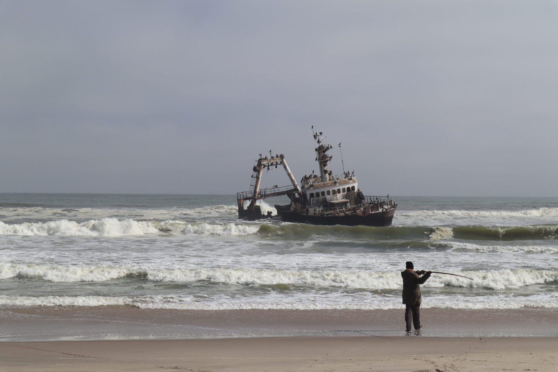
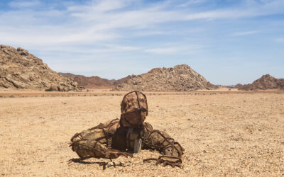
Next, you will enter the Skeleton Coast, an area where there are strong sea currents caused by the Benguela sea current. This current causes heavy ocean fog and very strong waves that have made it a frequent place for shipwrecks. Currently, different wrecked ships can be seen.
One of the important points to see on this coast is Cape Cross, located 120 km from Swakopmund. It is a very famous cape for his large population of sea lions. It is one of the largest colonies in the world. At some point, it can be as high as 200,000, and that’s just one of the points in the country that you can’t miss if you like animals!
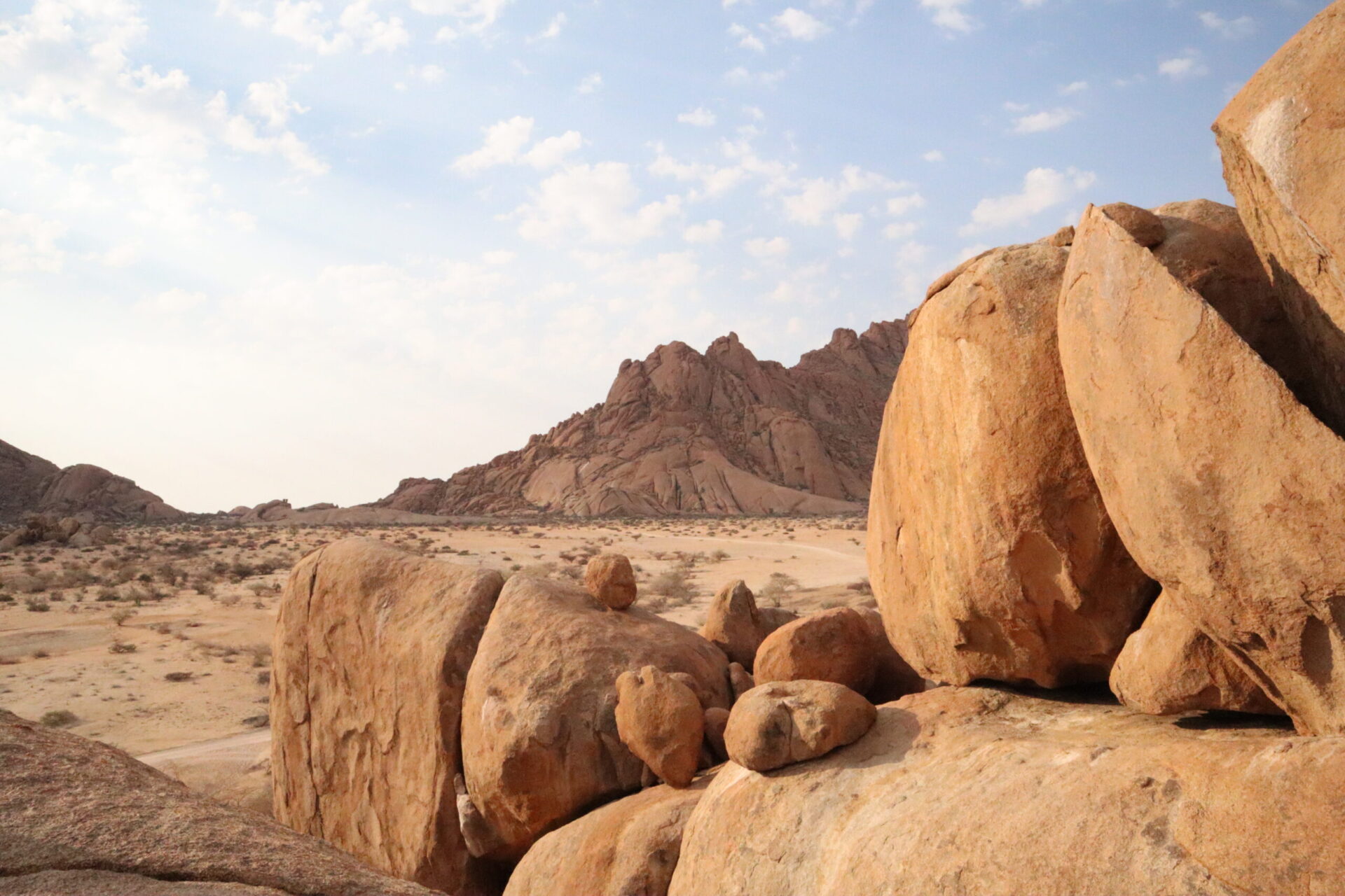
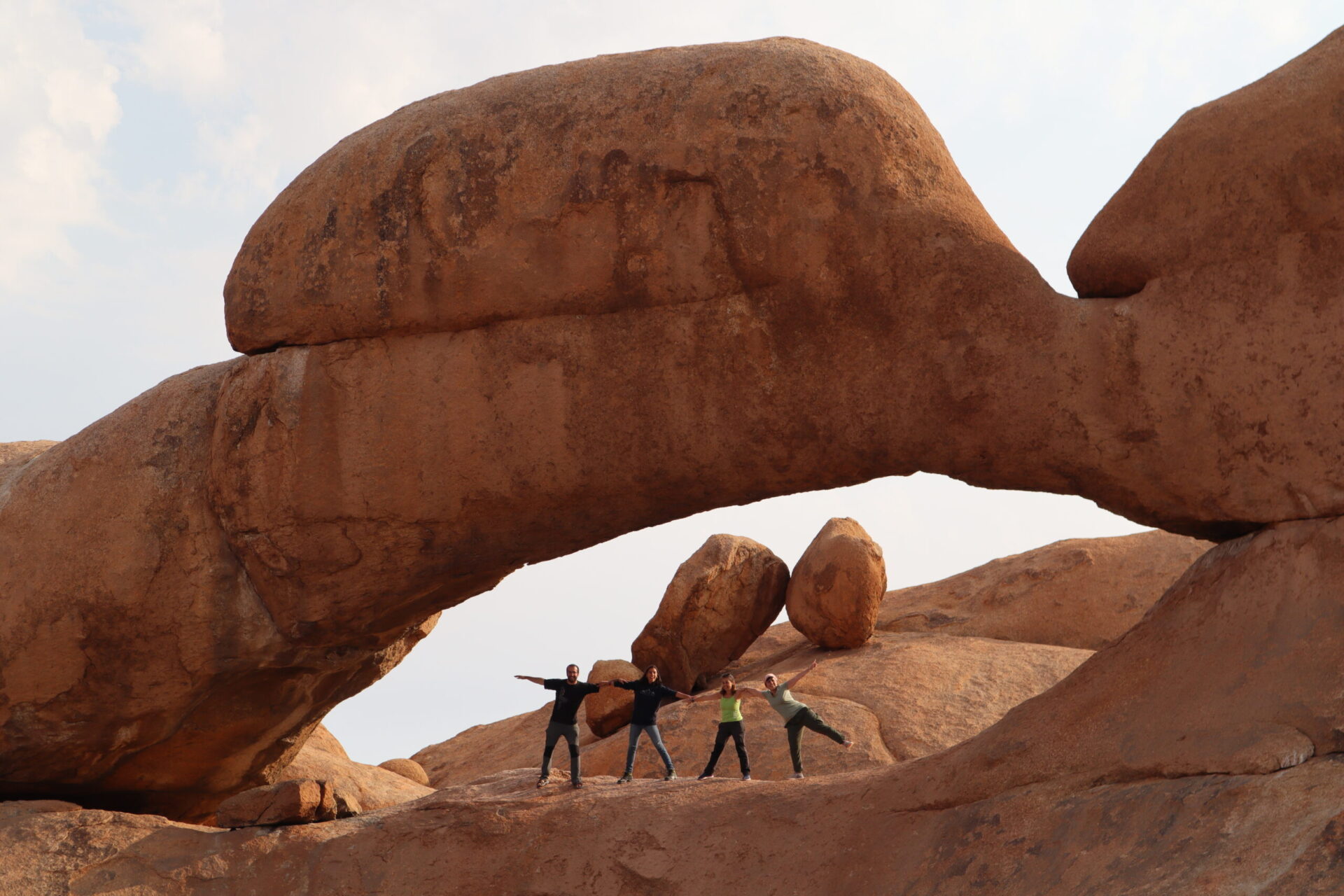
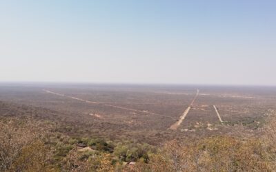
Spitzkoppe is the most famous granite mountain in all of Namibia, a mecca for many climbers but for us it is one of the best places to visit in the country even if you do not practice this sport. This rock formation is of great interest from a geological point of view forming walls with strange shapes and incredible rocky arches. It has cave paintings between 2,000 and 4,000 years old and is considered a magical place by the San people who live in the area. It is also one of the best places also to see starry skies at night, walk through strange landscapes and see stunning sunsets.
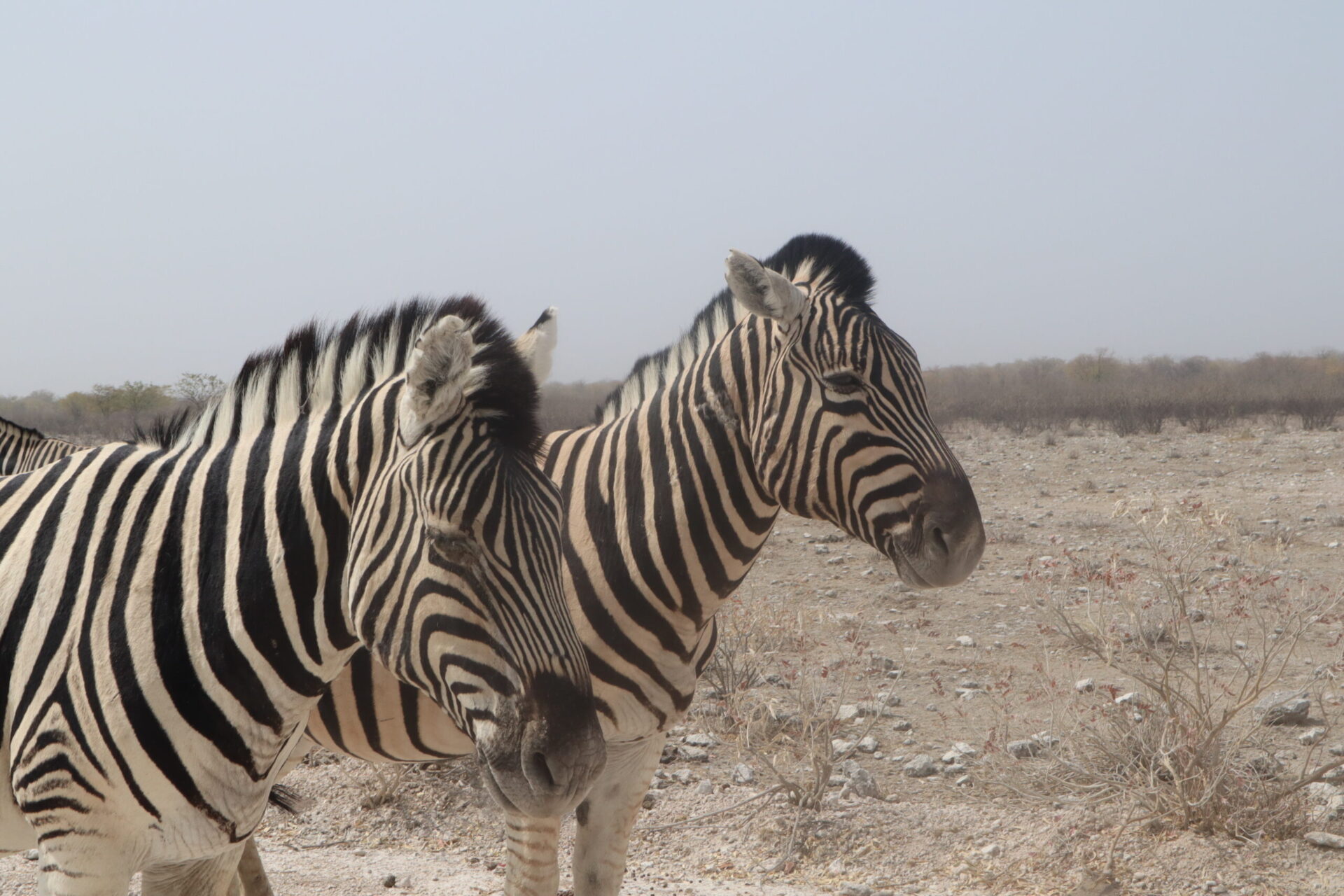
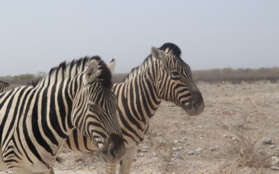
The route advances towards the best park par excellence for sighting animals of all kinds. Etosha is the best national park for wildlife sightings in the country. 4 of the Big Five stand out, but it is not possible to see water buffaloes. You can also see giraffes, zebras, springboks, oryx, hyenas and wild dogs, jackals, ostriches, etc.
Apart from the safaris through a park guide, you can tour the park with your own car (no 4×4 required) and make your own route inside the park. You can stay inside the park, where there are several camps, or sleep outside where there is also a wide range of accommodation.
Waterberg Plateau stands out for its 200 m high mountain but which is completely flat at the top. This fantastic plateau is 50 km long and 16 km wide, a paradise for a great diversity of birds and endemic plants in the area. You can do rhino sighting activities with hired safaris and also on your own, you can do various routes around the plateau with great views of your surroundings. It is a good stopping point between the Windhoek-Etosha route.

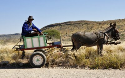
The Caprivi Strip is a non-touristy area that many people do not stop and only uses it as a crossing area to get to Botswana or Victoria Falls. For us, it is an area that we really liked because you see the authentic African life. It is one of the most populated areas in the country, where you can stop passing small towns around the road and the Zambezi River, smelling the essence of Africa. It is also a good place to visit the Mahango Game Reserve, a small but special reserve for the species that can be spotted there. It’s also a good place to see hippos, the only place to see them in the whole country.

Opuwo is the town that serves as a starting point for this region of Kunene, located in the northwest of the country and the cultural heart of this region. Around the city, there are a few Himbas villages. In this area, the Epupa waterfalls (about 250 km from Opuwo) stand out, which serve as a natural border with the neighboring country, Angola. These waterfalls are formed by the large waterfall of the Kunene River, about 20/30 m high. The road that goes to these waterfalls, is quite bad, we recommend the 4×4 and spend the night in the accommodations near the waterfalls.
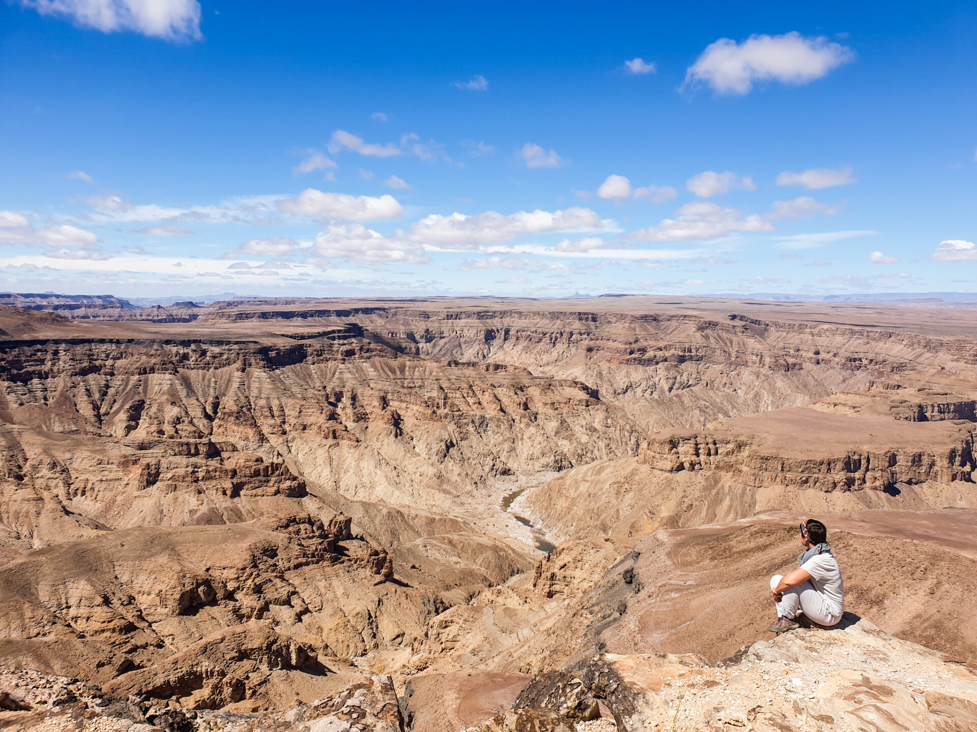
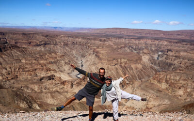
It is one of the largest canyons in the world, located about 8 hours from Windhoek. You can do a very demanding route of 5 days walking (85km) or a route through different viewpoints that you can do in one day. They advise going to the main viewpoint where you can get an idea of what the canyon is like. There is another lookout point, Hiker’s point (2.5km), but the road is often full of sharp rocks and usually people get a flat tyre on their car. If you have time you can do it on foot. Admission is 80 NAD / person and 10 NAD / car.
There are two places to visit the canyon: one is Hobas (north of the park, perfect for going to the main viewpoints) and the other is Ais-Ais (south, through the hot springs).
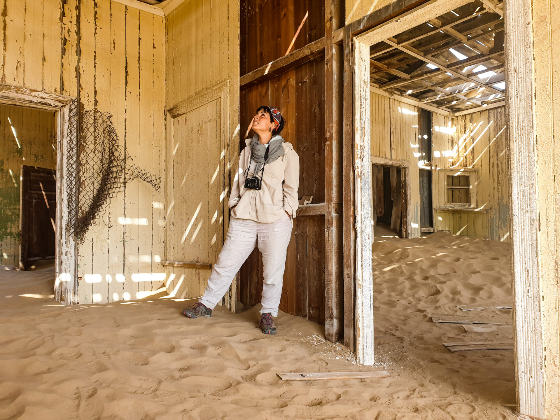
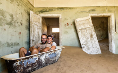
The Lüderitz area is a fairly remote area of Namibia, located in the south of the country, which was a very important place for diamond mining, but which has now become one of the most important fishing centers in the country, with a coast and a very interesting peninsula to discover, as well as mining ghost towns to photograph and wildlife to look for like the few wild horses left in this area. A very interesting visit if you have time to discover this vast country that is Namibia.
11. BRANDBERG MOUNTAINS
It is one of the highest mountain formations in the country, with an altitude of more than 1,800 m. The highest peak is Königstein, with 2,573m. It is located about 30 km from Uis. These mountains are made of granite and stand out for their caves where a large number of cave paintings more than 4,000 years old have been found. The most famous is called “White Lady”, the white lady, a cave painting made by Bushmen more than 2,000 years old and which actually represents a shaman of the time.
It is a magical and spiritual place for many tribes in the area. The visit can be done from 8.00-17h but it cannot be done for free. Admission fee (100 NAD / pers) includes the local guide who will accompany you during the trek through the area. It is recommended to tip at the end of the route if you enjoyed the visit.
12. TWYFELFONTEIN
It is a valley inhabited for 6,000 years. It is a World Heritage Site, where we can find very beautiful cave paintings depicting human figures along with wild animals. Near this town, the Organ Pipes, or organ pipes, are some volcanic basalt rocks known by their name for their shape. Admission is about 100 NAD / person and includes the guide.
13. KEETMANSHOOP and QUIVER TREE FOREST
Keetmanshoop, is a small town notable for its colonial-era church, and the imperial post office which is now the tourist office. It is a place to stop, to withdraw money, to fill a deposit, etc.… 15km away is Quiver Tree Forest Park, which is full of centuries-old Aloes Dichotomas located inside a farm called Gariganus. To access it you have to go to the Gariganus Lodge and pay a fee of 75 NAD. Inside, there is a car park where you can leave your car and you can visit on foot.
You can also visit Giant’s Playground: an expanse of land with rocks with curious shapes. Take the C17 (exit the farm on the left) and drive a few km. On the right, you will see a fence where there is a sign for the place. Open the fence and enter it by car, drive a few km and leave car parking. There is a path that you can see rocks on the top of others (be careful not to lose direction).
0 Comments