


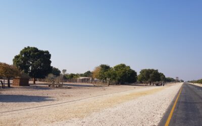
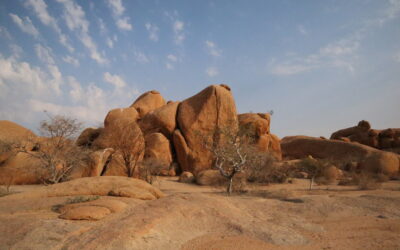
Namibia is one of the most special countries in Africa, especially in terms of its landscape. It is notable for its large area, dominated by the Namib Desert and the Atlantic coast, and rocky plateaus and gravel roads with almost zero population density. The north of the country, one of the less busy destinations in terms of tourism due to its difficult access, stands out for having roads full of stones; to cross dry rivers that are flooded during the rainy season; to still maintain the traditions and customs of the different tribal groups in the area; for rocky and desert landscapes; for waterfalls and rivers separating Angola from Namibia and for being a totally remote area where you will have no connection or coverage. With all these ingredients, the adventure is guaranteed!
On this one-year trip to Africa, we decided to explore northern Namibia, also known as the Cunene region, with our own car for a 5-day tour. It is important to be well prepared as you will need to bring everything you need with you for all these days because in this area you will not find supermarkets or petrol stations (if you can, take an extra tank of petrol and plenty of water), and you will be alone with the landscape and the few local population still living in this remote place in Namibia.
Below we will tell you about our experience in northern Namibia if you want to include it in your travel itinerary. We consider northern Namibia to be the area above Etosha National Park (to read our experience in this park, you can click here), and located west of the C43, the road that goes from the natural border from Angola to Palmwag via Opuwo, the main city in this region. Northern Namibia borders Angola, where the Cunene River forms the natural border between these two countries; and to the west directly along the Atlantic coast, in a desert area also known as the Skeleton Coast, in the middle of the Namib Desert. This whole isolated and desert region is also known as the Kaokoland territory.

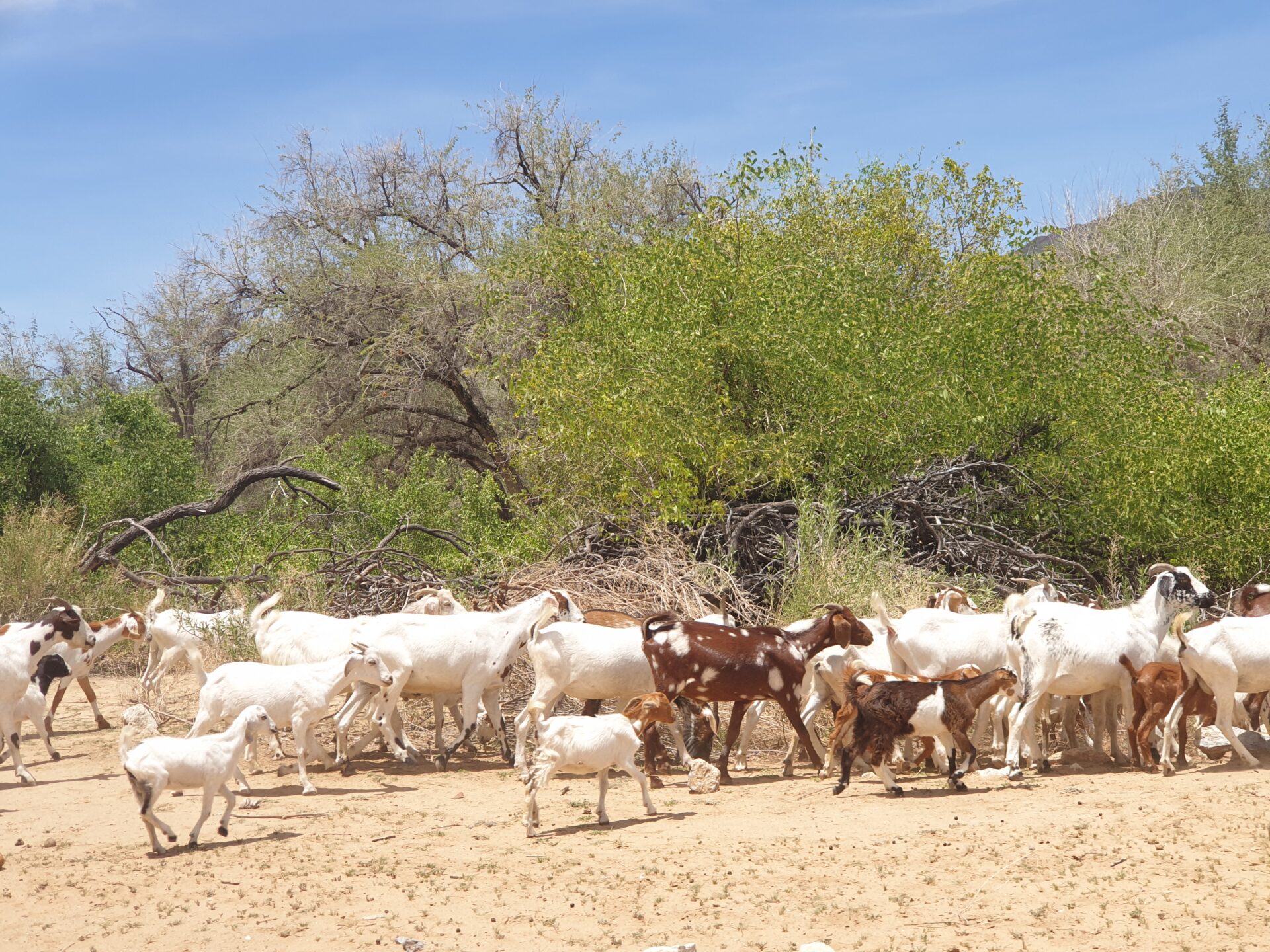
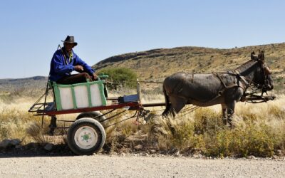
In this area of northern Namibia, you will find many Himbas, a tribal group characteristic of the Cunene region and the Kaokoland. The Himbas are a semi-nomadic people who are mainly engaged in livestock farming. Driving on the roads of northern Namibia you are very likely to find Himba villages along the way, as well as Himba women who are characterized by going with breasts uncovered and wearing mud braids on their heads. Even, strolling through the city of Opuwo you can find them inside the shops mixing with the other tribal groups. A very interesting anthropological view to see how tradition and modernity come together in the 21st century in Namibia.
In northern Namibia, we also find the Epupa Falls, waterfalls that come from the Cunene River and separate this country from Angola. In fact, from Namibia you will be just a few meters from Angola, you just have to cross a river where you can sometimes find crocodiles. This river is one of the most important in the country, along with the Orange River (which borders Namibia with South Africa) and the Okavango River, located on the Caprivi Strip (to learn more about our experience in this place, you can click here).

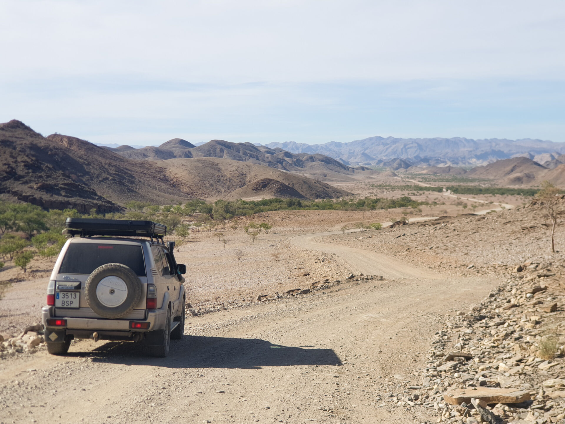
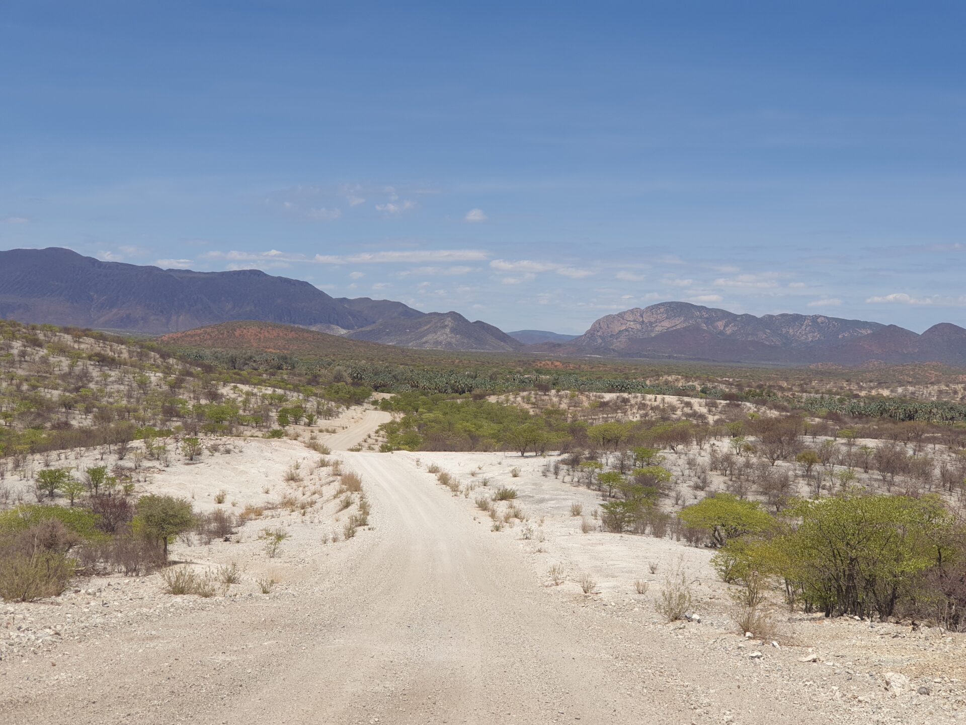
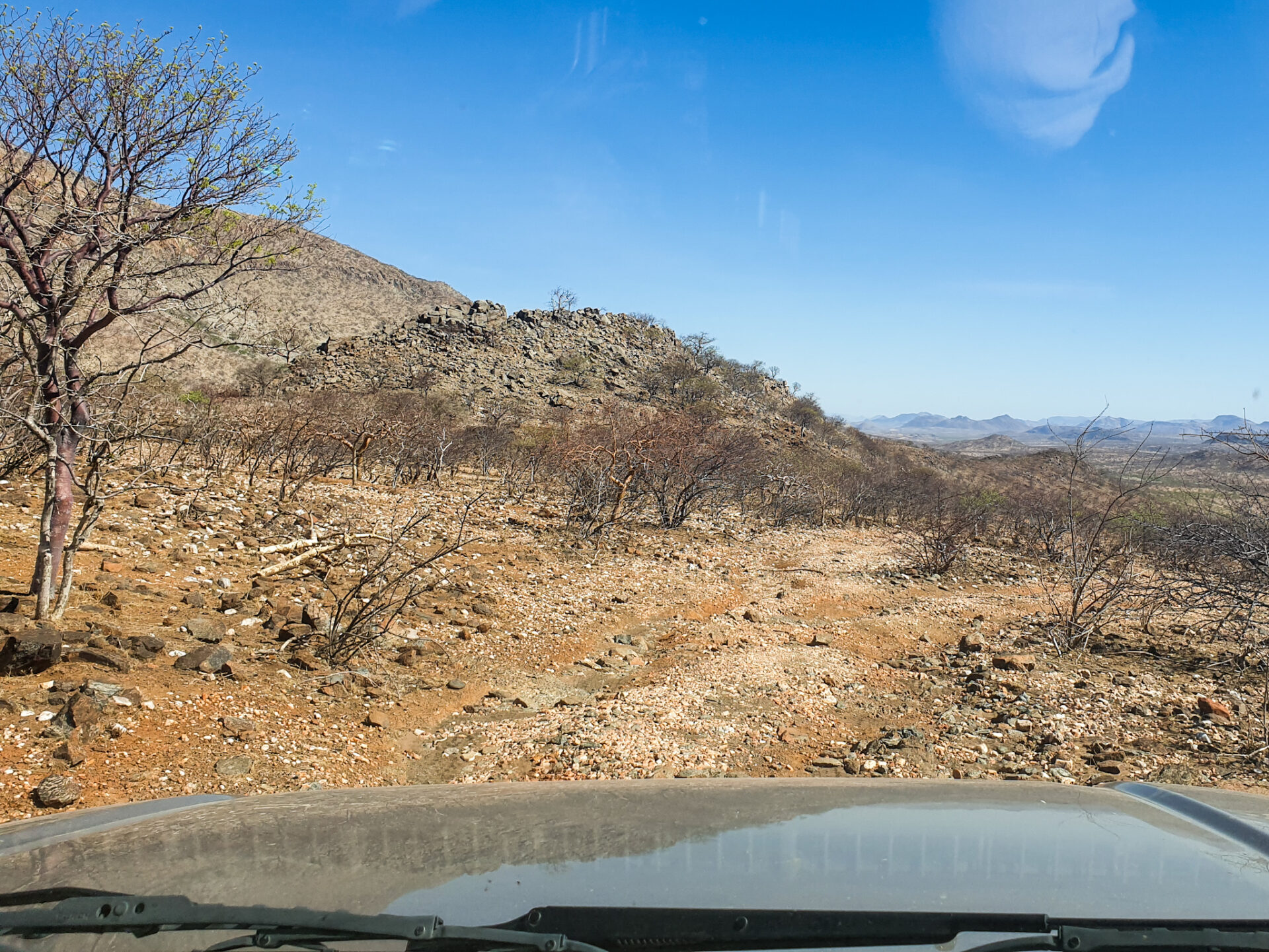
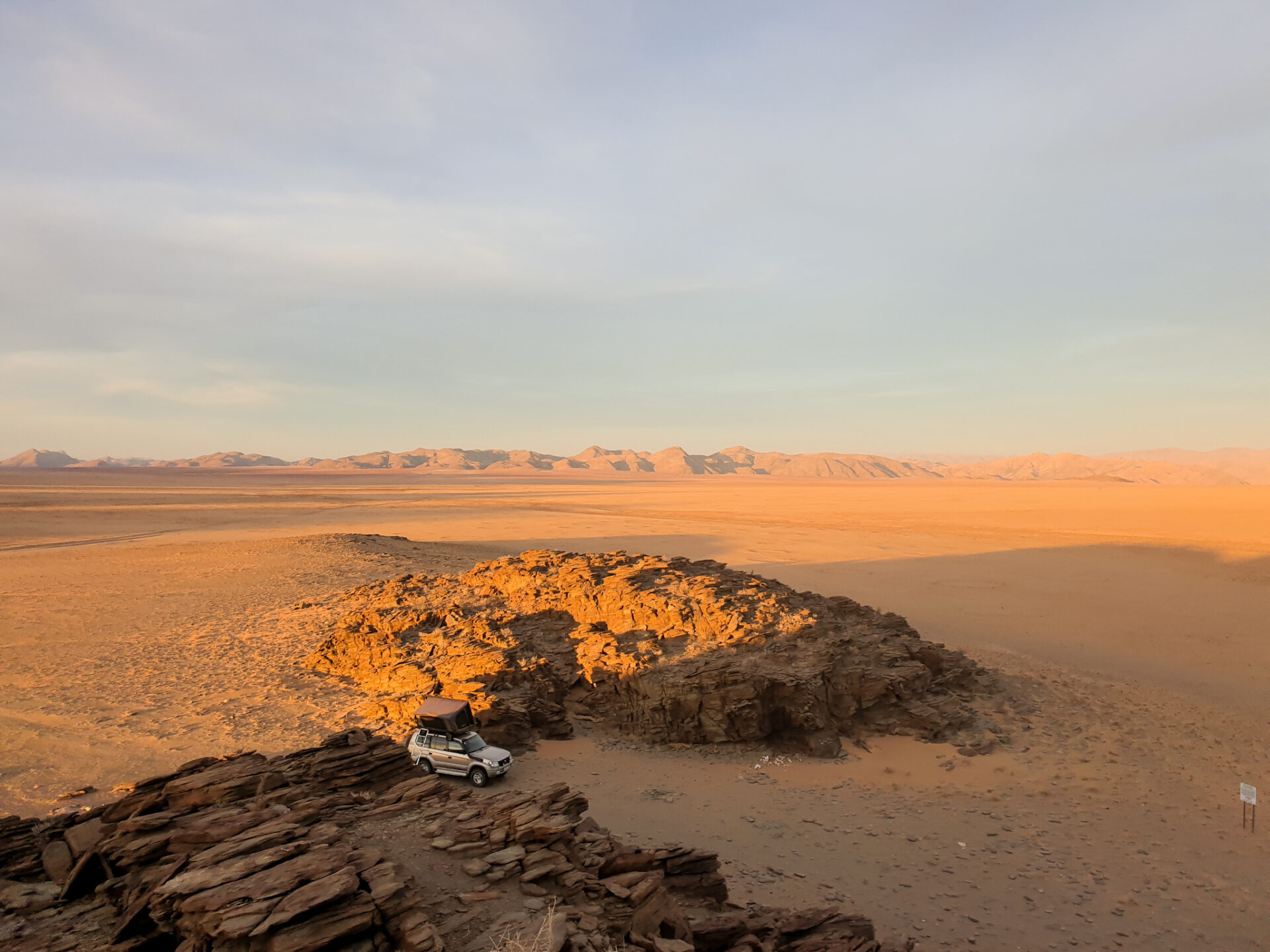
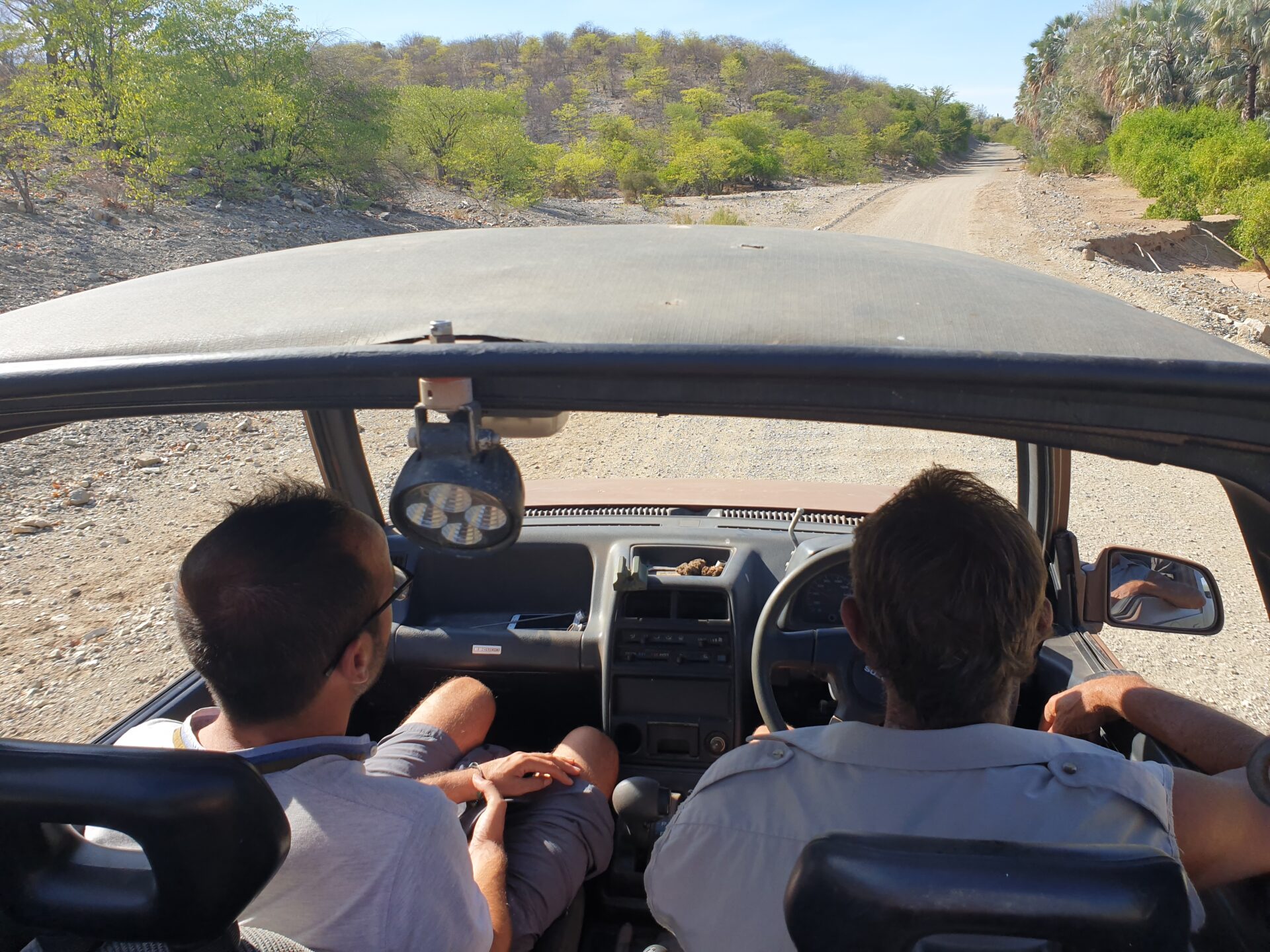
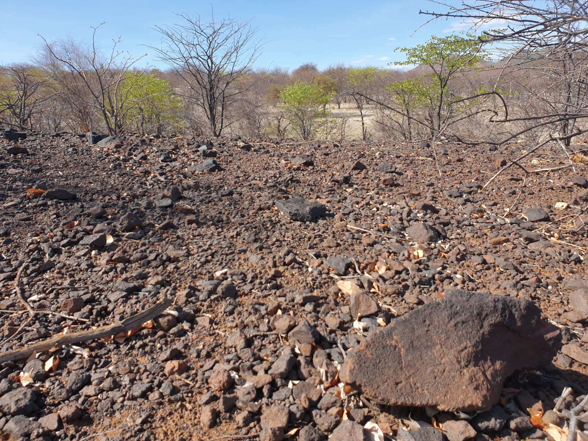
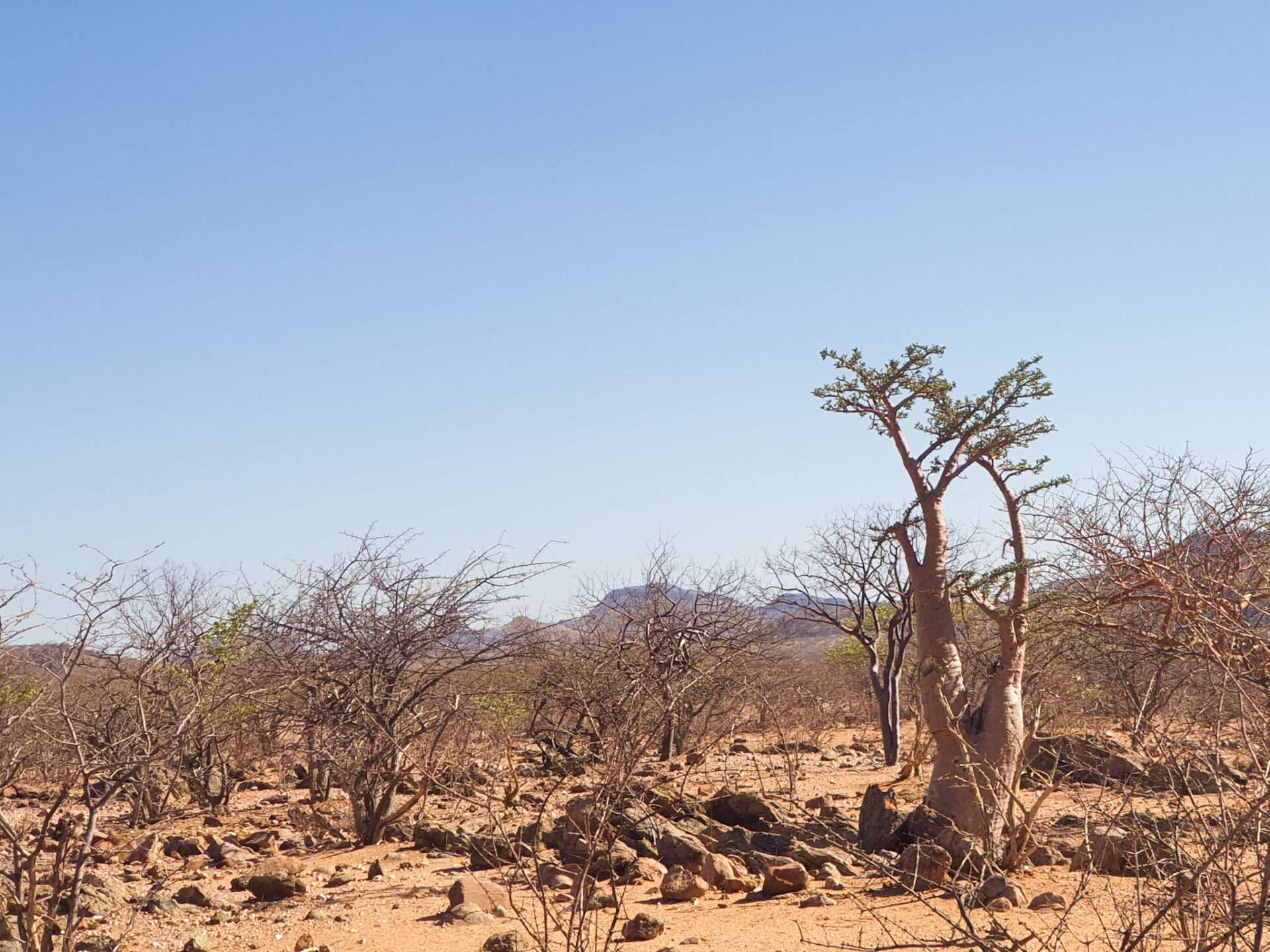
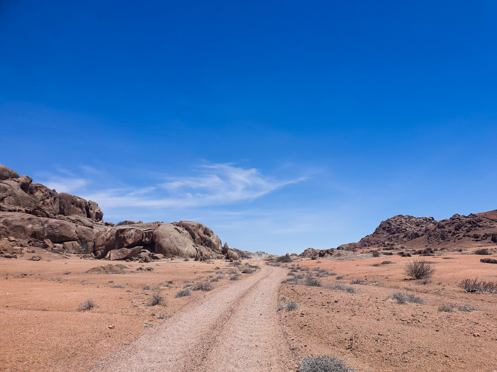
Roads to access northern Namibia can only be made if you travel by 4×4. Think that the roads are all gravel, and in many cases made up of large stones that you will have to cross while driving slowly and carefully. Therefore, we recommend that you check your car and wheels before to see they are in good condition. On the other hand, they are very beautiful roads, with semi-desert landscapes, where you can discover the mysterious sculptures of the Stone Men that we will talk about later, as well as rock figures in the middle of the desert, different wildlife that survives in completely isolated areas, and a totally remote area of the country.

Driving through northern Namibia is totally an experience that will surely not leave you indifferent. You will still discover the ancestral traditions of human anthropology, barren landscapes that have thousands of years of history, cross-border rivers and a wild environment that you will have to tame by driving your 4×4 on the rocky roads of the Cunene region and Kaokoland.
How to get there?
Opuwo is the main city of Kaokoland and the Cunene region. From there, you can discover different places in northwestern Namibia, such as the Epupa Falls, the Orupembe, or the Himba tribes. If you are coming from the north of the Etosha NP or the Caprivi Strip, the best way to get to Opuwo is to follow the C41, a road that runs from the city of Oshakati to Opuwo on a journey of 225 kilometers that can be do in about 3 hours on a very good paved road.
If you are coming from Windhoek or the south, the best way to get to Opuwo is to go to Kamanjab (the western entrance of the Etosha NP), and from there drive 205 kilometers on the C35, a paved road and in very good condition, until you reach the detour of the C41, where you will have to drive the last 60 kilometers until you reach Opuwo (in total, from Kamanjab it is about 3 hours’ drive).
From Opuwo, you will be able to access Kaokoland’s main points of interest by gravel roads, where you will need a 4×4 and be well prepared, that is, with an extra tank of petrol for the car, water and food. In the section “What to do in the Kaokoland region?” we explain how to do some of the routes we drove, in case they may be useful for you to use as a guide.

What to do in the Kaokoland region, in the north of Namibia?
North Namibia is a very remote area where you can enjoy spectacular scenery and tricky roads but well worth a visit to some places of Africa that still remain as they were and where you will experience an adventure. The main activities we highlight are:
– Visit Epupa Falls
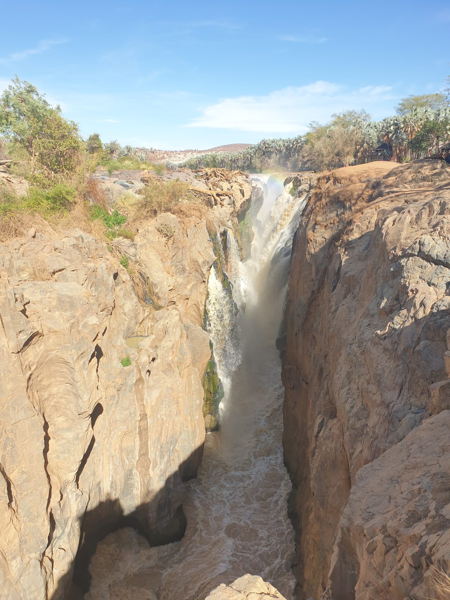
The Epupa Falls are probably the main tourist attraction in the Cunene region. They are a series of large waterfalls created by the Cunene River on the border of Angola and Namibia in the Kaokoland area. The river, about 500 meters wide on both sides, falls into a series of 1.5-kilometer-long waterfalls, where the highest waterfall is 37 meters high. The name “Epupa” is a word that in Herero (the local language) means “foam”, in reference to the foam created by falling water.
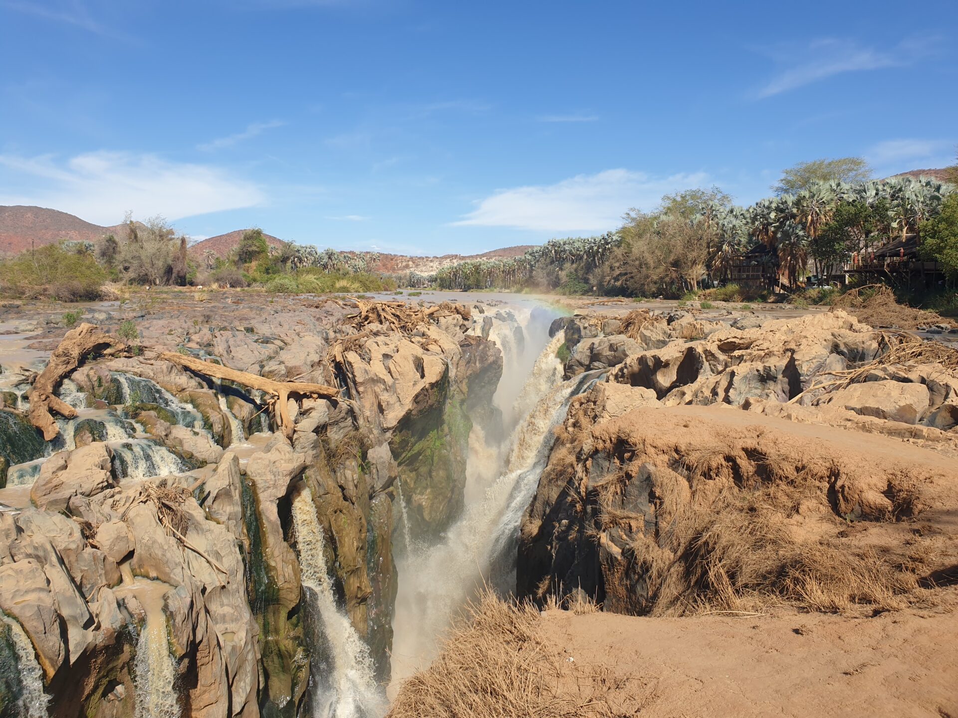
Entry fee to the waterfalls is free. However, you will find several local people who will offer to guide you in exchange for a small tip, and they will tell you the story of the place and the customs of the people there. Next to the waterfalls and the river there are different community accommodations where you can camp and relax while listening to the sound of the water. In the “Where to sleep in the Kaokoland region?” section, we specify some of these accommodations.
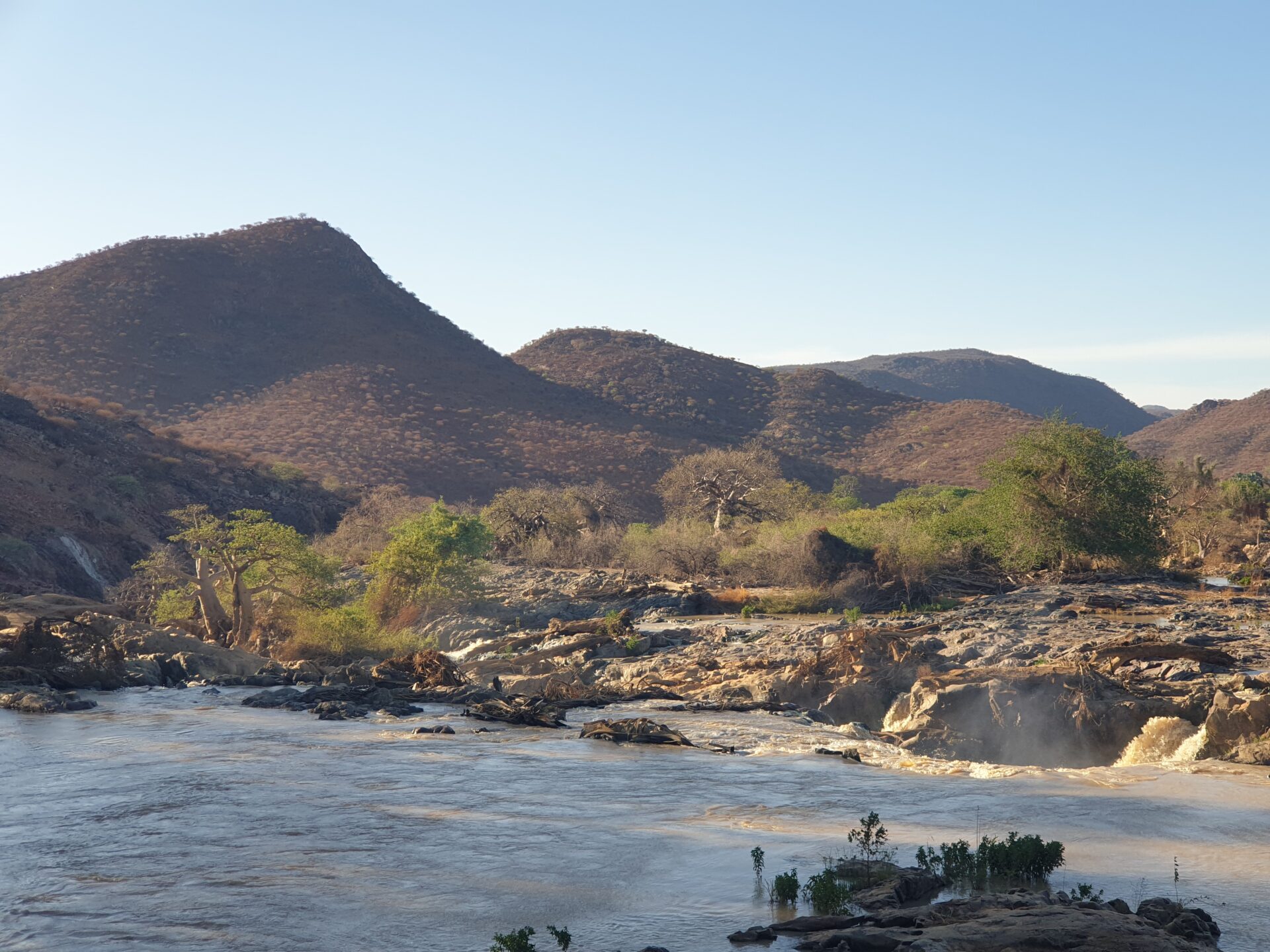
The Epupa Falls are the most important waterfalls in Namibia, but being located in a fairly remote place, they do not usually receive a large number of tourists. Visiting this place and all its surroundings is an activity that we consider essential if you visit the Kaokoland region and northern Namibia.
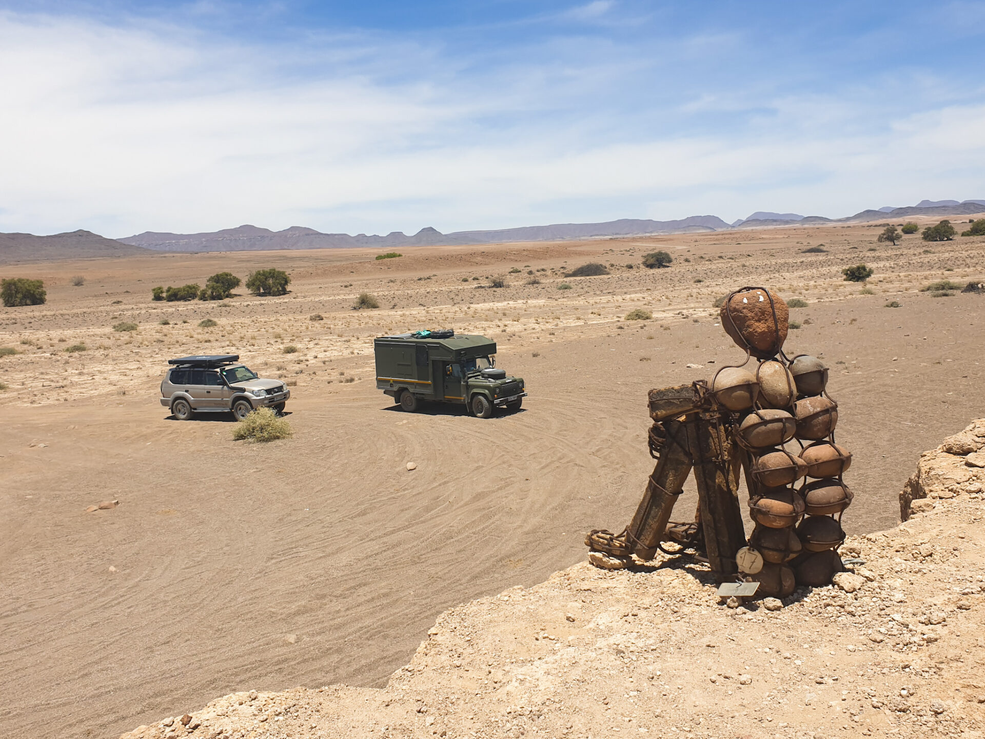
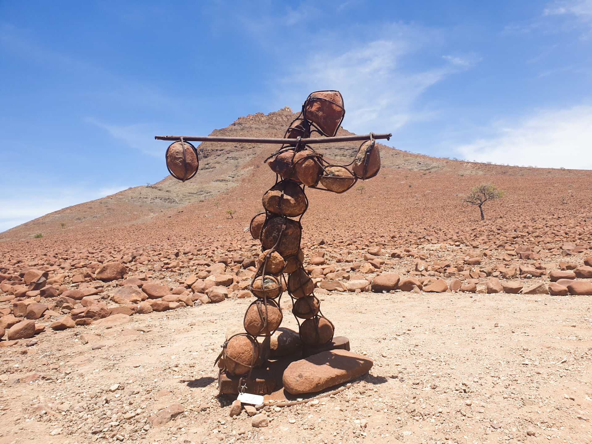
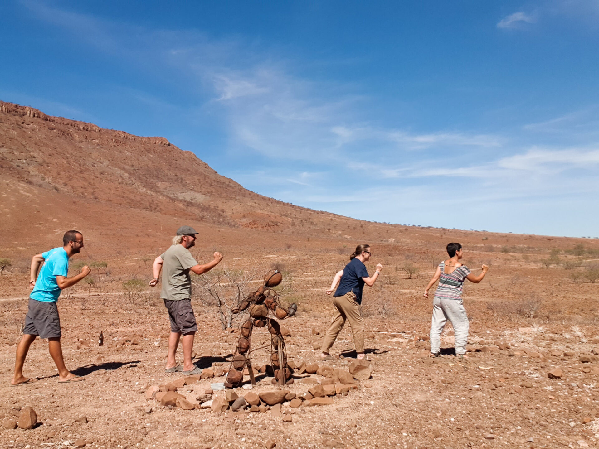
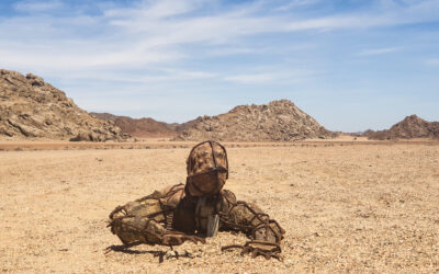
– Go in search of the mysterious Stone Men
If you drive along the roads of northern Namibia and suddenly see a man-shaped stone sculpture in a certain position, it means that you have seen one of the mysterious Stone Men in the Kaokoland, a remote and isolated area of northern Namibia.
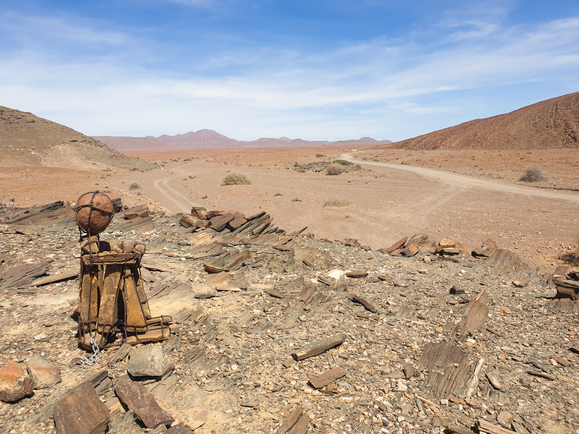
The Stone Men are an unanswered riddle in this wild region of Namibia, only suitable for adventurous travelers in a deserted paradise of mysteries and wonders. These stone sculptures, also known as The Lone Men of Kaokoland and made of rock from the Cunene area, are characterized by the human figure of a man representing various personalities. Each figure is in a different position: sitting, standing, kneeling, crawling, hands up, holding on to a rock… In each sculpture, you will find an inscription indicating the number and a short message indicating the title of his posture and the direction in which this mysterious man is going.
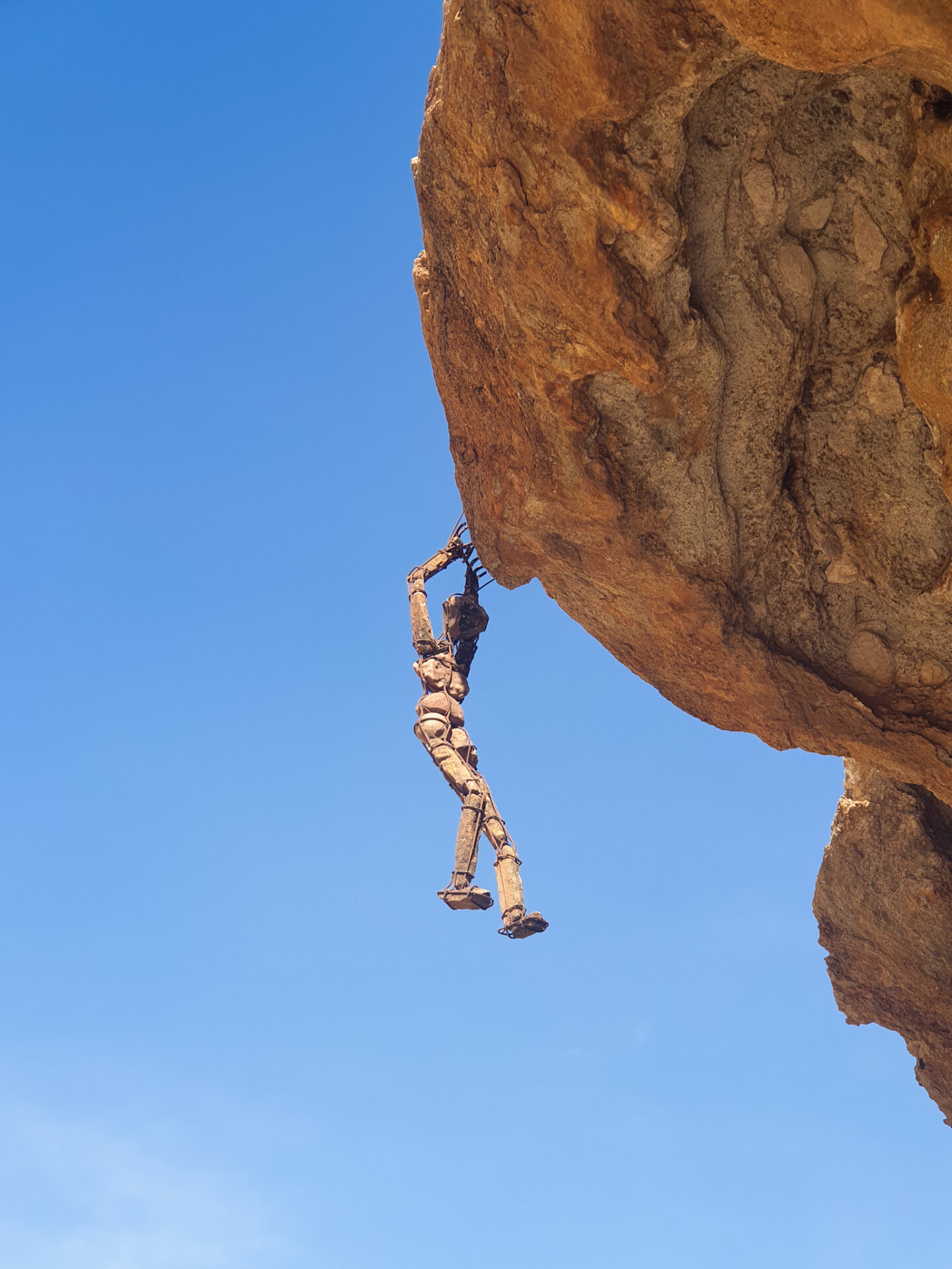
You can find them in different parts of Kaokoland, such as Purros, Van Zyl’s Pass and the Skeleton Coast. We, in this article, explain in more detail the different Stone Men we encountered during our 5-day route north of the country. Do you dare to discover more for yourself? When driving through the remote lands of Kaokoland, probably you will have a Stone Men nearby!
Besides, no one knows the artist of these sculptures. In other words, the creator of the Stone Men has managed to go unnoticed and build a gallery of outdoor sculptures in the forgotten landscape of Namibia’s Kaokoland. And here, surely, lies much of the mystery of these sculptures. Why in this position and in this place? Could the artist be placing new Stone Men in the Kaokoland region? Why doesn’t it come to light? Perhaps these questions are what make this place special and make the search for Stone Men a very entertaining activity to do during your days in northern Namibia. The mystery is still to be solved …
– Get close to some Himba tribe
In the region of Cunene, in northern Namibia, we find much of the Himba population. These are also found in southern Angola where they are known as muhimba. As you drive along the roads in this area, you will find several circular villages where the Himba live alongside the roads. It’s a great opportunity to get closer to them and try to make a connection so that you can get closer to them and learn a little more about their history and traditions.
The Himbas are a semi-nomadic people. They are engaged in herding their goats and cows and are moving in search of water and food for the cattle. Himba culture could not be understood without the cattle, which is present at any important event: weddings, funerals, births, puberty rituals…
The Himba live in circular villages called kral and stand out for being a structure, also in shape of a circle, of different houses made of mud and straw. In the middle of the village, we find a space to keep the cattle. While the men are engaged only in grazing the cows and the herd, the women are in charge of building and maintaining the village, the children, cooking, milking the cows, fetching water and caring for the goats. In fact, cow’s milk is the mainstay of their diet.
The Himba woman is characterized by the mud braids she wears on her head. Every morning, with the mixture of clay, ocher powder and cow’s butter, they make a kind of clay with which they anoint the body. Aside from being an iconic element of the Himba tribe, this mud serves to protect them from the sun and mosquitoes. The different hairstyles they make with the mud depend on the status within the tribe. It’s a sign that life is changing. For example, changing from puberty to adulthood means a change of hairstyle. If you want to know more about them, you can read the following article here.
During your journey through the Cunene region, you will see Himba people walking the streets and roads. Some of them will often ask you for money if you want to photograph them. Therefore, we advise you not to remove the camera without first talking to them. Also, they will ask you for food and the little ones will insist on the word “sweet”, a word they have learned to say because certain tourists, and in our opinion incorrectly, give candy to children feeling the most solidarity of the planet. You need to be aware that you are visiting a tribal group, so you need to have some empathy and respect for them, their way of life, and approach them in a humane way. If you can, take your time and break this border of tourists with money and they will surely give you back an unforgettable experience.

– Drive a 4×4 route through the different places in this area
Northern Namibia and the Kaokoland area in the Cunene region are one of the last wilderness areas left in Namibia. This country is notable for its long gravel roads that traverse desert landscapes with beautiful rock formations, as well as national parks such as the Etosha NP. Apart from that, it also has a good artery of paved roads between the main cities of the country. But like the roads in the north, you won’t find any like the rest of the country.
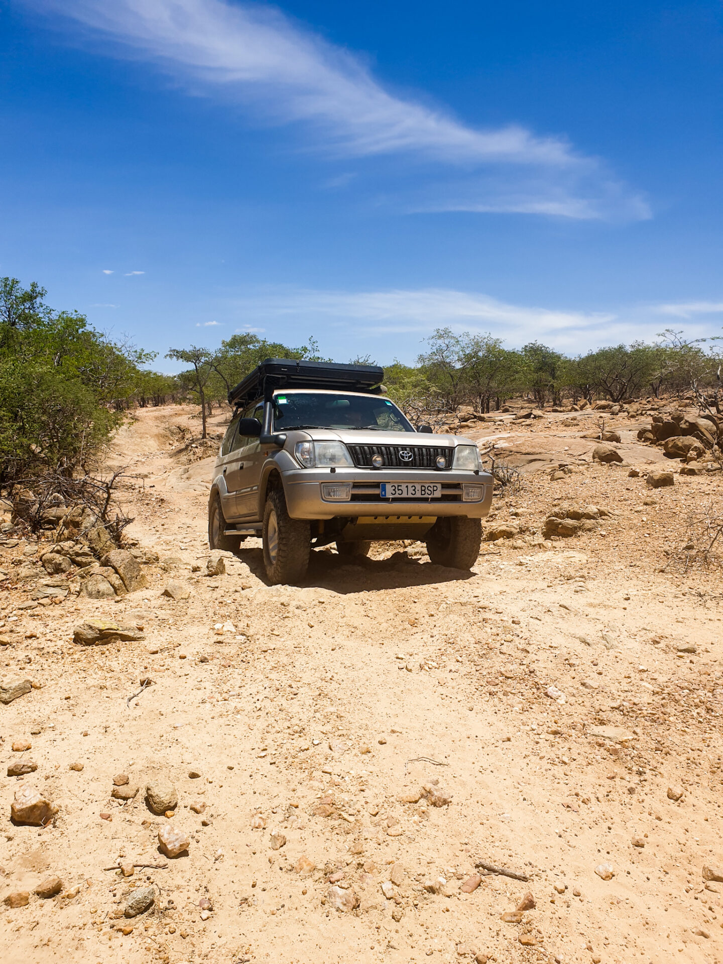
The roads of the Kaokoland are only suitable for 4×4 vehicles, as they stand out for being roads full of stone, with some river crossing (in the rainy season, you may not be able to cross the river and therefore cannot visit any part of ‘this area) and a very steep terrain that make it a challenge for those more adventurous travelers.
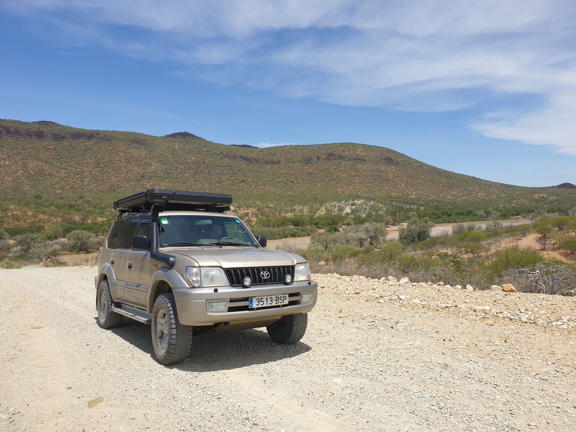
We went with our Toyota Land Cruiser 4×4 which held up very well all the way, although the wheels wore out faster due to the topology of the terrain and we had to change them after about a month of doing so. We advise you to activate the 4×4, and take a good map to drive and be patient, as on certain roads you will not exceed 20 kilometers per hour due to road conditions.
Here are some of the routes we took through northern Namibia in case they are of interest to you:
– RUACANA-EPUPA FALLS (driving the D3700): This is probably one of the best roads we did. Partly because the route from Ruacana to Epupa Falls is being arranged and conditioned to facilitate the arrival of tourists at these waterfalls. From Ruacana, which is where the asphalt road of the C46 coming from Oshakati (in the north-central part of the country) ends, to Epupa Falls there is a total of 160 kilometers on a gravel road (D3700) which is fine and which runs parallel to the river Cunene, and where you can find different Himba villages along the road. Think that in Ruacana there is the last gas station before heading into the Kaokoland region. Therefore, we recommend that you fill out all the deposits here. You can do this route in about 4 hours.
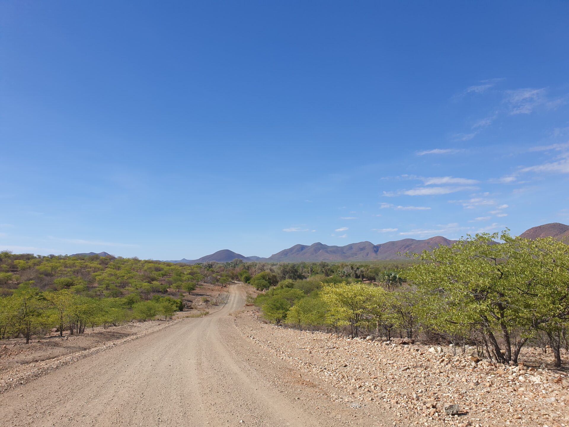
EPUPA FALLS-OPUWO (driving the C43): This route, which runs entirely along the C43, connects the Epupa Falls with the main city in the region, Opuwo. This road is also gravel but in good condition, with a distance of 180 kilometers that you can do in about 3 hours. Along the way, you will find different Himba villages, as well as villages like Okangwati and primary schools where visitors are welcome, such as Omuhonga School.
– OKANGWATI-OPUWO (driving the D3703): This 180-kilometer route is one of the most difficult we did during our route to northern Namibia. Exit the town of Okangwati, where you reach the C43 from Epupa Falls to Opuwo, where you turn west. The first few kilometers are gravel and pass through different small villages, but from the village of Etengwa, the road is very complicated. With lots of slopes and rocky terrain, driving through this area is a challenge and you will have to go very slowly. Then you come to a small swamp of water, which is the Ovivero Dam, where you will find different herds and shepherds waiting in the shade of some of the trees while the heat of the day hits hard. A nice place to stretch your legs (if you prefer, you can leave the car parked before the sand, as to access it you have to cross a dry river).

After a few kilometers of the dam, you will find on your left a turnoff that goes to Van Zyl’s Pass, the trickiest road in this area due to its difficulty where you can take 3 hours to go through the little less than 40 kilometers of this complicated route. We didn’t do it and we followed the D3703 until we reached the turnoff that takes you to Orupembe. We left this road here and headed further west.
From the turnoff to Orupembe (located near the town of Etanga), to Opuwo driving on the D3703, there is a total of 100 kilometers that you can do in approximately 2-3 hours as the road in this part is in better condition.

Therefore, if you take the circular route from Okangwati to Opuwo, you will find the first part very difficult to drive with your 4×4 passing through different slopes full of stones. If you have a lot of experience and want to do the Van Zy’ls Pass, you have to take this road and deviate just a few kilometers after the dam. If you want to go to Orupembe, as we did, you have to turn right just before Etanga.

– ETANGA-ORUPEMBE-OPUWO (from the D3703 junction, then driving the D3707): This route starts just 13 kilometers before Etanga, at the junction that turns west towards Orupembe. Here the road becomes flatter, with different river crossings and different paths leading in the same direction. We recommend that you follow the Maps.me app to see the route.
Here the roads are more open, with some ascents but not as strong or hard as the Okangwati route to the Ovavi dam. We started doing this route at noon, sleeping in the middle of the road, in an area where there were baobabs and a very quiet area full of small trees. Until you reach the D3707, it is a total of 70 kilometers but you will do it in a time of 4-5 hours.
The next day, however, instead of going straight to Orupembe, we turned off to go to the Marble Camp, which is 25 kilometers north of Orupembe, and which stands out for having a marble mine from where you can take very good snapshots as it is in the middle of nowhere. And along the way, you’ll be able to start finding some of the mysterious Stone Men. The route is complicated, but it can be done if you go slowly and carefully.
Then, from Orupembe you can go directly to Opuwo by taking the D3707, a 215 km dirt road, where you will find different villages and water points, before reaching the main city in the region. We did not do this part, because we went from Orupembe to Sesfontein also following the D3707, the route that we explain below.

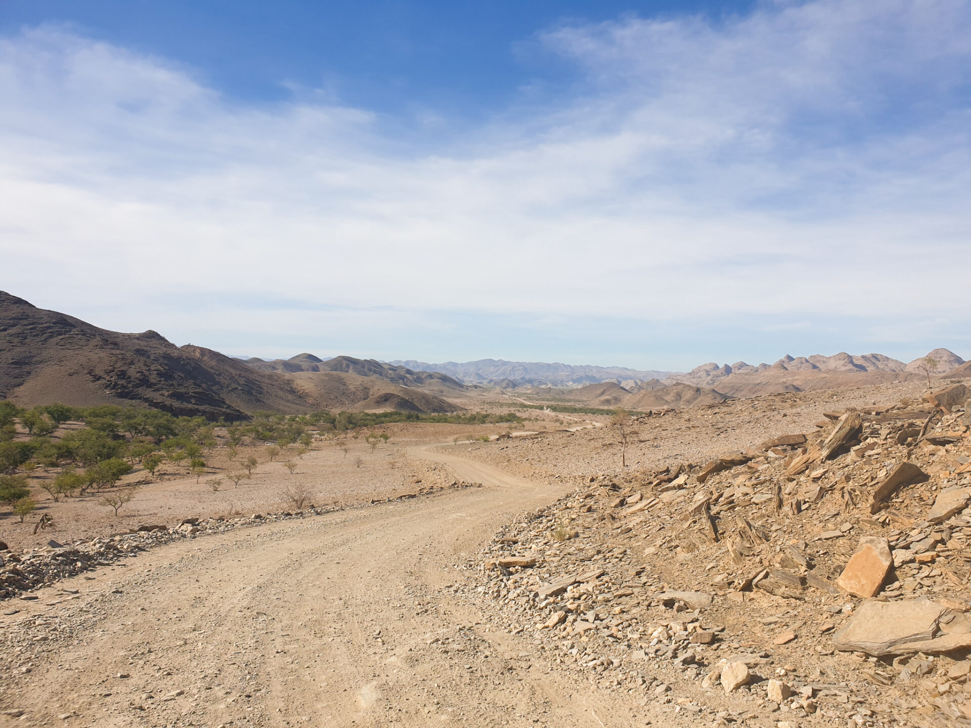
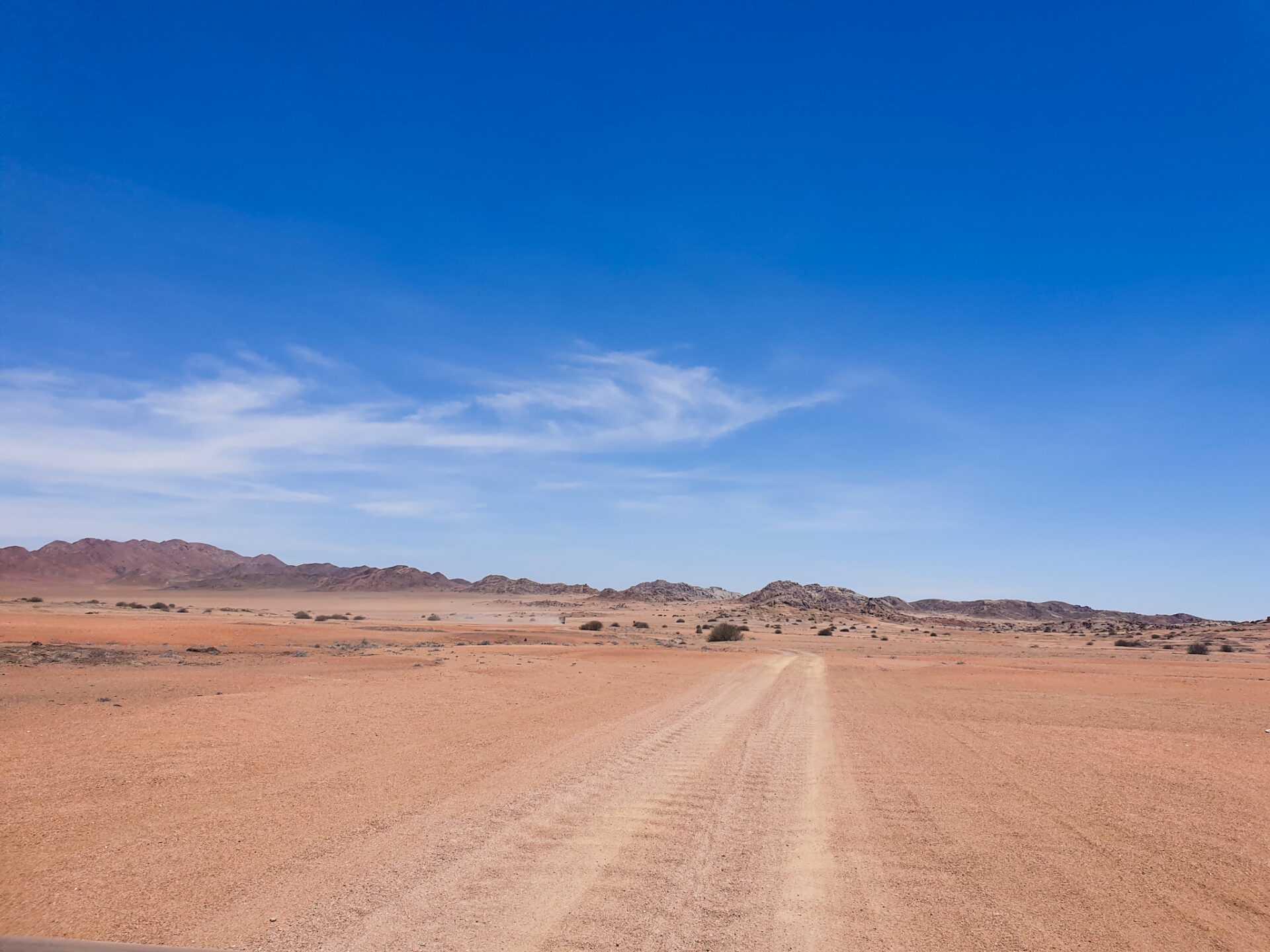
– ORUPEMBE-SESFONTEIN (driving the D3707): Here, the road becomes Namibian again, that is, wide and with long straights of gravel. But this road stands out for having a wavy pavement that will make the car constantly shake. The landscape changes, with a much broader perspective than the previous routes and with views of the desert on the horizon. Get ready to see different Stone Men along the way!
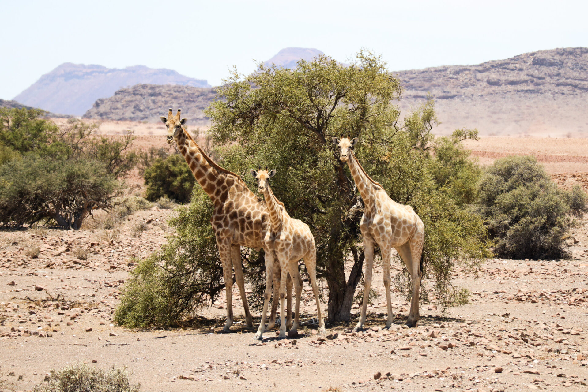
From Orupembe you will go to Purros on the D3707, where you will find some animals such as giraffes and antelopes. We took the opportunity to have lunch by the roadside while watching these long-necked animals and wondering how they could live in such a remote place like this.
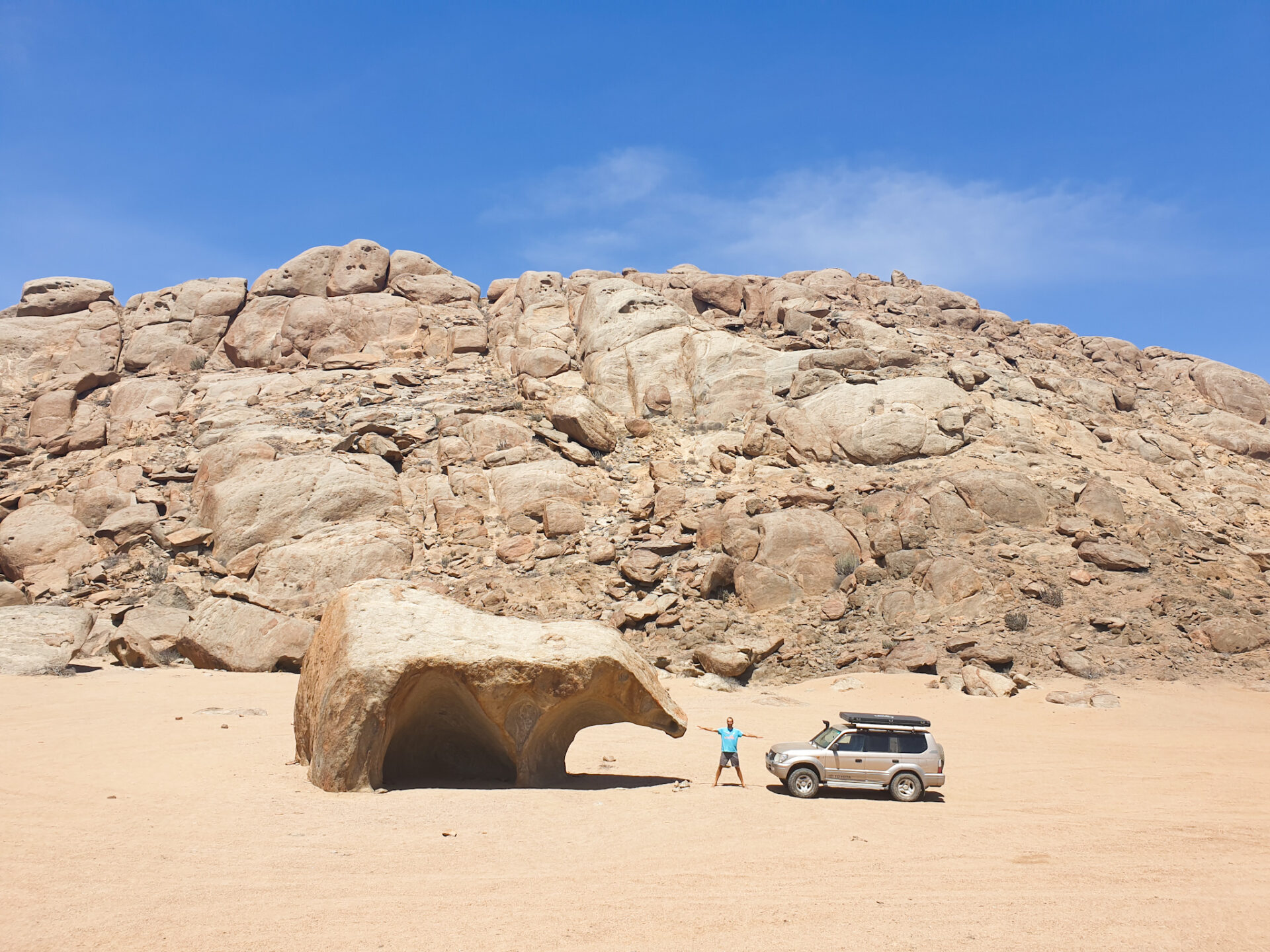
At 43 km from Orupembe, there is a path that leads to the desert. If you take it, you will end up about 16 kilometers down a path that is already in the middle of the desert to a curious rock formation: a bear-shaped rock. Along the way, you’ll find some more Stone Men sculptures. A very beautiful place in the middle of nowhere.
After that, we followed the same path until we reached the Khumib River, where we headed north until we came back to the D3707 road. It is likely that in the rainy season this road is impassable, as we had to pass through the middle of the river at certain times which was, at that time, dry. There is a total of 18 kilometers from the rock formation to the D3707 driving by the river.
Once you are back on the D3707, you will be only 35 kilometers from the town of Purros. Along the way, you’ll find new Stone Men sculptures. To cross the village of Purros, it is highly recommended that before reaching the town you turn off towards Omenje Camp to cross the Hoarusib River, one of the most important rivers in the area. Above all, because if you follow the D3707, the crossing of the river in that area is full of sand and it is very difficult to cross… Nevertheless, if you do the detour we propose, you will be able to cross calmly. If it’s raining, you need to keep an eye on the water, ask to local people and make sure you can cross it as it is one of the most important rivers in the Kaokoland.
Finally, from Purros to Sesfontein there is a total of 100 kilometers on a road in good condition, gravel but wide, with sculptures of Stone Men and that will not cause you any problems. You can do it in 2 hours with your vehicle. Here, many times, people have seen elephants by the side of the road, in a totally desert landscape. We were not so lucky.
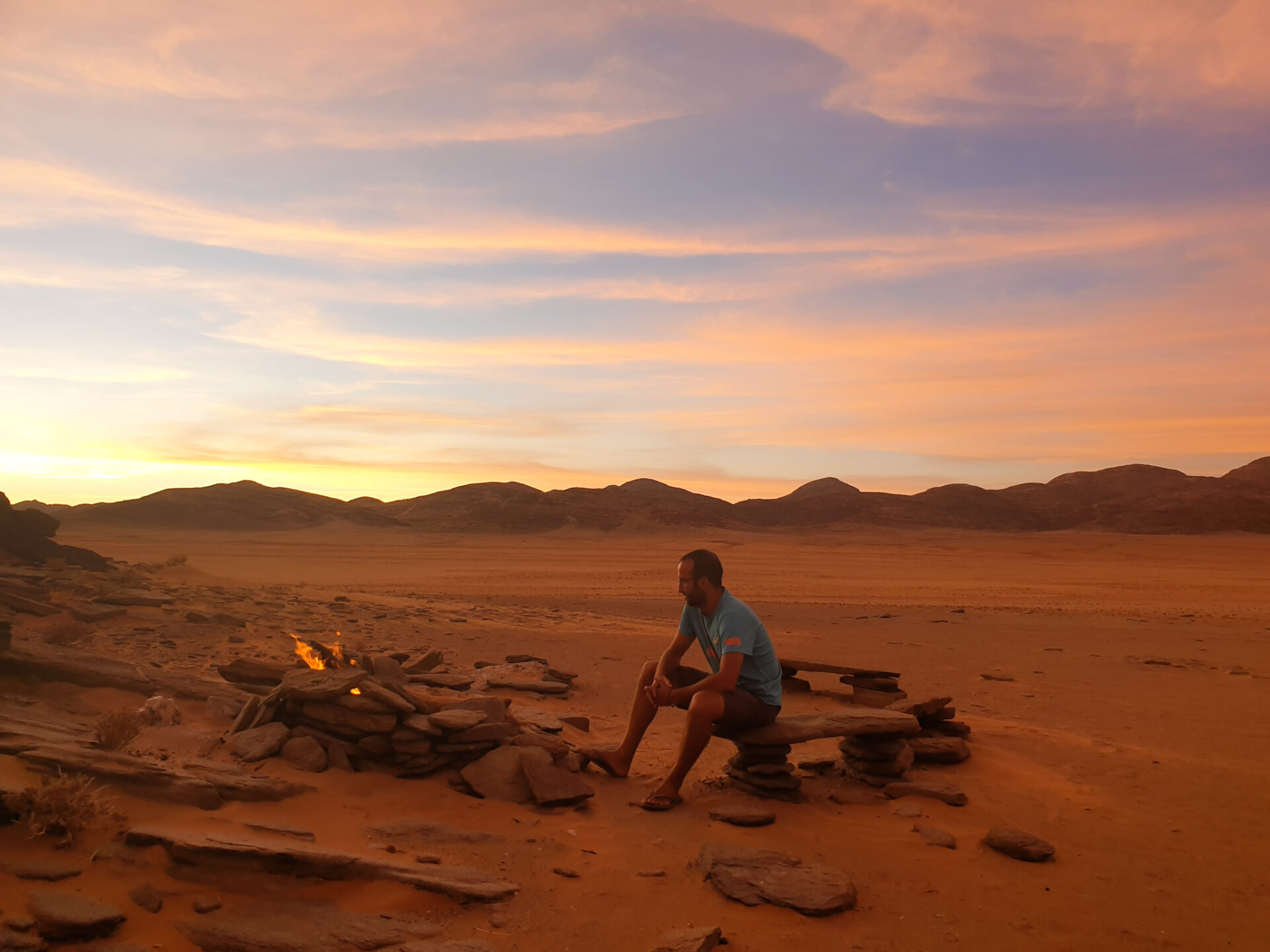
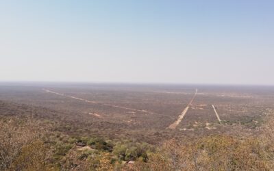
What we did do, though, was go to wild camp on Signal Hill, a small mountain in the middle of the desert. To get there, you have to turn south on the small road that you will see located just 45 kilometers before reaching Sesfontein, and drive along a road in the middle of the desert for 7 kilometers until you reach this small mountain, where you can climb to contemplate the sunset and the vastness of the desert.
Some friends who had camped there a few years ago told us that they had seen lions there when they woke up. We were not so lucky, but it is true that there are people who have seen elephants and lions in this area of Namibia. They are the elephants and lions of the desert, which have adapted to this environment and are characterized by having a greater adaptation to this environment, without the need to drink water so often and with an ecosystem different from the rest.
Sesfontein is a town that has a gas station as well as accommodation. From Orupembe to Sesfontein, if you do not deviate to see the rock formation of the bear as well as Signal Hill, there are a total of 211 kilometers that you can do in 4 hours on a gravel road where the car will shake very often but you will arrive calmly to your destination. From Sesfontein, you can reach Opuwo again (150 km – 2 hours) by the C43, a very panoramic road that, in most sections, is paved; or turn off to Palmwag in the south and leave the wild territory of northern Namibia behind.
Where to sleep in Kaokoland region, in the north of Namibia?
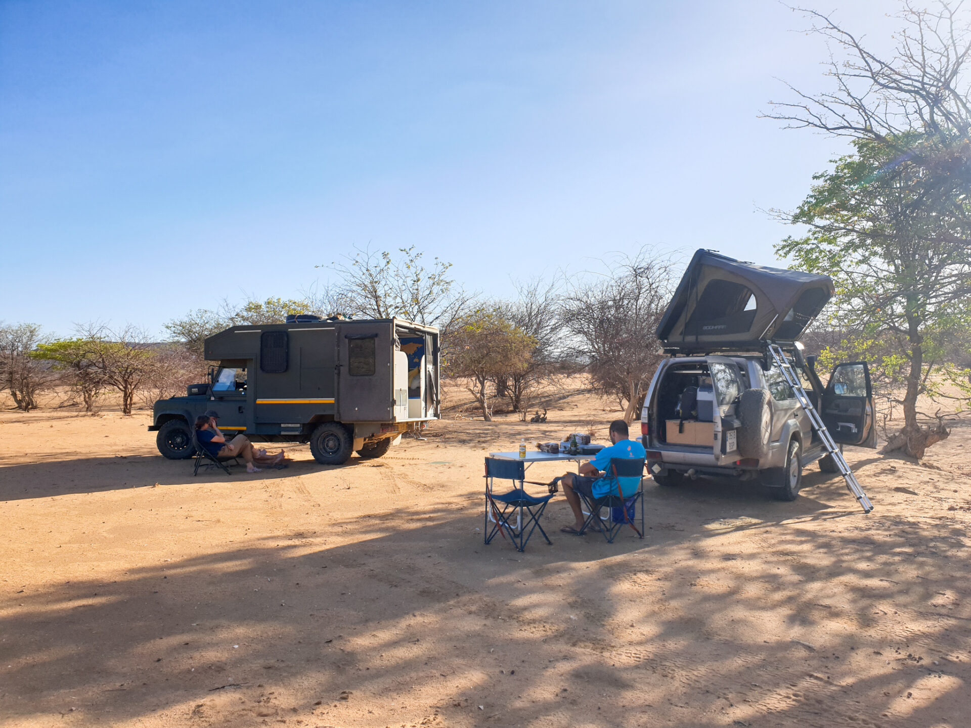
The Kaokoland region stands out as a place with very little tourist infrastructure. We did wild camp by the side of the road during several nights. We were completely alone and did not receive any visits during our entire stay there. It is a good place to do this type of camping, although it is important to keep in mind the presence of wildlife and not to be placed next to riverbeds because they can be flooded very easily.
Also, we slept in some accommodations that we will highlight below. These are found in more touristy places like the Epupa Falls. We were in:
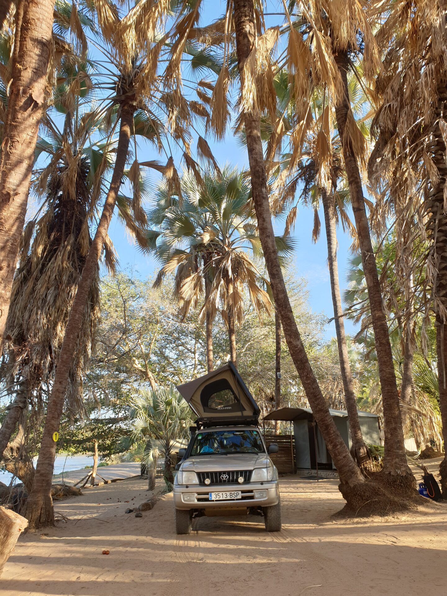
– Camp Cornie: This accommodation is located on the road from Ruacana to Epupa. It only has a camping area next to the Cunene River and under the shade of palm trees; as well as tents set up for those who do not have camping equipment. It has a toilet, shower, fireplace and wifi (although not always available). We paid 150 NAD per person (about € 8.50 €) and can only be paid in cash. For more information, click here.
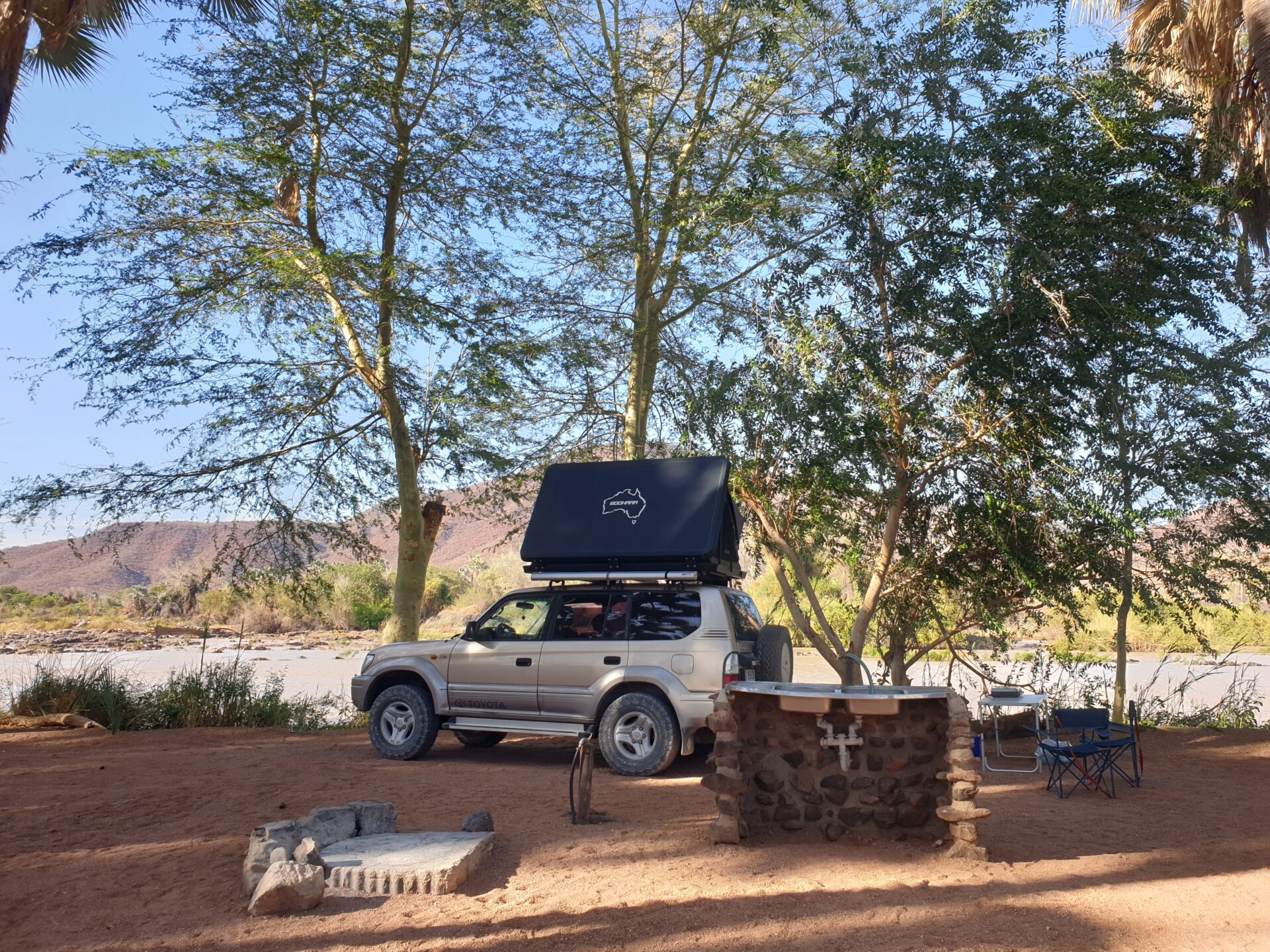
– Epupa Falls Lodge: This Lodge is located next to Epupa Falls and Cunene River. It is a beautiful place because it has a good shaded camping area, from where you can hear the sound of waterfalls. There, you can cool off in the pool, enjoy a beer from an elevated platform where you can see the waterfalls from above, and be just a few meters from the Epupa Falls. A great place to spend the night before or after visiting the waterfalls. For more information, click here.
Our route
DAY 1: We woke up in Oshakati, a city where we stayed for a few days to process the visa for Angola at the Consulate. Having already handed over all the documents, and having solved a small scare with the car that passed us (an attempted robbery that ended only with a broken glass thanks to the guard of the Consulate of Angola who warned us to park the car in front of him so that he could control it), it was time to discover the Kaokoland and the northwest of Namibia, a totally remote region of the country.
We left Oshakati in the morning, after loading the car with food and water supplies, and bought a 25-liter tank from Cymot (the Decathlon of the campsite) so that we could fill it with diesel for the car. A long day of road awaited us where we would stop before Epupa Falls as we saw that the whole journey from Oshakati to these very popular waterfalls in Namibia would take more than one day.
At first, the road was paved and in very good condition. We arrived in Ruacana, in about 2 hours, and there we loaded the car tank full of diesel (and also the extra tank we were carrying). From there, the asphalt was finished and the adventure of these days in this region of Namibia began.
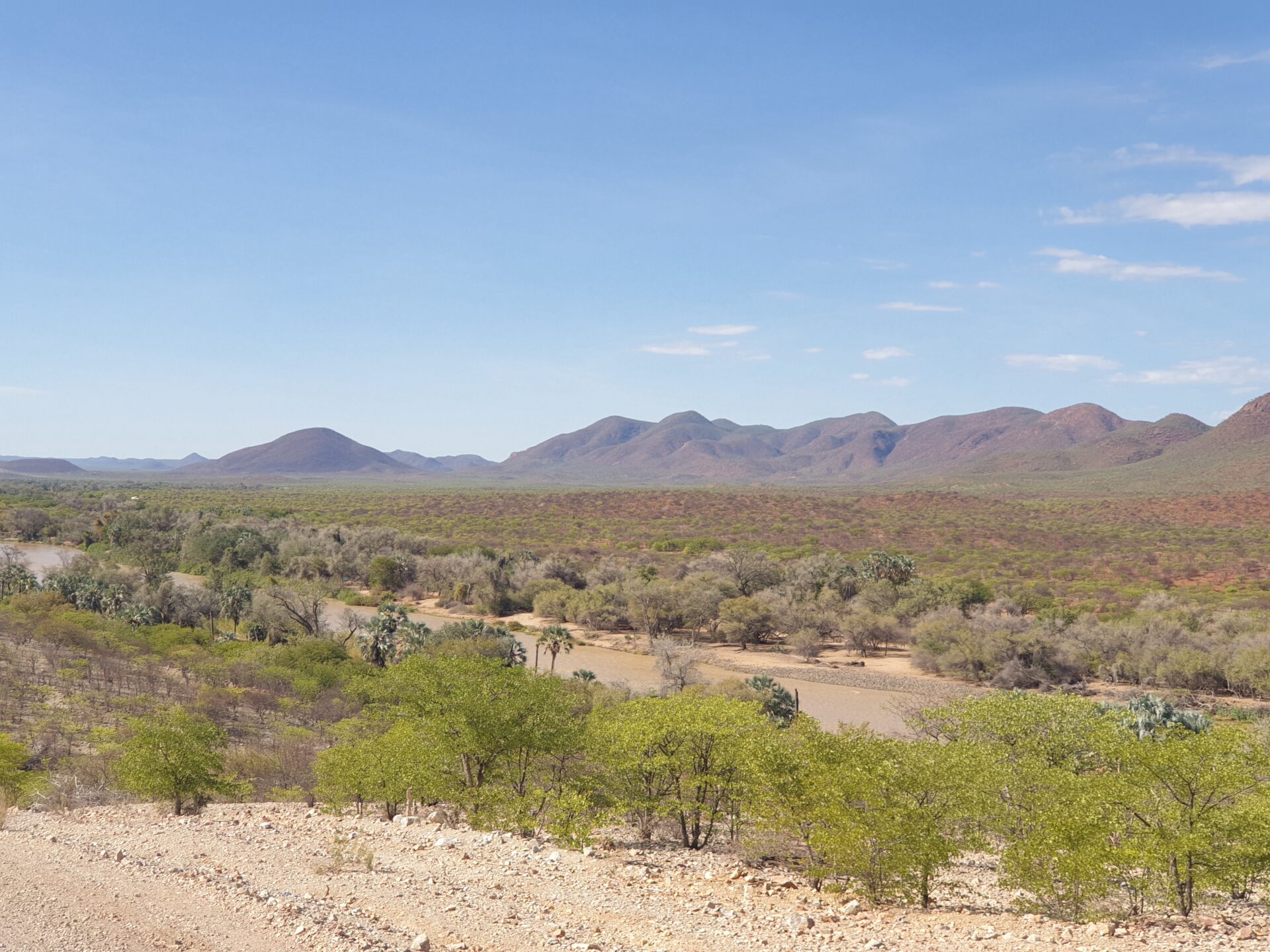
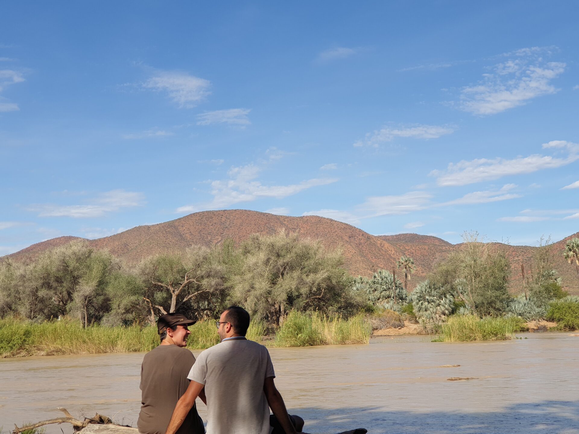
We made a first stop at the Ruacana Falls, which were completely dry as the dam was not open. There, for the first time, we saw the Cunene River, a river that separates Namibia and Angola and flows into the Atlantic Ocean, and that would accompany us during these first days. In Ruacana, there was a checkpoint to cross into Angola, but unfortunately the country had its land borders closed and therefore was not open. At that time, we were two meters away from stepping on Angola, so we crossed our fingers waiting for a positive response from the Consulate and being able to visit this country of ex-Portuguese colony that so many people had spoken so well to us.

After leaving Ruacana behind, we continued along a road that was in better condition than we expected. Before, the road from Ruacana to Epupa was hell, but now they were widening and fixing it, which made it easier to drive. Along the way, we began to find the first Himba settlements. Some were abandoned and others only saw women and children running out to shout “muzungu” from the side of the car. Some even misbehaved when they saw that you didn’t stop to give some candy or something. The counterproductive effects of tourism in these remote places.
We arrived at our campsite, Camp Cornie, a place where we were completely alone by the Cunene River and surrounded by palm trees. As we set up our rooftent, a motorcycle with 3 himba on top was approaching to give a package to Ian, the person in charge of the campsite. He invited us to visit a place he had discovered where (according to him) a meteorite had fallen. So, we didn’t think about it and went with him and his car.
It was obvious that he knew the road because he was driving fast … Ian was very interested in the subject of fossils and that morning he had seen a more charred area where a meteorite had probably fallen. After making a U-turn on the road, we stopped at the sidewalk and started walking until we discovered some darker, different rocks than the ones around us. We don’t know if it was a meteorite, but Ian was right that something had happened in those hundreds of square feet. We took the opportunity to take pictures and take some stones to research at Camp Cornie. Ian was looking for a geologist who was interested in doing a research study in this area, so he was posting it on Facebook.
After this short tour of the area, we saw another car coming through the door. They were Nelly and Julie, an English couple who had been traveling around the world for over 3 years. They were blocked by the pandemic in Africa and we coincided with them on New Year’s Eve in the Caprivi Strip. Nelly is one of the managers of the overlander groups, travelers who travel with their car around the world. We were happy to share a little barbecue with them and a good evening by the Cunene River.
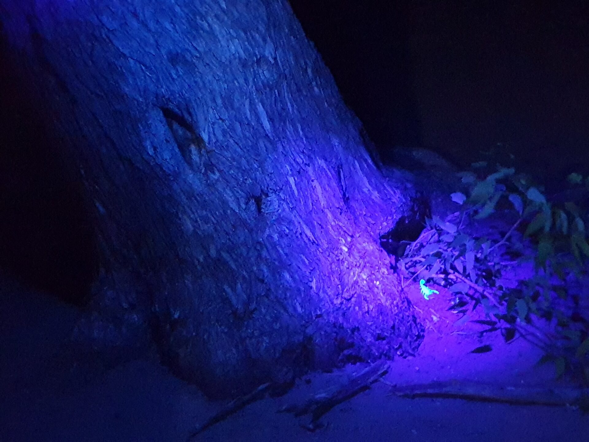
Before going to bed, Ian came back to show us scorpions that shone in the ultraviolet light and were in the trees. In addition, we were lucky enough to receive a visit from a small antelope while searching for scorpions and taking pictures of these curious animals. It was the first time we saw them during our trip to Africa, so now we could go to bed. Tomorrow it was time to arrive at Epupa Falls.
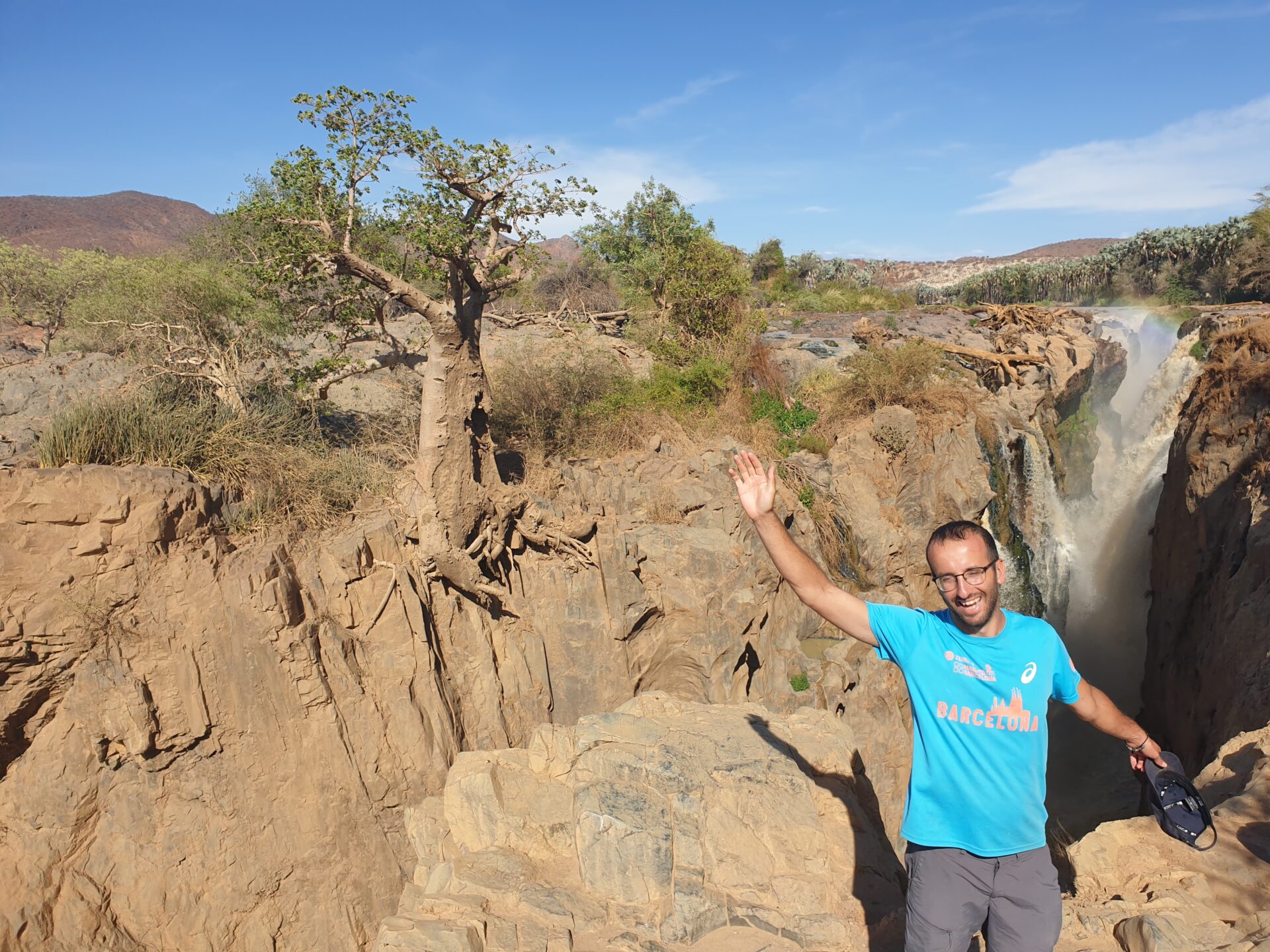
DAY 2: In the morning, after saying goodbye to Ian, we headed to Epupa Falls. It was a short walk along the Cunene River. We arrived at the Epupa Falls Lodge where Nelly had told us that they were discounting prices for travelers traveling with their car, so we got there and enjoyed the space that had a pool and a camping area under the palm trees from where you could hear the roar of the water from the waterfalls.

Nelly and Julie arrived later than us as they are slow waking up, so we then went with them to see the Epupa Falls, one of the most beautiful spots in the northwestern part of Namibia. The waterfalls that form from the water of the Cunene River did not leave us indifferent. Seeing the water fall heavily through the rocks and the river continuing its course was a way to meditate on nature and see the grandeur of the planet in places as remote as that.
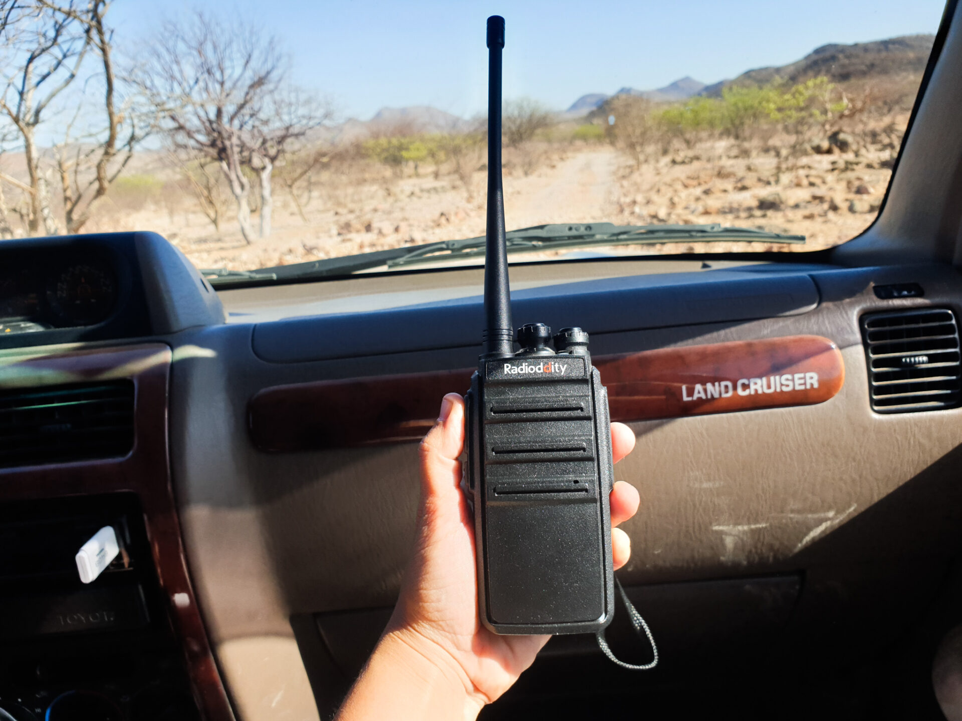
After taking several snapshots of the place and of the moment, we returned to the Lodge where we were able to enjoy a good Spanish omelette together with Nelly and Julie. After passing this first stop in Epupa Falls, the next day we had to venture through the deserted roads of Kaokoland and the mysterious Stone Men. Just in case, Nelly and Julie left us a walkie-talkie to keep us informed in case something happened. And finally, we had to use the device…
DAY 3: We got up early to go to the town of Okangwati, where the day before we had made an appointment with the caretaker of our lodge that we would take their children to the city, so that they could return to school after a few vacation days. It was a sunny day, and when we left, the two boys were waiting for us, who shyly climbed into the back seats and remained silent for most of the journey. Nelly and Julie, as usual, left later. So, we agreed with them that we would meet at the junction of the D3703 road that goes towards Orupembe.
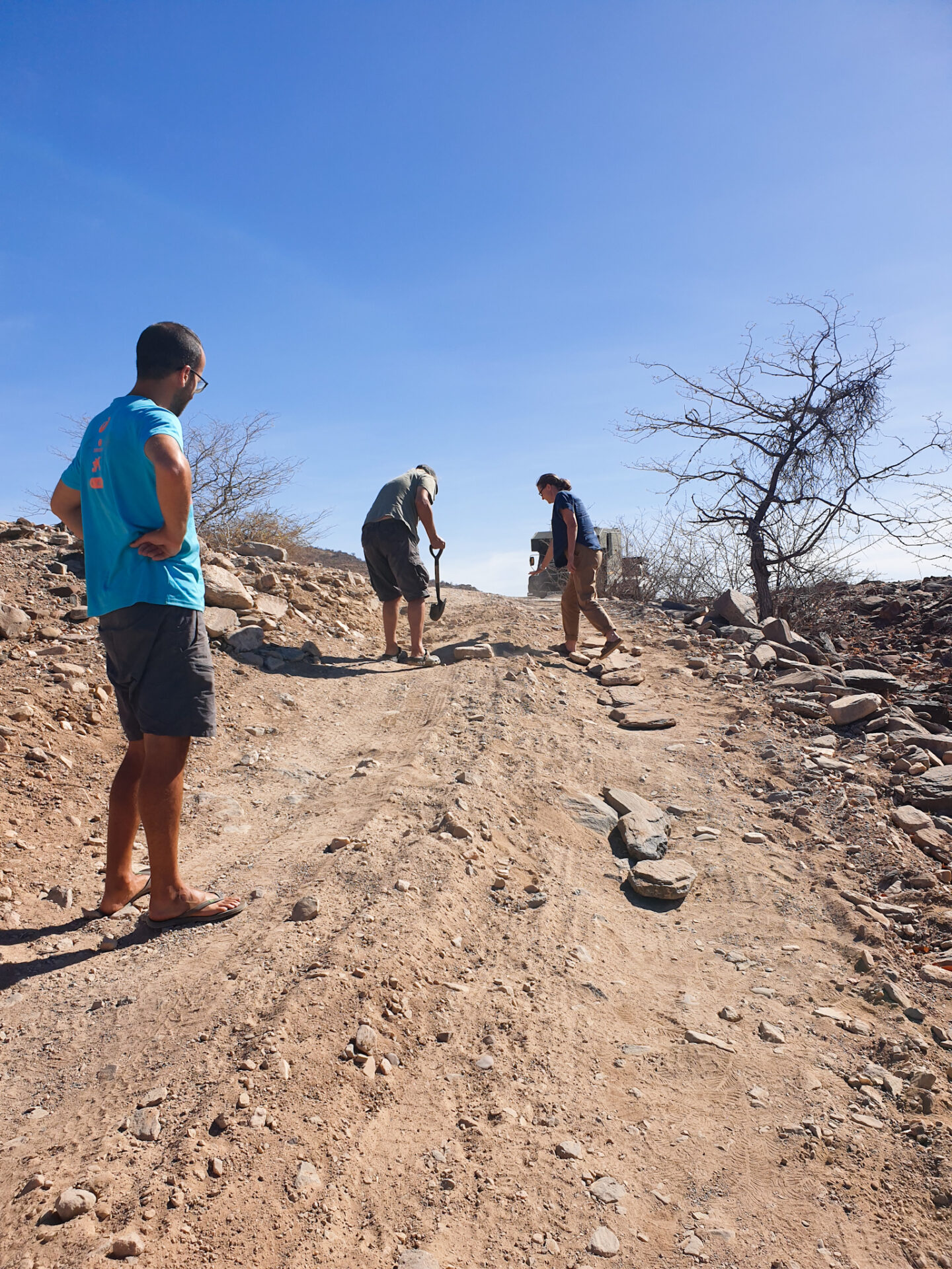
We reached the town of Okangwati, a place with a lot of atmospheres where we found different local ethnic groups and there, we deviated to start the route… And, what a route! At first, with our 4×4 we were doing it quietly, but then there were very steep slopes with rocks in the middle of the road that unbalanced the car and therefore the co-driver had to get out of the car and guide the driver to of passing the different impediments we were encountering on that road.
We reached the Ovivero Dam, a swamp by the side of the road that was full of drinking cows and the shepherds in the shade of the trees. We walked over to where they were, and we could only speak English with the only man who knew the language. We were asked what country we came from and we talked about the problem with the lack of water in this area. Aside from the shepherds, there were also Himba women and children who took refuge from the heat, and beyond that young people who were distracted by playing cards on the sandy ground of the swamp.
It was time to move on, as we were trying to use the walkie-talkie that Nelly and Julie had left us. It was strange not to receive any signal because we had advanced very slowly and had stopped for a while with these shepherds, but we tried to touch all the buttons and there was no way to contact them. So, we decided to keep driving as we were a few kilometers from the junction towards Orupembe.
We continued along the road, which was characterized by being narrow, in the middle of trees, rocks and nomadic shepherds. We passed the Van Zyl’s Pass turnoff, and for a moment we thought about taking it to see what that road really looked like, which is said to be one of the worst in Namibia. For a journey of 40 kilometers, it takes about 3 hours! But in the end, common sense prevailed and we continued, little by little, driving on the D3703.
Until we reached the Orupembe junction and there we waited for Nelly and Julie to arrive. And, we waited a long time… We were suffering because they were traveling in a much heavier car and we were convinced that they would probably have had problems crossing the road that we had made a few hours ago. But we didn’t get a response from the walkie-talkie… We didn’t know what to do anymore, until suddenly the walkie-talkie made a little noise. Finally, there was communication! We tried to contact them saying that we were already at the point where we had said, and we heard Nelly saying that he was 5 kilometers from Etanga. The walkie-talkie had worked!
When they arrived, they told us that they had understood that we would wait for them in the Okangwati junction, but we understood that the meeting point was the Orupembe junction. They continued to drive to Opuwo on the main road to see if they could find us and then turn into Etanga on the D3703, in the opposite direction to where we were going. And luckily for them… Because from Opuwo to Etanga, the road was in good condition according to Nelly. And when we showed him the videos of the road we had taken, he was already clear that his car had not passed by. So, what a coincidence, in the end we met again and it was good because we all arrived safe!
Then, we drove together towards Orupembe. That day, we would not reach the town, so it was time to look for a place to wild camp. We followed Nelly and Julie’s car and enjoyed a landscape that opened up behind the mountains, with a wider path and different river crossings and small tribal groups and shepherds we met along the way.
We passed by a baobab, and set off on our way to the interior of the mountain, where we found a quiet, sheltered place to spend the night. Today had been an adventure, going through one of the most difficult roads of the whole trip along with the road to Mount Kenya. We had already gone through the hardest part of our adventure in northwestern Namibia! Or so we thought…
DAY 4: We had agreed to leave together around 9am. That way, we’re not lost. Nelly and Julie had been to this area before, and they loved going in search of the Stone Men. On a mobile map, they had written down every sculpture they had seen during the first time they came to Kaokoland, so this time they were hoping to find new ones!
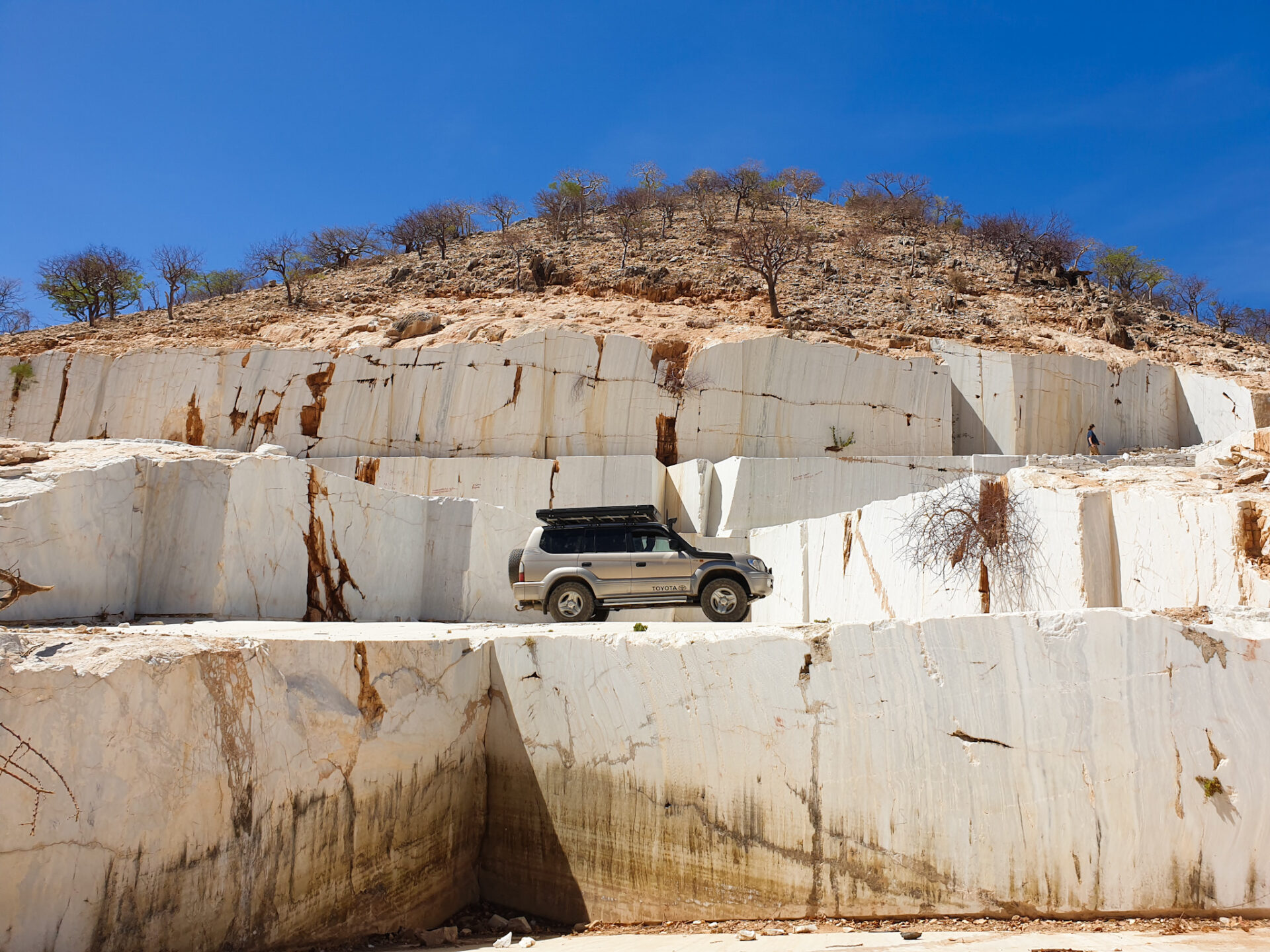
We wanted to go to see a marble mine that we had heard was very curious to be in a totally deserted area. Sometimes the contrasts we find in nature seem untrue. The mine was near Marble Camp, so we turned off the road to Orupembe and on our way to the mine, Nelly turned around and, suddenly, there was our first Stone Men! A stone sculpture where a man came out as if he were walking looking north. It was a mystery who was the author of these sculptures and the reason, but it was beautiful to find in that landscape those secret and enigmatic figures that made this route more special.
After taking different pictures with the first Stone Men, we followed the route until we reached the marble mine. There, there was a mountain of white marble characteristic of the furniture of our toilets… There was no sign of life around, so we went in there by car and walked to capture this image with our cameras.
It was time to move on to Orupembe, and suddenly another Stone Men was on our way. We were approaching an area where we would see different Stone Men. They say there are officially 16, but there are people who have counted more than 30 … How many? It’s a mystery too! During the journey, at some river crossings, we sometimes had to get out of the car and place stones to level the ground and in this way, Nelly and Julie with their car (much heavier than our Toyota) could advance.
After Orupembe, we stopped for lunch on the side of the road, where there were several giraffes eating quietly from the few remaining trees. We had already left behind those narrow stony paths and river crossings; and we were advancing towards a totally rocky, dry, desert plateau. It was very curious to see these animals in that place, but as is the case with desert elephants, they get used to the ecosystem where they are found. The giraffes were there watching as two cars were parked, with the tables outside, eating comfortably after days of bouncing and driving around totally offroads roads.
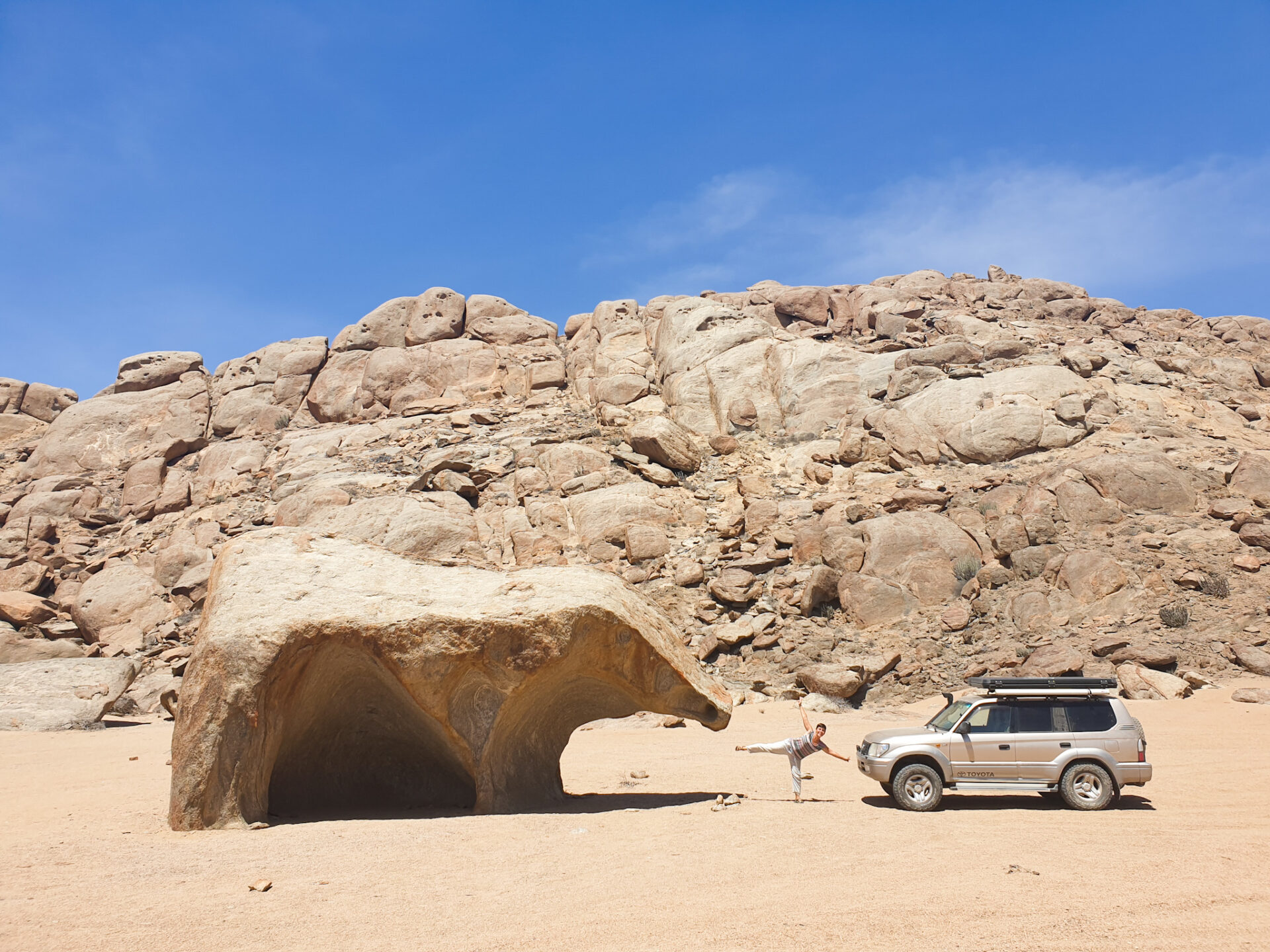
After lunch, we continued on until we came to the junction that led to a very curious rock formation: the figure of a bear. On the way, in the middle of the desert, we found another Stone Men crawling on the ground. As if he were completely thirsty for the heat, and tried to reach his final destination anyway… We were also very hot for those sunny days, but luckily, we were traveling in a good car and we were going much faster than walking through the desert.
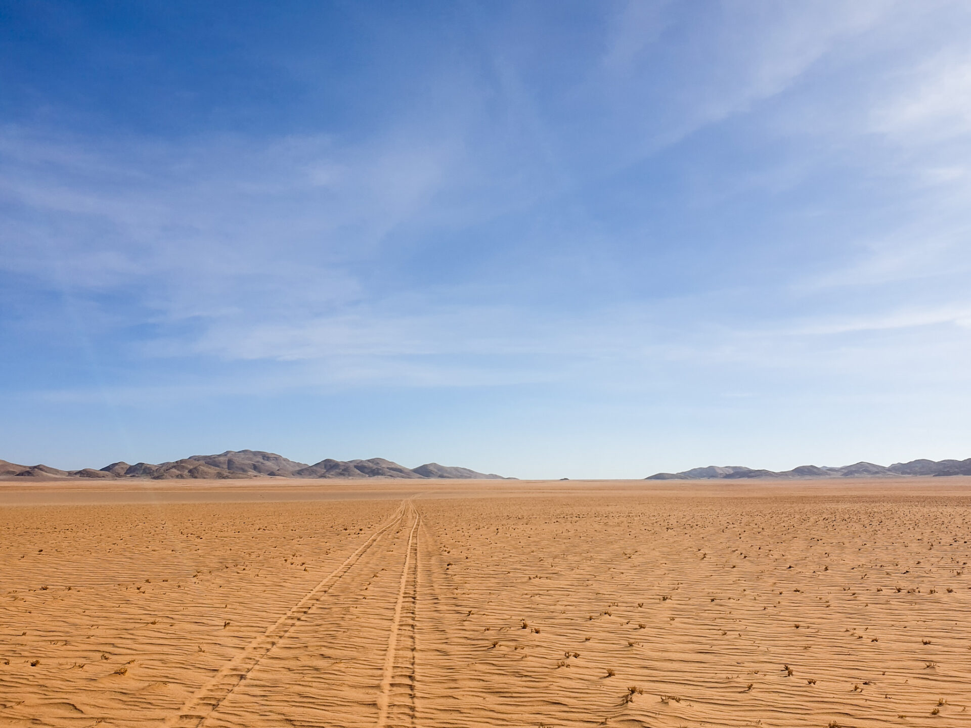
After a few kilometers where the landscape changed completely, having in front of us a large sandy esplanade on either side, with small mountains of rock protruding and a fully visible horizon; we reached the bear rock. This rock was really bear-shaped. And, surely, if we looked for more shapes in the multitude of rocks we had encountered along the way, we would have a very long and original list!
At this bear rock, we finally said goodbye to Nelly and Julie. They would do wild camp in that area and tomorrow they would advance towards Purros; while we decided to go further and continue until after Purros to sleep on Signal Hill, a place where Nelly and Julie met lions when they did wild camp there. We were amazed at the idea of seeing these animals and elephants in a landscape as different as the desert, so we headed there!
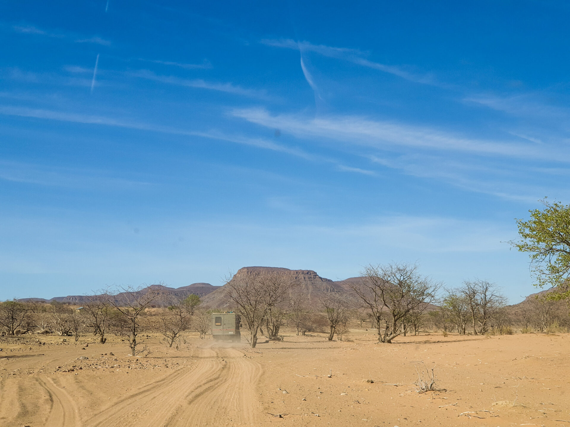
And to get back to the main road, we did a very tricky path! We didn’t want to go back to the same place and drove off-road in the middle of a completely deserted landscape. We were in a very remote place, and right in front of us we found a dry river that had to be crossed and advanced following its silhouette to reach the road that would take us to Purros. Luckily, the river was completely without water but on the other hand it had a lot of sand. But our car, again, was able to with this new challenge and we reached the main road, the D3707, which would take us to Purros and which was heading towards Sesfontein.
Before reaching Purros, following Nelly and Julie’s advice, we turned off to avoid a sandy area of the Hoarusib River. There was a very high chance of getting stuck, so we turned around and went through different campsites before heading back to the main road.
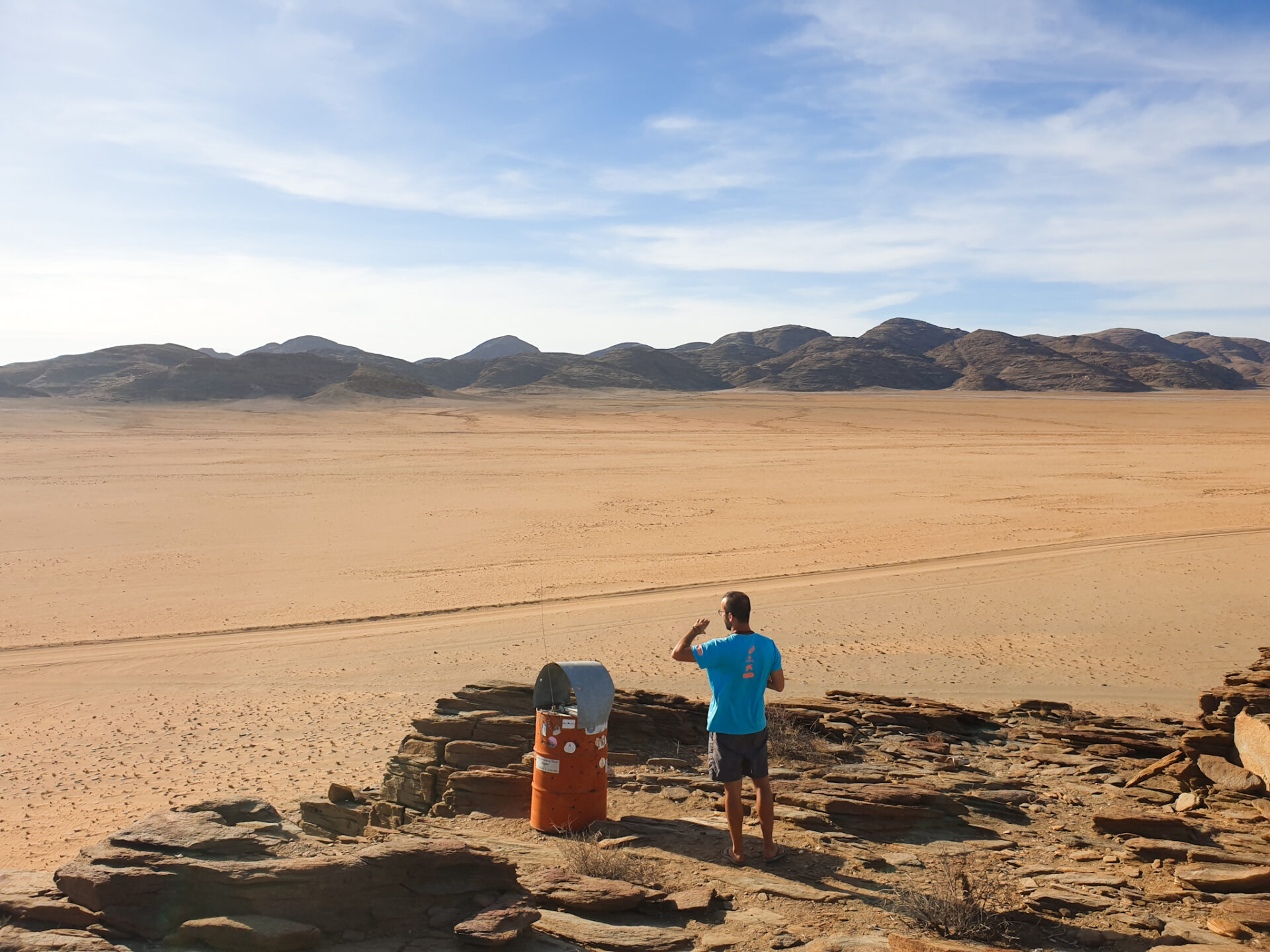
We reached the turnoff that led us to Signal Hill (luckily Nelly told us where it was, because it wasn’t signposted at all) without seeing any desert elephants. From there, we had before us a vast desert that stretched tens of kilometers to the Atlantic coast. We advanced only a short distance, about 8 kilometers, before reaching a small mountain that had a plateau on top with a poster full of traveler labels that had left their mark there.
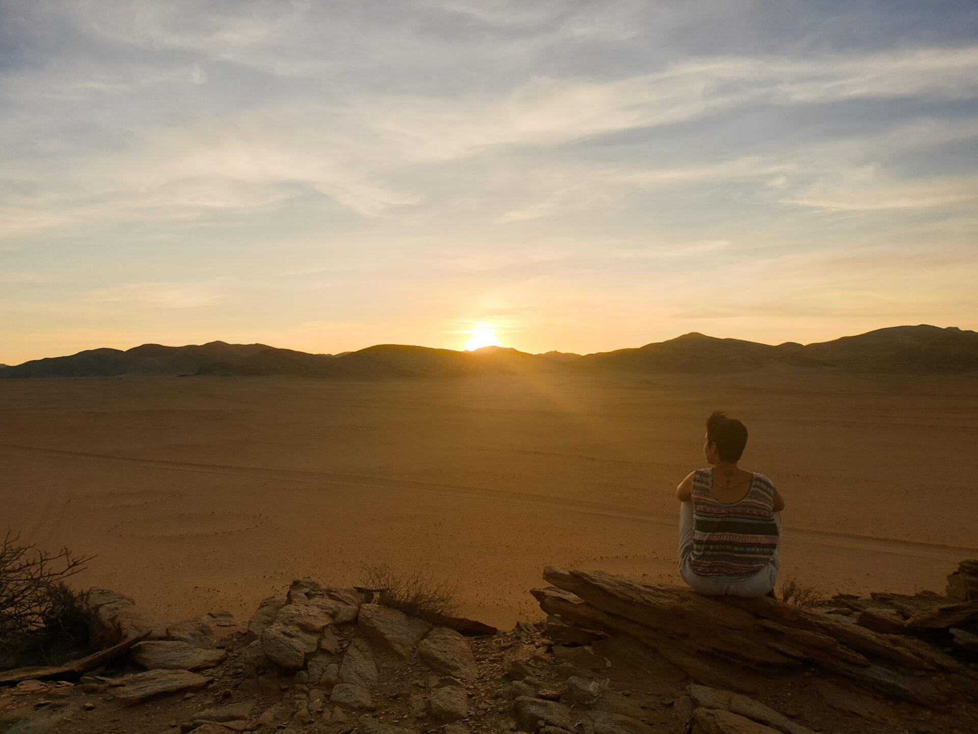
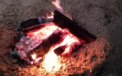
We set fire, and enjoyed a great sunset as we watched different oryx slowly entering the desert dunes. The sky was starry that night. It was already the last night during our adventure through the northwestern part of Namibia.
DAY 5: We got up hoping to find some lion by our side but unfortunately there was no trace of cats. We only saw a few antelopes from the distance and the vastness of the desert sand in front of us. It was a different desert than the one we had seen in Sesriem, rockier and with more mountain and little dune, but it was equally impressive to see the great unknown expanse of land in front of us.
After breakfast, we returned to the main road until we reached Sesfontein, a town where we had cell phone coverage again and where there was the first gas station on our route after refueling in Ruacana. We were lucky enough to have the extra deposit we had because we spent it all during those days. We refilled the tank and reconnected digitally to the world.

And there, in the mobile, we had a very important message from the Angolan Consulate in Oshakati. Our visa was approved, so we could pick it up and travel to Angola with a PCR test done no less than 72 hours before!
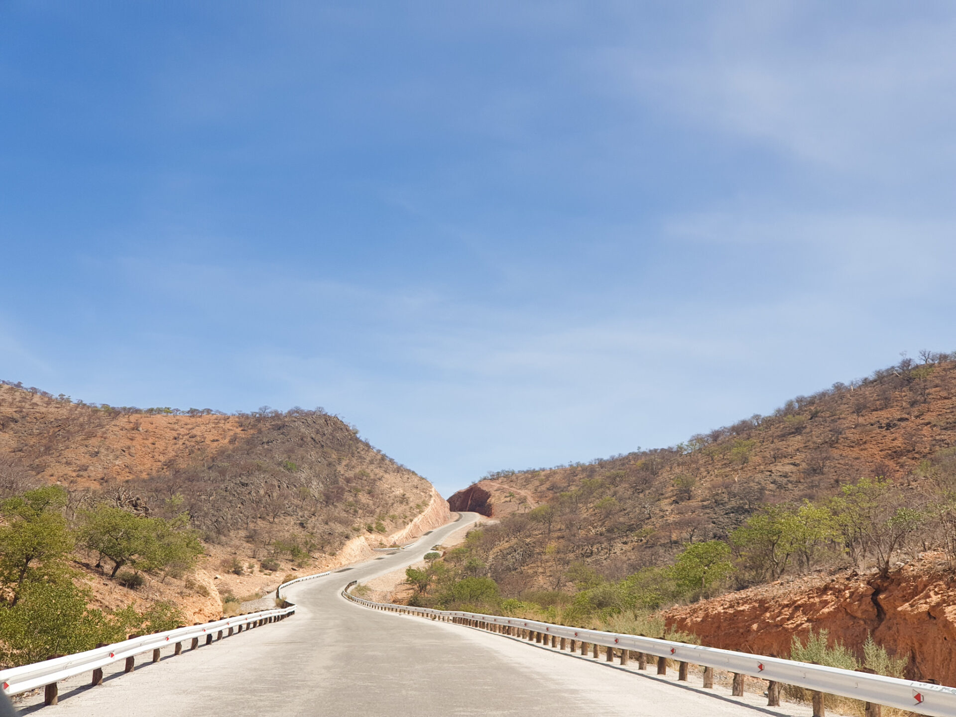
So, we quickly made our way to Opuwo on the C43, a scenic road in many stretches paved and very beautiful. Along the way, we found cars and people on the side of the road again. We were back in civilization after 5 days in complete isolation in a remote part of Africa.
We arrived in Opuwo, bought lunch at the supermarket, and went in search of a Himba village that someone had recommended on the Internet. We looked for them but we didn’t find them… Surely, either the indications they had given us were wrong; or we were wrong; or the Himba people had moved. During this time of drought, many tribal groups traveled in search of water for the cattle, leaving behind their old houses to build new ones, hoping that there would be more resources for their animals in that region.
Finally, it was time to return to Oshakati. We had discovered the Kaokoland with our car. A very remote place where you are immersed in a completely silent landscape, where loneliness is accompanied by complicated routes, isolated tribal groups, cross-border waterfalls and impassable roads but of a unique beauty that make this place, the Kaokoland, a special place.
0 Comments