


Cape Town is a multicultural and cosmopolitan city with a wide variety of activities that can be done by visiting the different touristic points of the city, as well as moving a few kilometers from it. It is a city that, despite its size, enjoys a spectacular environment that makes it very easy to make day trips to visit the outskirts and disconnect from the bustle of the big city. Some of these activities that can be done on the outskirts of Cape Town are: the Wine Route, the Garden Route and the Cape of Good Hope route.

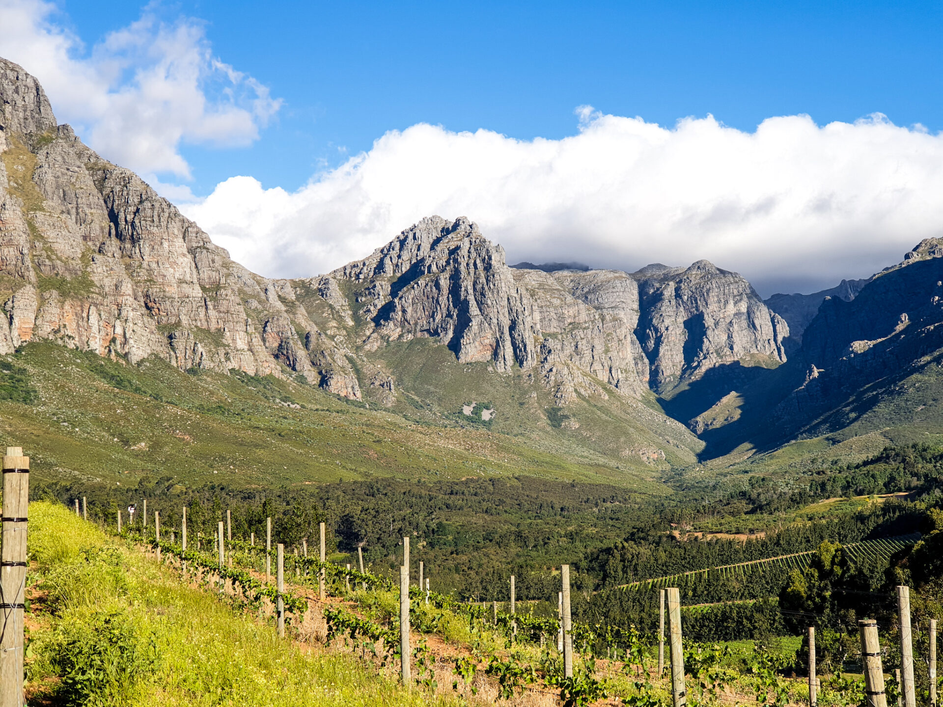
The Wine Route in the Paarl, Franschhoek and Stellenbosch area is an activity where you can enjoy a variety of wine tastings and food tastings combined with hiking through beautiful mountain scenery. We recommend that if you want to know more about our experience, you click here.
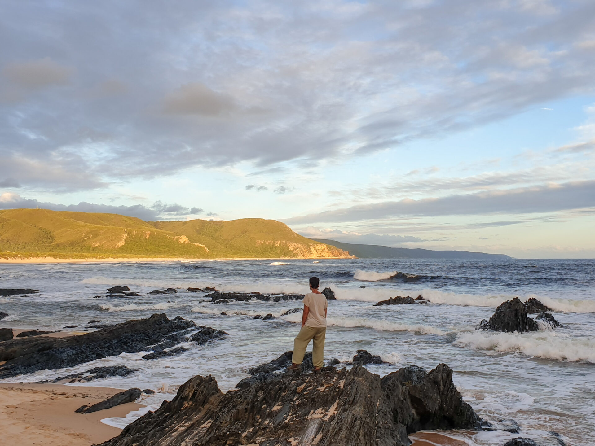
The Garden Route consists of more than 700 kilometers of coastline where you can visit different amazing landscapes and coastal towns for hiking, watching marine animals, doing adventure sports, visiting natural parks… It is one of the most coastal beautiful of the continent that will surely not leave you indifferent. If you want to see our experience along this route, you can click here.
Finally, a visit to Cape Hope is another activity on the outskirts of Cape Town (if you want to know what to do in the city, you can click here) that we will explain later in this article. You can take a day trip and go back to the city to sleep like we did, or if you have a lot of days, you can stay in some of the places that we will explain below and thus extend your stay.
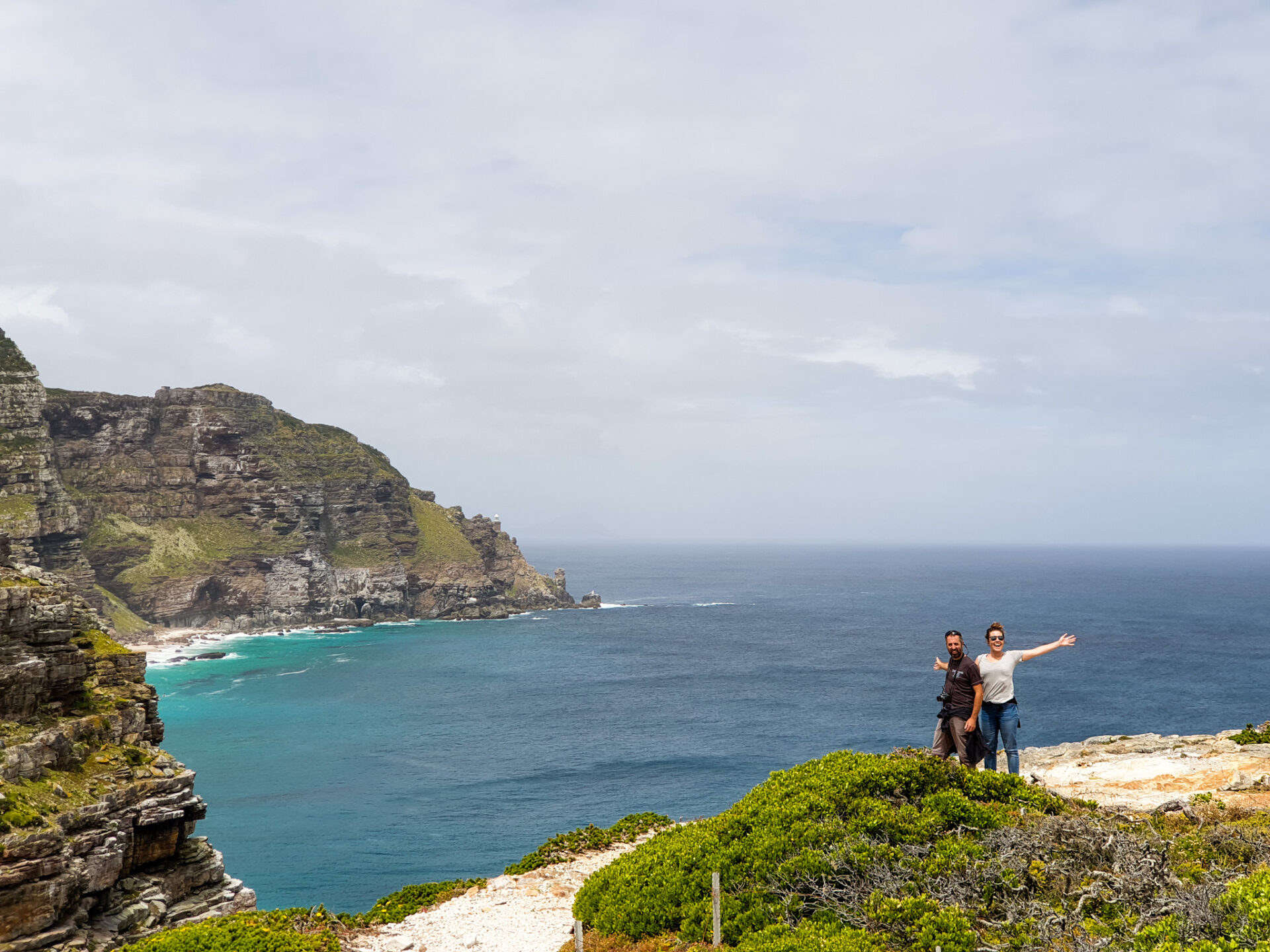
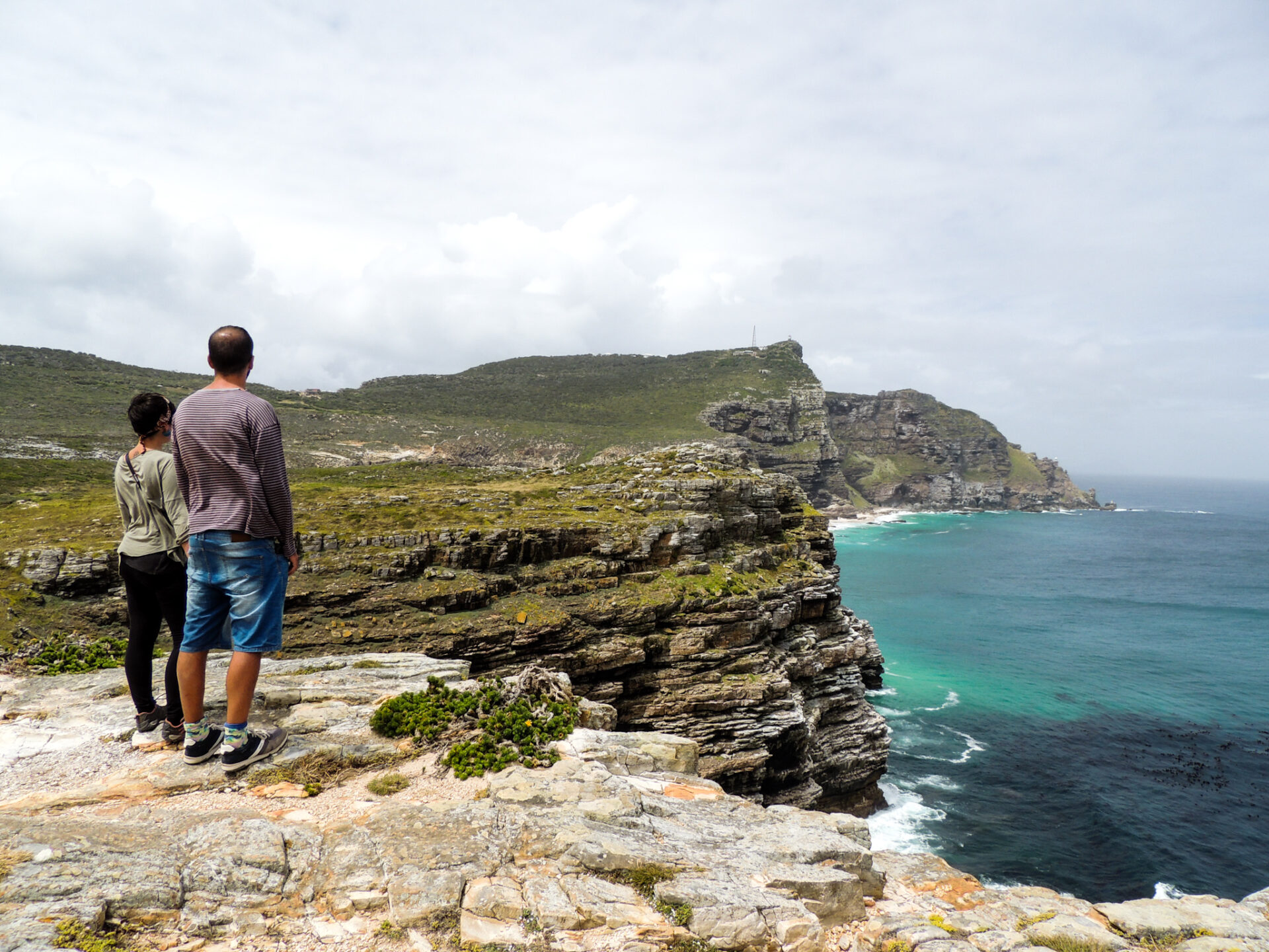
The whole Cape of Good Hope peninsula is worth a visit. It is a beautiful place with a steep coast, full of cliffs with waves crashing against its rocks, beaches with calmer waters that invite you to swim and others perfect for learning to surf, penguin colonies and finally, at the top of the road, the lighthouse that still illuminates the course of many boats.
How to get there?
The Cape of Good Hope is located south of Cape Town. There are different points of interest that you can explore in a day leaving the city early, and arriving again there after sunset. Now, we will explain how to get to Muizenberg Beach, Boulder’s Beach, how to get to Cape of Good Hope entrance, drive to Chapman’s Peak and return to Camps Bay in Cape Town. This is a circular route that you can also do in reverse. Think that in Cape Town you will also find private and organized transport that can take you on this journey through the Cape of Good Hope.
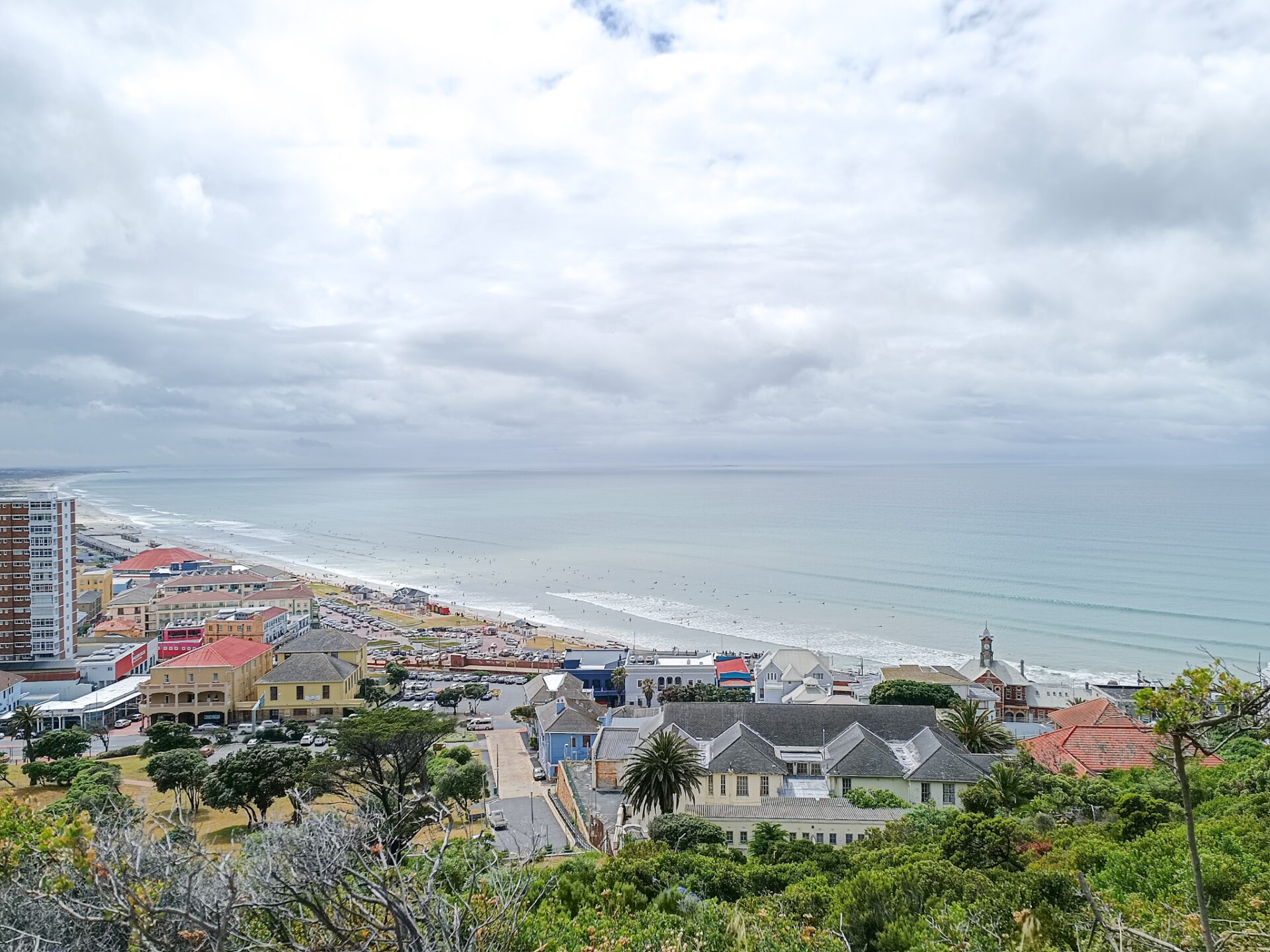
To get to Muizenberg Beach from Cape Town, the best way is to first take the N2, one of the main arteries in the city that leaves just after the train station and the castle of Good Hope. After about 4-5 kilometers, instead of following the N2 towards the airport, you will have to take the M3, also known as Simon van der Stel Freeway. You will have to drive along this road for about 16 kilometers, passing the Kirstenbosch and Groot Constantia junctions, until the end of this route; where you will then have to turn left to drive the M4, which already leads directly to Muizenberg beach. There, you will see that there is a small road that goes through the mountains, but you have to follow the coast for 6 kilometers, and at a traffic light where you will see a small bridge to cross on your left, turn following the R310, pass below the train track bridge, and after a few meters park in the various car parks near Muizenberg beach. Parking is free, although you will find people in yellow vests watching the cars and charging a tip.
The next stop on our route to the Cape of Good Hope peninsula after visiting Muizenberg was Boulder’s Beach. To get there, we recommend taking the mountain road as it has good views of Muizenberg and the surrounding area. To take this road, which is the M75, you will have to turn back as if you were returning to Cape Town, and to the town of Muizenberg itself, less than a kilometer from the road bridge, take a turnoff to the left (Old Boyes Drive) which, on a steep slope, climbs up to the M75.
This M75 passes over the mountain, with different stopping points to look at the perspective of the coast and the mountain. You will have to drive around for only about 4 kilometers, until you get back down to the coastal road, the M4. After about 5 kilometers, after passing the village and the beach of Fish Hoek, you will come to a junction, where if you turn right (onto the M6) you will come directly to Chapman’s Peak. But since we want to get to Boulder’s Beach, we have to go straight on the M4 for about 6.5 kilometers until we reach the penguin colony. This is hidden between urbanizations that are past the town of Simon’s Town, so go slowly to find the turnoff on your left that will take you to the main parking of Boulder’s Beach.
From Boulder’s Beach to the entrance to Cape of Good Hope there is no loss. You should continue driving on the M4 for about 9-10 kilometers heading south. You will see that you are increasingly abandoning civilization and entering an area of cliffs, mountains and nature. You will almost be in the wild. Just after passing the Smitswinkelbaai tented camp, on your left you will find the sign that will mark the entrance to Cape of Good Hope. The reception to pay for your tickets is about 700 meters from this junction.

Once inside Cape of Good Hope, there is a set of roads that are paved and marked. You will find different junctions to see viewpoints and you will pass the central offices of the park. If you want to see, firstly, the famous point of Cape of Good Hope in the south-west, you have to turn right after 10 kilometers from the main entrance. However, if you want to go to Cape Point, you will have to go ahead and after a small roundabout, go up to the point where the cable car leaves and where you will find the parking lot for vehicles.
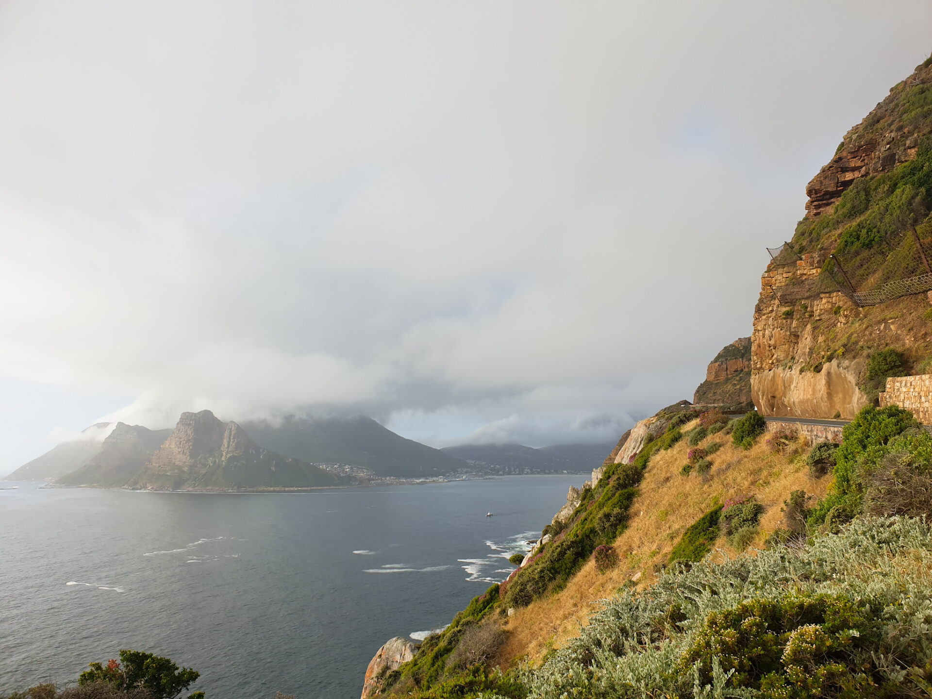
Finally, after enjoying these tourist attractions, we can return to Cape Town via the western part of the peninsula. From the Cape of Good Hope NP junction, turn left following the M4, which is now the M65. After 8 km, we turn left towards Kommetjie. We will continue along the M65 for 18 kilometers, passing this town and some suburbs with poorer housing, until we reach the junction of the M6. From there, turn left onto Chapman’s Peak, following the M6. Keep in mind that after 800 meters on the M6, you need to keep left to continue onto Chapman’s Peak, and not to keep straight. After 6 kilometers, you have reached Chapman’s Peak.
After the town, start the road that crosses the mountains with the steep coast right next to you and a breathtaking view. Think you will have to pay a toll of 54 Rands, payable only in cash. This road of about 8-10 kilometers is a route with a beautiful landscape and different viewpoints where you can stop to enjoy the views. Afterwards, you will have reached the town of Hout Bay. There, at the second roundabout, just past the BP gas station and the police station, turn left onto Victoria Road (M6) to Camps Bay. This road runs along the coast, and after 11 kilometers, you will have reached the main beach of Camps Bay and the entire ambience area on the beachfront.
Finally, to get to Cape Town from Camps Bay, you have two options: follow the M6, the coastal route, which will take you next to the football stadium and the Waterfront (about 5 kilometers from Camps Bay); or, just before you reach the main beach, turn right and take the M62 up the mountain to the intersection, 4 kilometers from Camps Bay, between Table Mountain and Signal Hill. If you go straight on, you’ll end up in the city, in the area of the Bo-kaap neighborhood and the CBD.
Here’s how to get to the main points of interest if you follow the Cape Town – Muizenberg – Boulder’s Beach – Cape of Good Hope – Chapman’s Peak – Camps Bay – Cape Town circular route. If you want to do the opposite, you have to follow the directions in reverse. Think that in between there are different mountain roads that follow Table Mountain and that are also very interesting to travel with your vehicle or bicycle, such as the M63. A peninsula with very beautiful landscapes.
What to do in Cape of Good Hope and its surroundings?
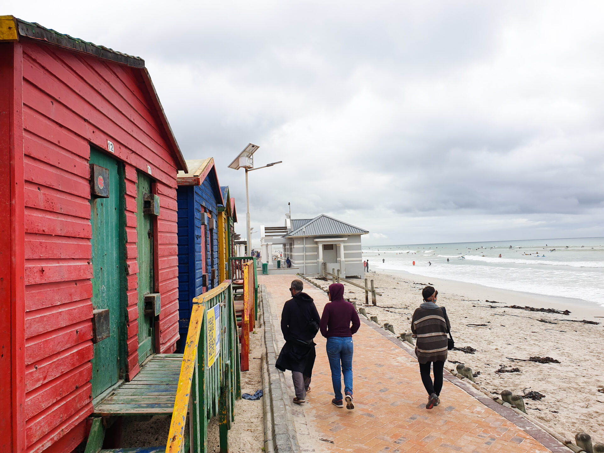
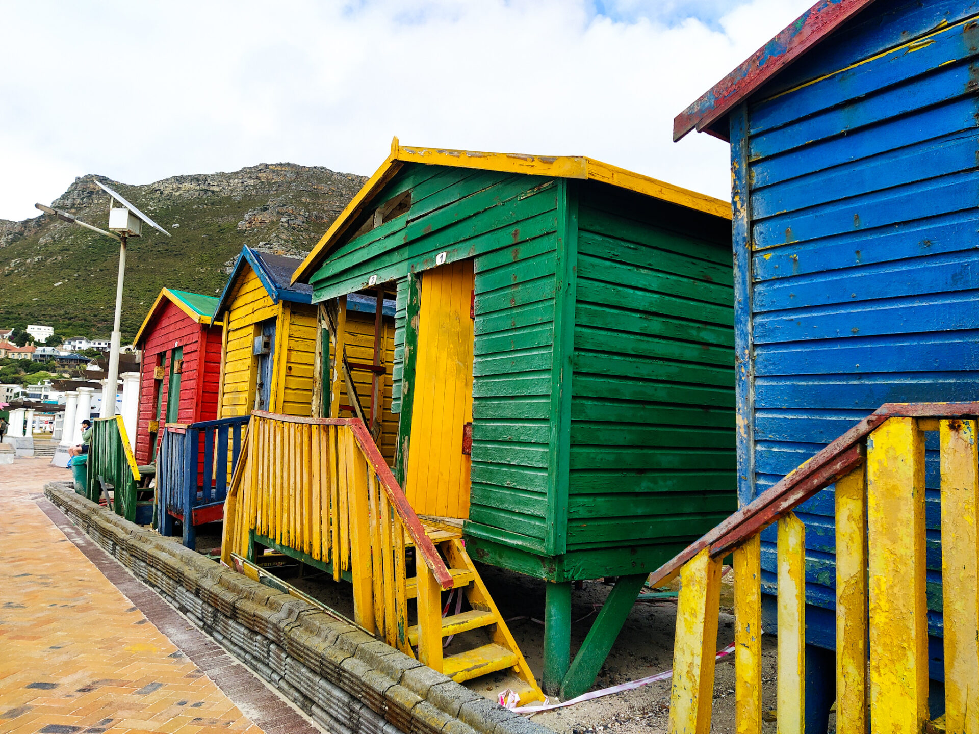
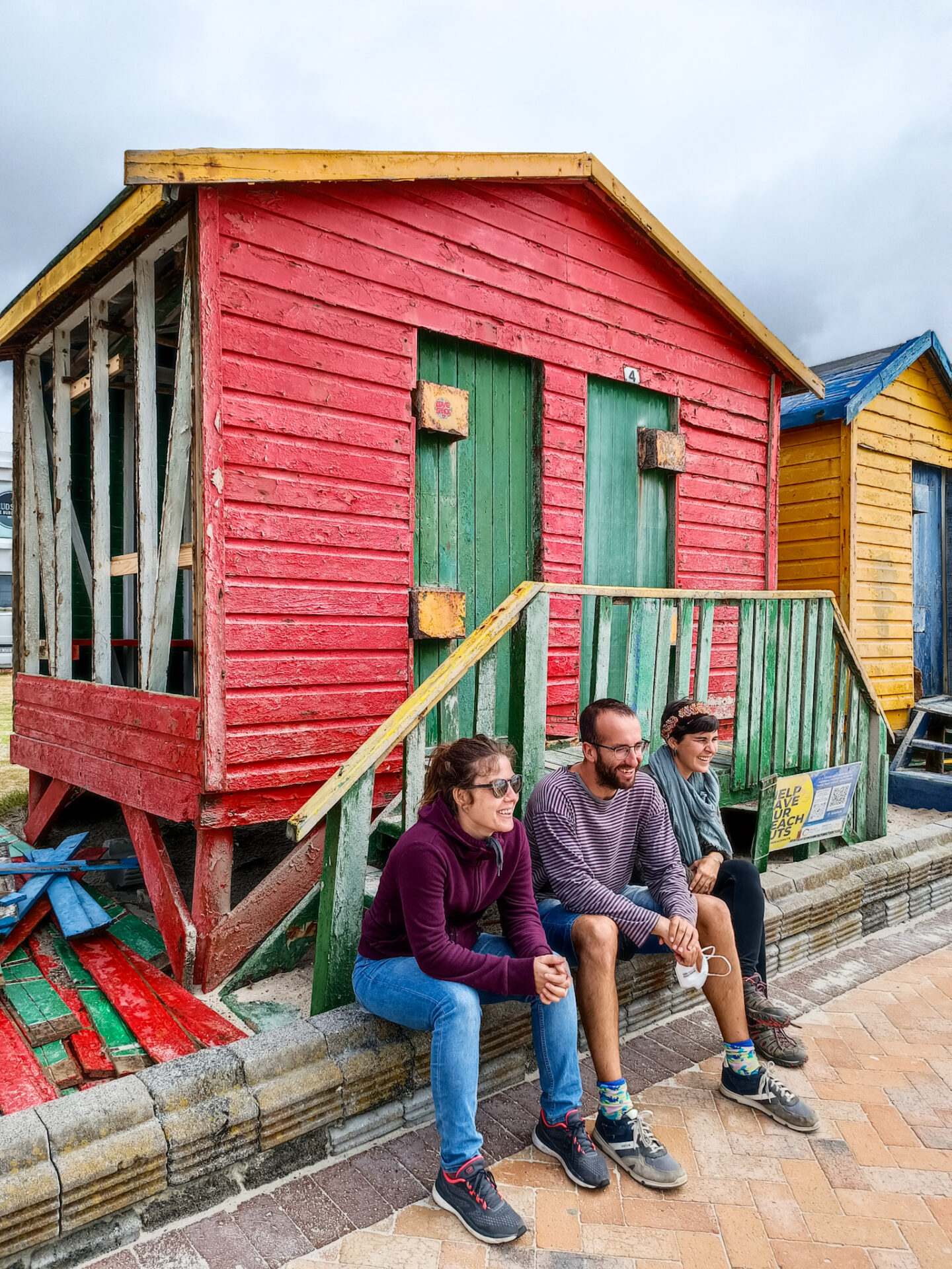
– Get started surfing on Muizenberg beach
Muizenberg is a town in front of False Bay. Muizenberg Beach is known for being one of the best beaches to learn to surf for its small and long waves perfect for any beginner in this world.

This sport, so famous in the country and especially in Cape Town, is beginning to gain followers thanks to the explanations of many surf instructors in Muizenberg. This town is totally focused on this type of tourism: car parks next to the beach where you can leave your car with your surfboards, toilet and shower facilities, surfing agencies that offer class and equipment hours, restaurants and bars facing the beach to rest and regain strength …
At the same time, it should be noted that there is a system for monitoring sharks in the area and a color code, which warns everyone who is in the water that if there is some shark near or they are in danger, they must go out immediately. So, do you dare to learn this great sport on a beach with a spectacular atmosphere?
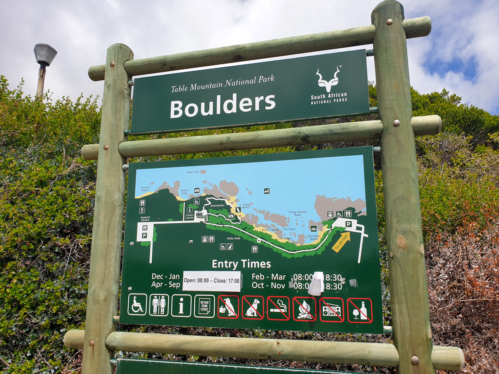
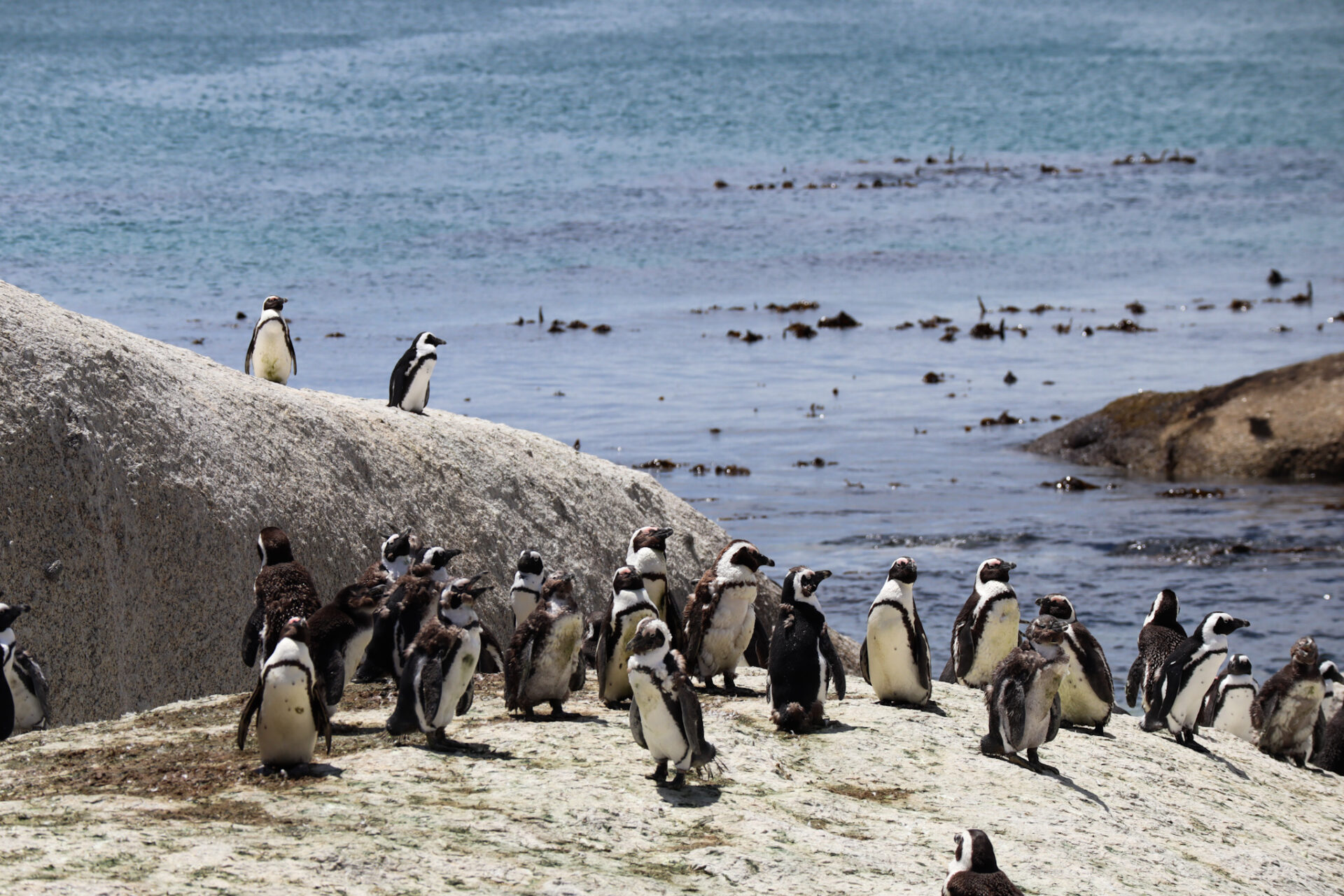
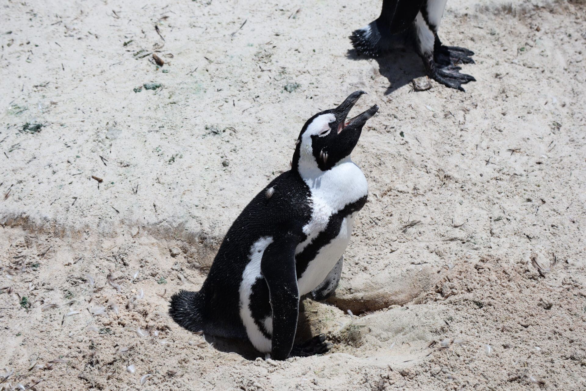
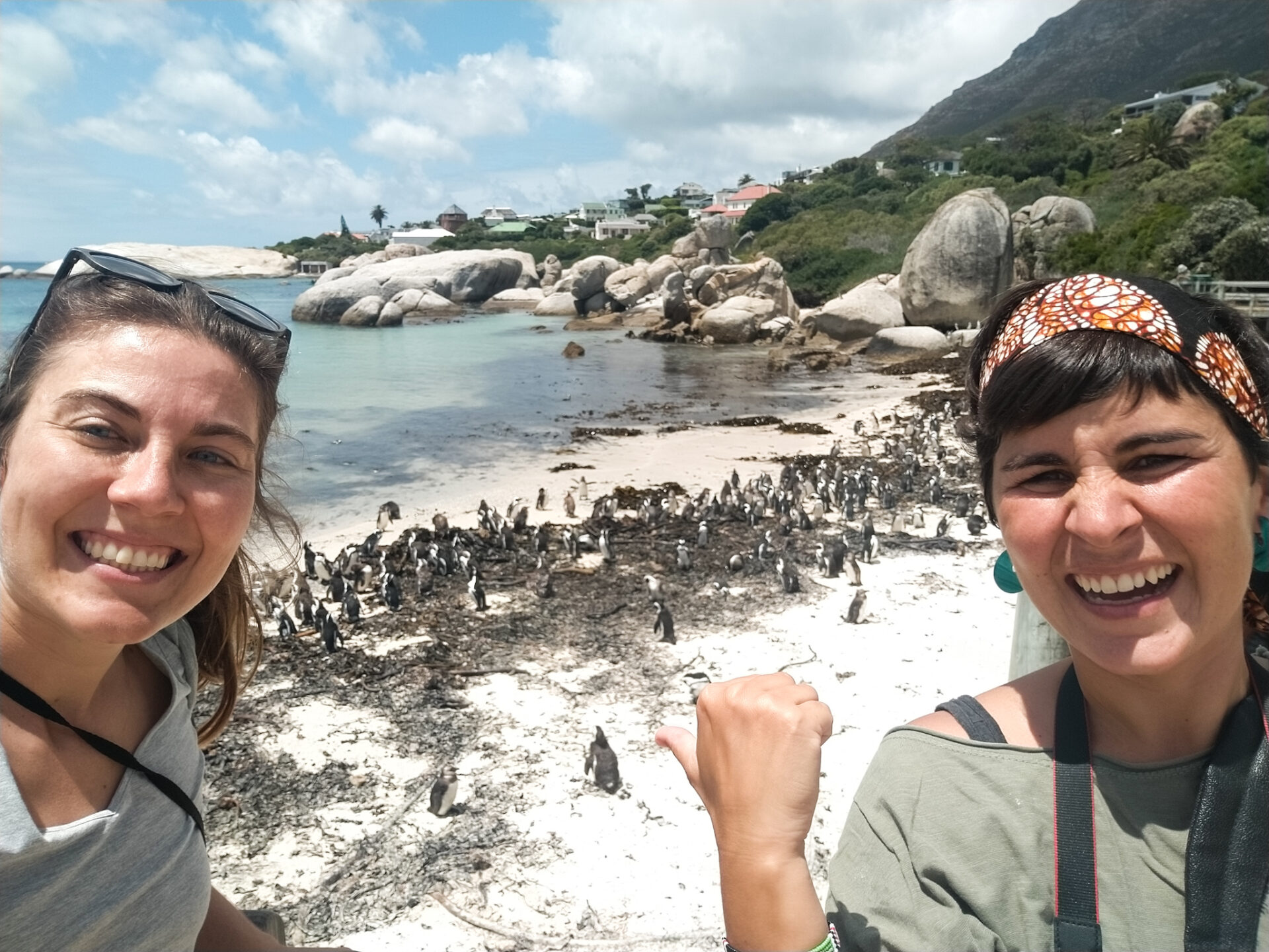
– Enjoy the fun African penguins of Boulder’s Beach
Boulder’s Beach is located 10 kilometers from Muizenberg. This beach has a population of 3.000 African penguins, after various measures of preservation and conservation of the area where they have the colony.
These fun animals are considered endangered as their population is declining exponentially. In 1931 there were 1.5 million African penguins, but by 2012 there were only 23.700 penguins. These frightening numbers have led to the launch of conservation programs to protect them, ban the collection of their eggs, and ban fishing in their marine areas, among others. If you want to know more about these fantastic animals, you can click here.
At Boulder’s Beach, you’ll find a walk of different wooden platforms where you can visit the area of this penguin colony. You can choose two types of itineraries: one where you can access the interior area and the two platforms near the beach; and the other, from Foxy Beach, where you can access on foot to the area of the beach sand to swim and see them very closer.
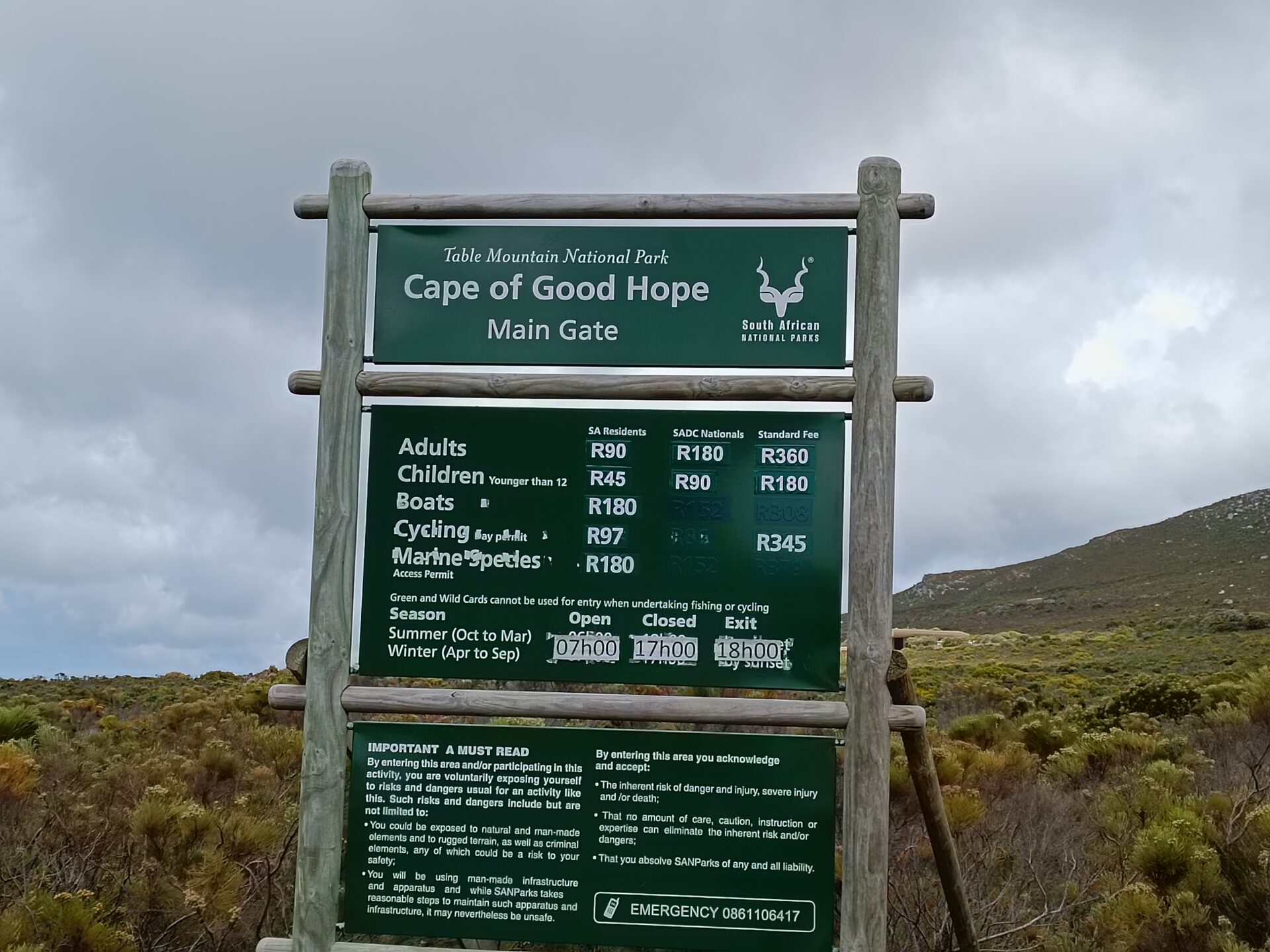
Entrance fees are 170 Rands per person. They also accept the Wild Card, which allows you to enter Boulder’s Beach for free. Check-in hours are based on daylight hours. So, from December to January and from April to September, you can access there from 8am to 5pm. From February to March and from October to November, entry hours are from 8am to 6.30pm.
Next to the car park, there is another route that is free and which follows the coast of this urbanization and where you can also see penguins (although not in large numbers). We also found a nice place to swim there! Before you drive again, make sure you don’t have a penguin below your car that is resting in the shade to keep cooler.
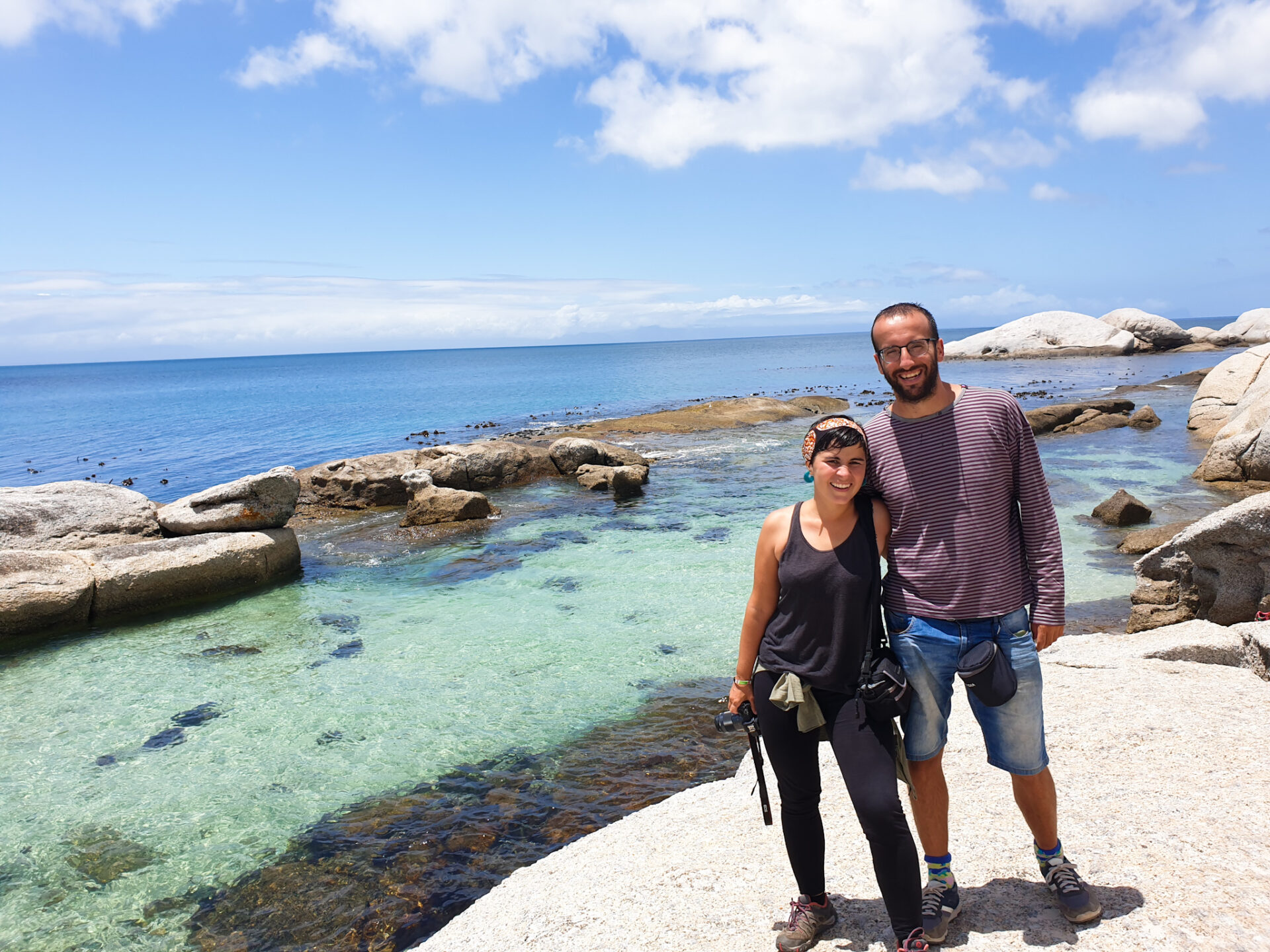
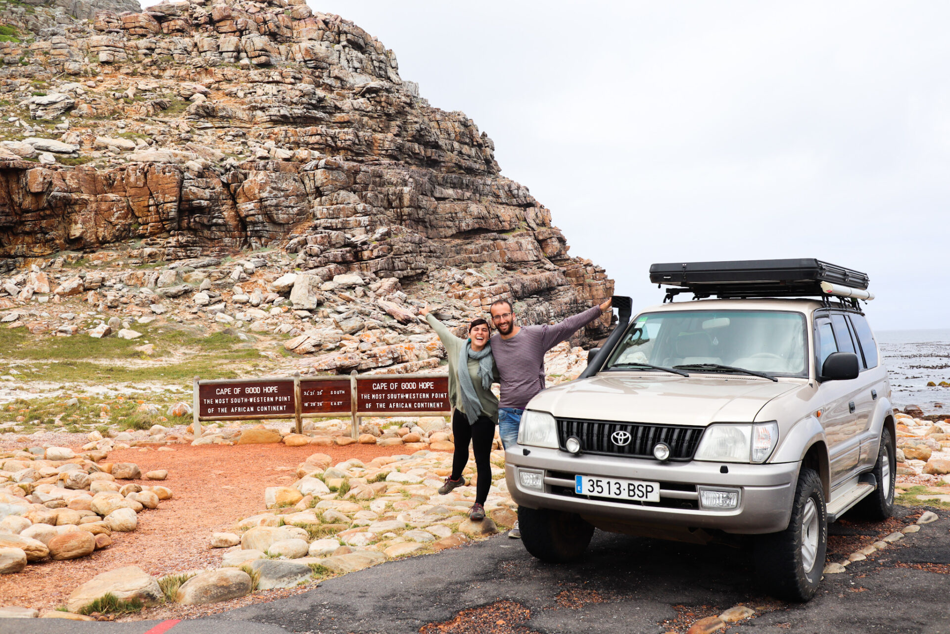
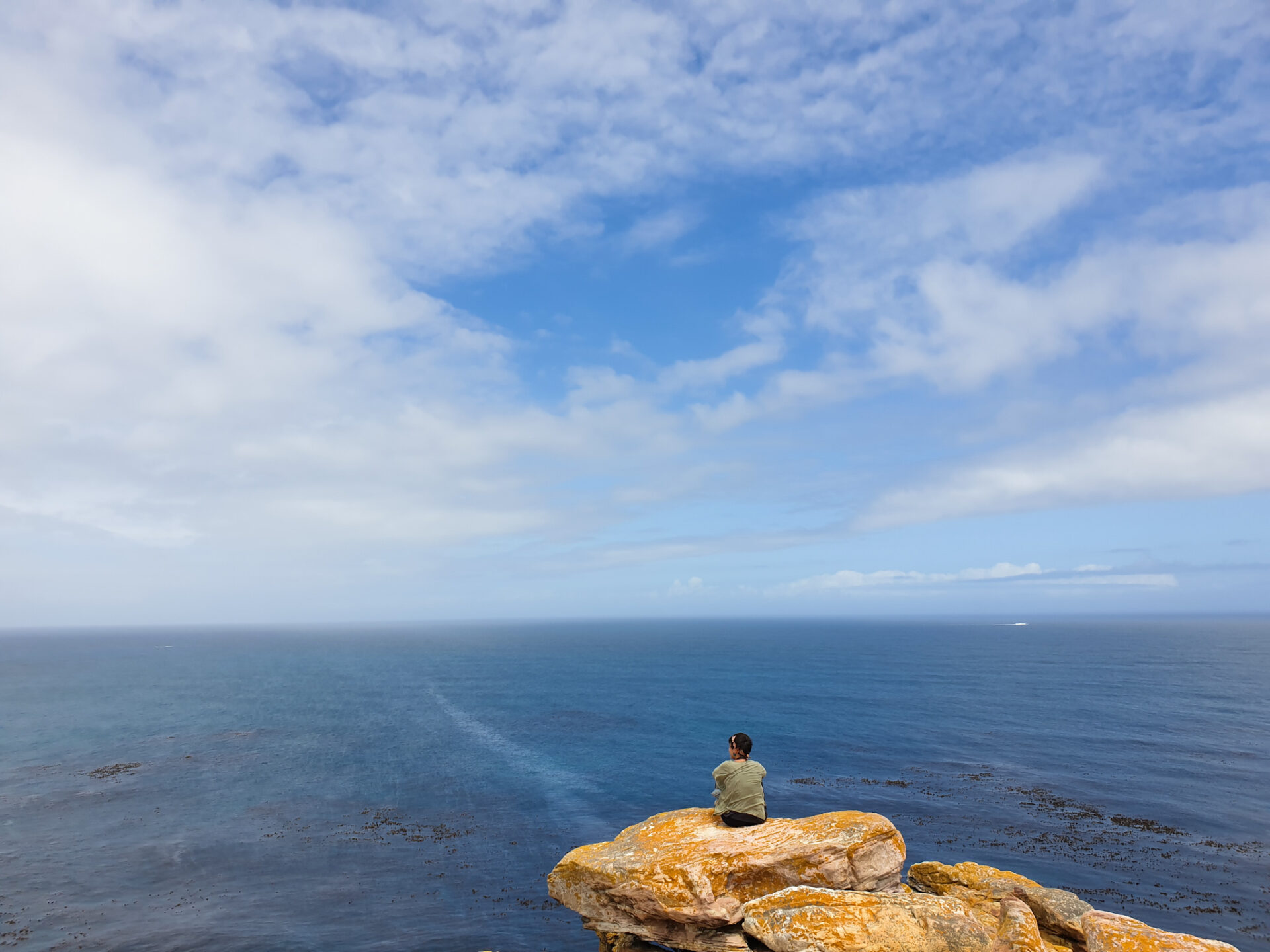
– Go to the most southwestern point of the continent and discover Cape Point and Cape of Good Hope
This national park is located right at the end of the peninsula. Cape of Good Hope is a famous cape in the world of navigation and in the history of this country. It is the most southwestern point of the African continent where many years ago, many ships in search of new trade routes to Africa discovered that it would be a good place for a human settlement, stopover, grocery supply and at the same time strategic point. It was also known as Cape Storms, as the whole area is usually not very good for navigating and there are large waves that can be a nightmare for the more experienced sailor.
This point was discovered by Bartolome Dias, one of the leading Portuguese sailors of the 15th century whose mission was to find a route between the Atlantic Ocean and the Indian Ocean. Shortly, however, the name was changed to the more promising one: Cape of Good Hope. However, it should not be confused with Cape Agulhas, located within the Garden Route, which is the southernmost point of Africa, which was also discovered by the same Portuguese explorer.
The park is accessed through the main gate of the national park, where you will have to pay an entrance fee of about 360R per person. You can see the different rates and schedules below. Please note that if you have a Wild Card, entrance is free.
Then, you have to drive the 14km road which is famous because it leads to the most southwestern point of the continent. There are two main points of interest within the park: Cape of Good Hope and Cape Point.
Cape of Good Hope is located at the junction of this main road on the right, where the road follows the coast until it reaches the most southwestern point of the continent. There is a car park where you can park your vehicle and you will find a sign marking the coordinates. You may have to queue to take the famous photo at this point!

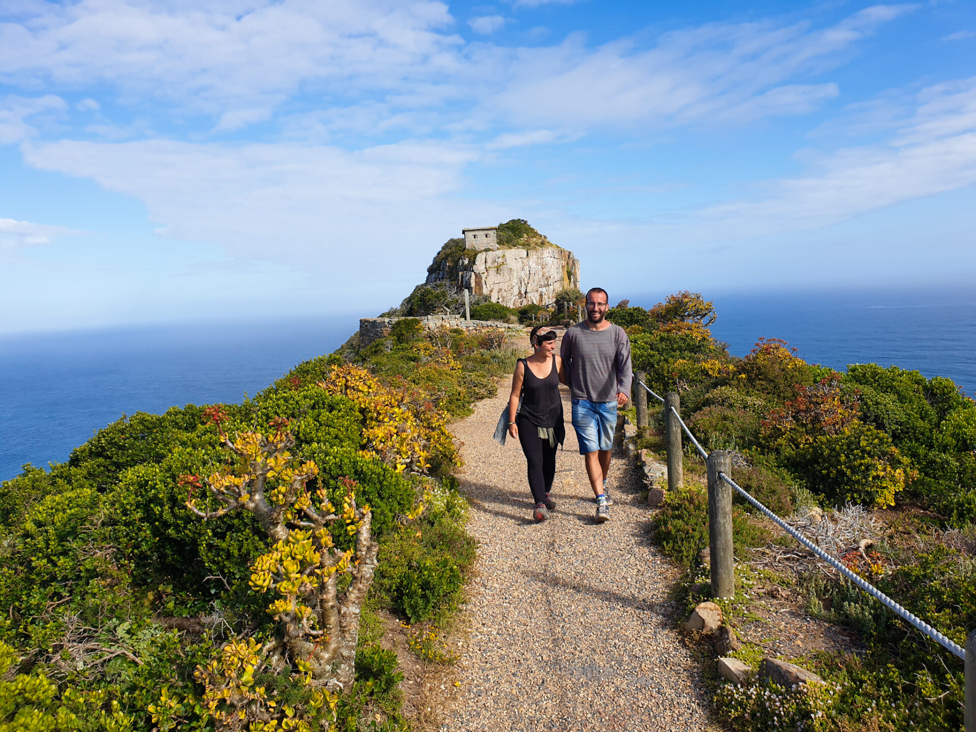
From this sign comes a walkable path that leads to Cape Point Lighthouse. It’s about 2km but with a lot of slopes, so you will need one hour to go and another to return if you leave the car there. We took a short walk to see the views but returned to the car park to drive to the other cape.

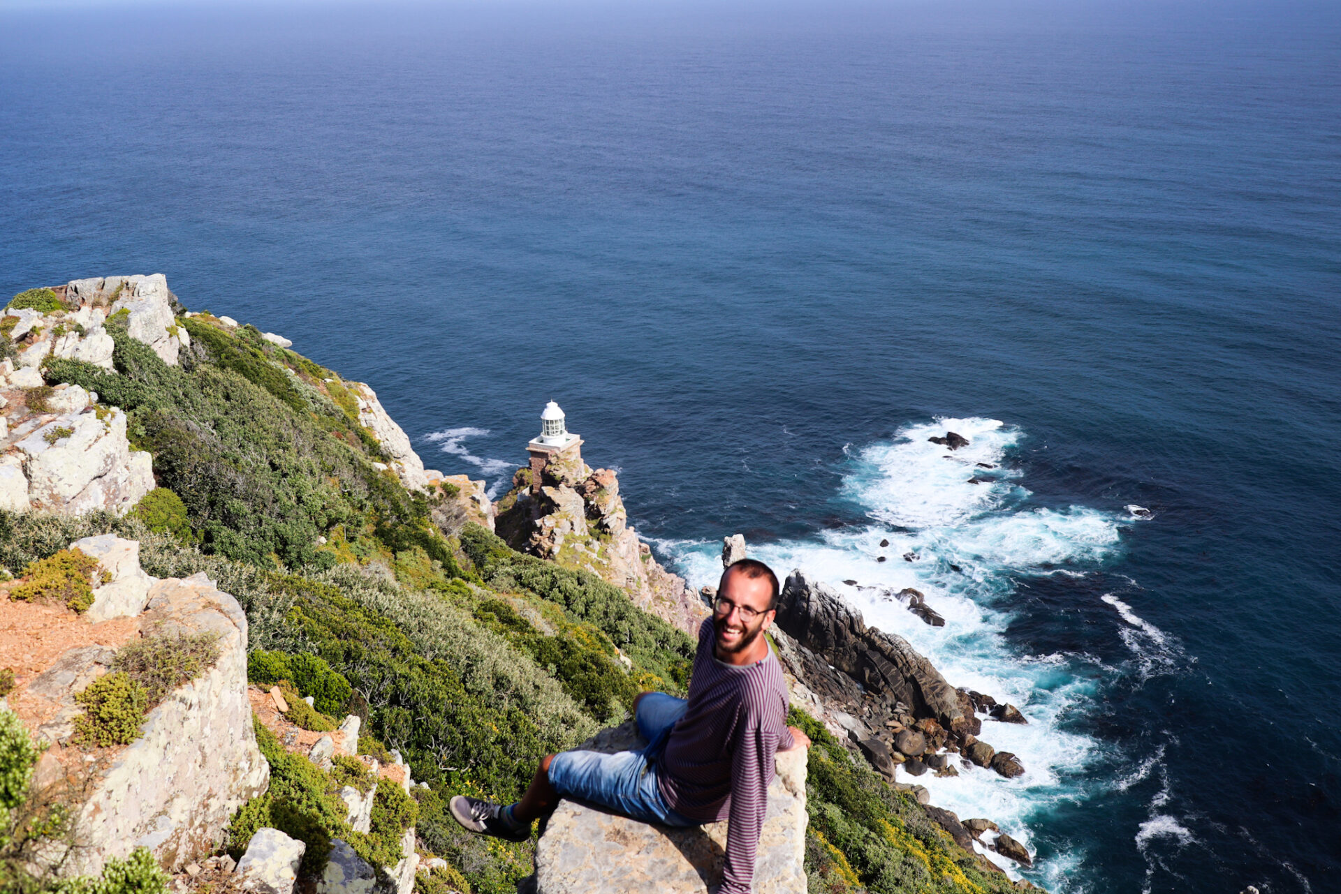
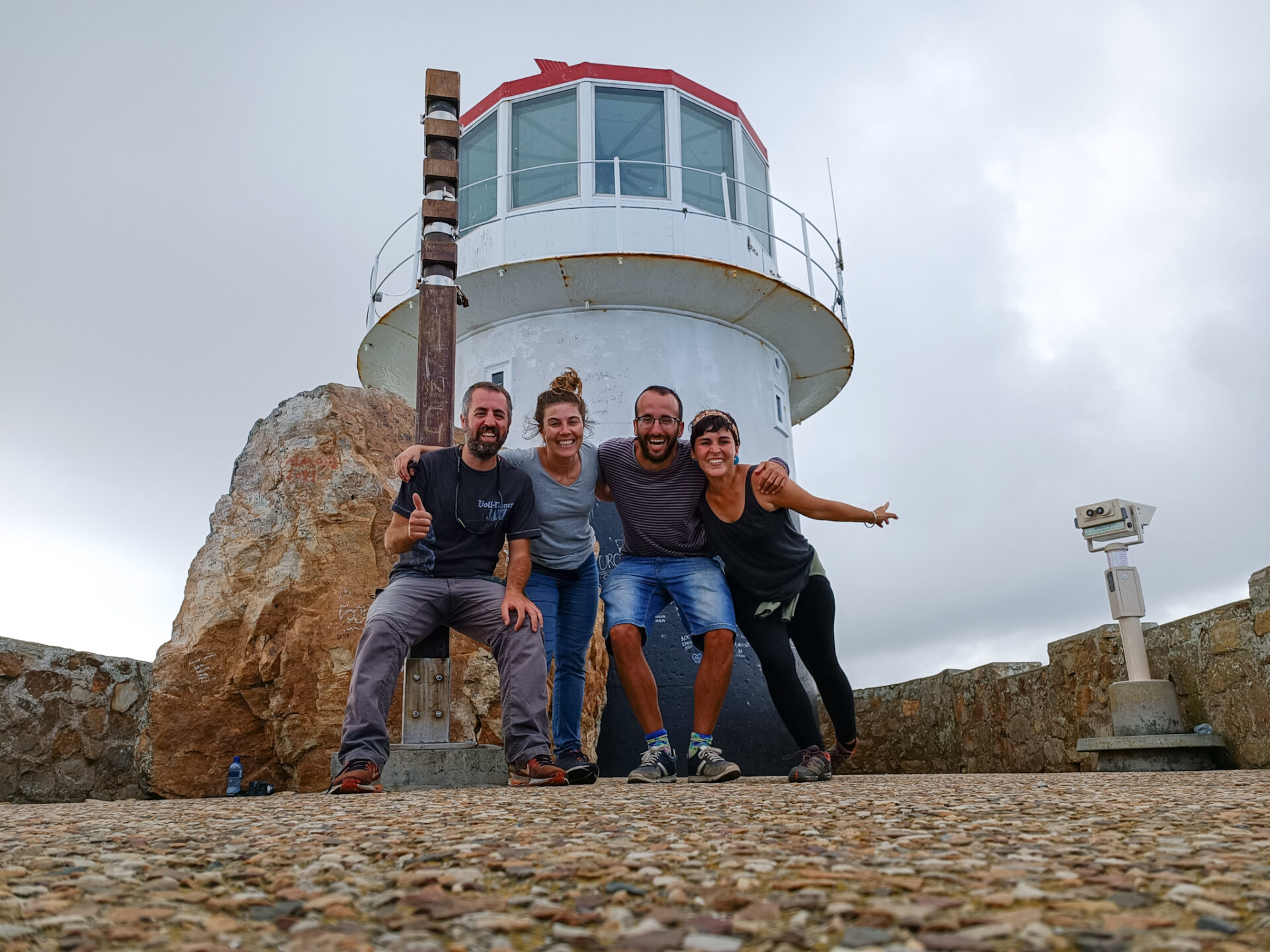
Cape Point is the site of the ancient lighthouse that illuminated sailors during the spice trade. It was put into operation in 1860 at an altitude of 249m above sea level. The problem was that this lighthouse was often covered in fog and clouds, and was ineffective. As a result, a new lighthouse was built 87m above sea level, next to Dias Point, not far from the old lighthouse.

The old lighthouse can be reached by cable car or on foot uphill paths with several viewpoints. Once you reach the lighthouse, you will see a 360º view of the area! An amazing place!
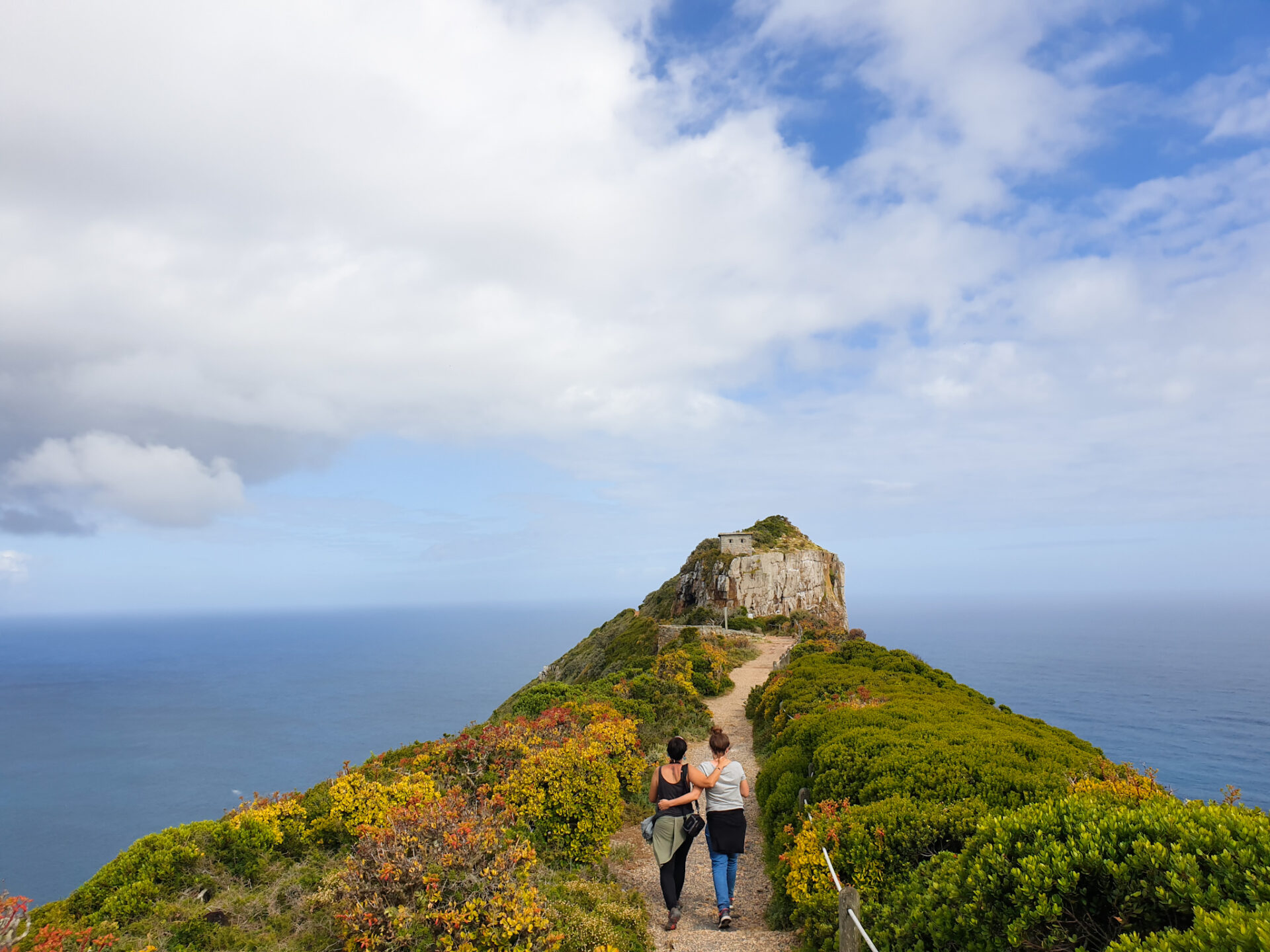
There is also a narrow path to the current lighthouse in operation, at Dias Point, which is just at the end of the peninsula and starts from the old lighthouse keeper’s houses. We recommend that you do it to see and enjoy the surroundings: waves crashing against the cliffs, the endless horizon, sharp rocks, endemic plants of the area… very beautiful!
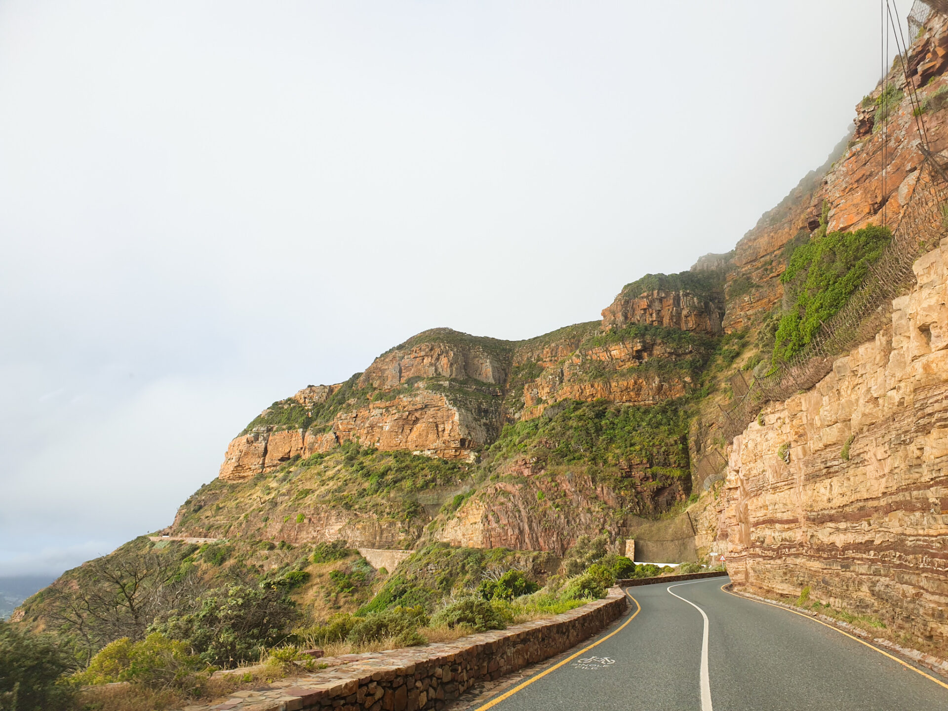
– Drive through Chapman’s Peak Road
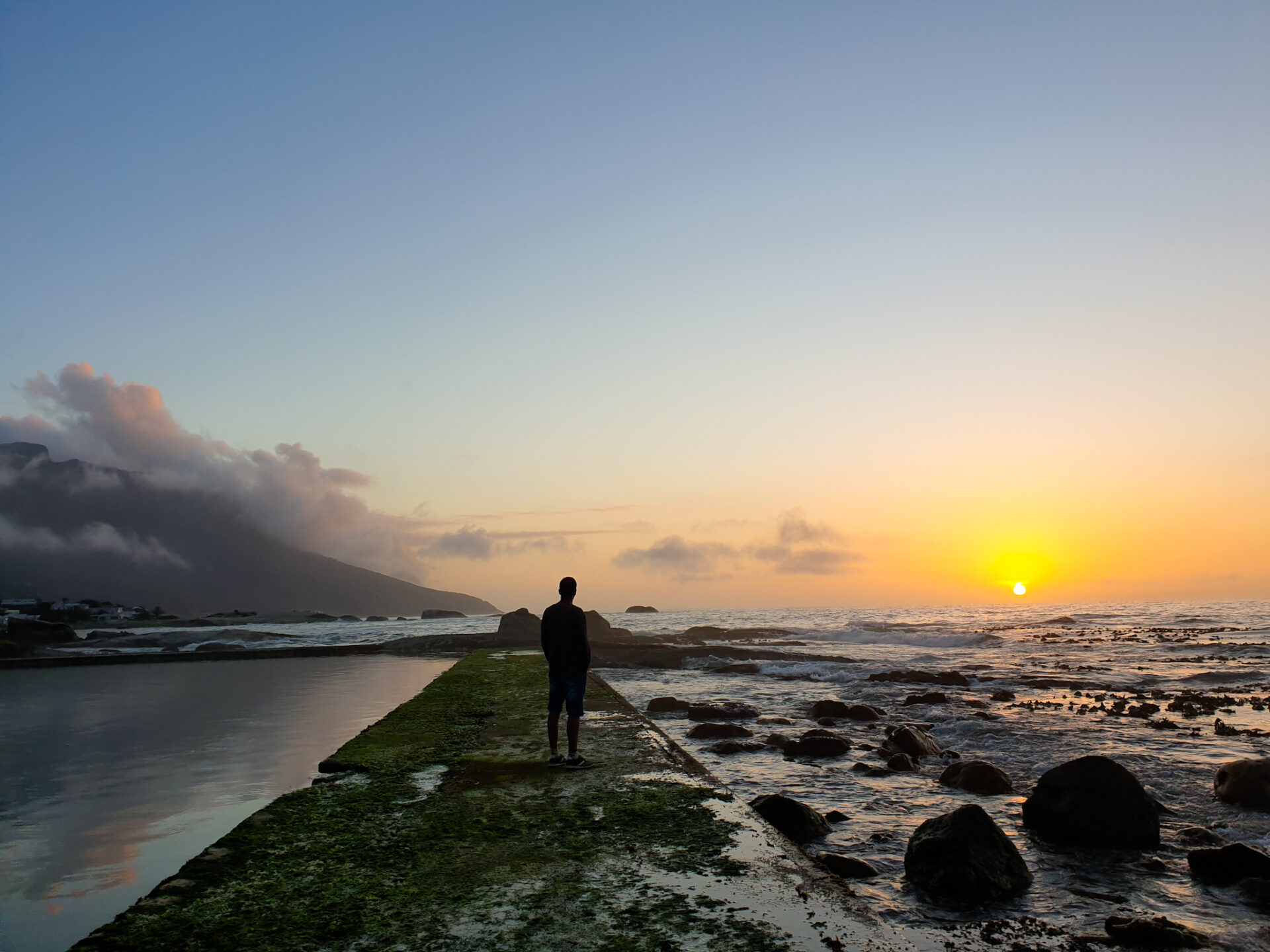
This road passes right next to the coast, through a rocky area with many cliffs. It is a scenic route with beautiful views that runs for about 10 kilometers along the coast of the town of Chapman’s Peak to Haut Bay. This road is also known by locals for barbecues and picnics on holidays or for watching the sunset. You have to pay a toll to go there from 54R per vehicle. You can only pay with cash.
It’s a narrow road, so drive slowly because the views are worth it. It has different viewpoints where you can stop and better contemplate the landscape. We recommend that you do this in the late afternoon, at Golden Hour, when the light takes on orange colors. It sure doesn’t leave you indifferent!
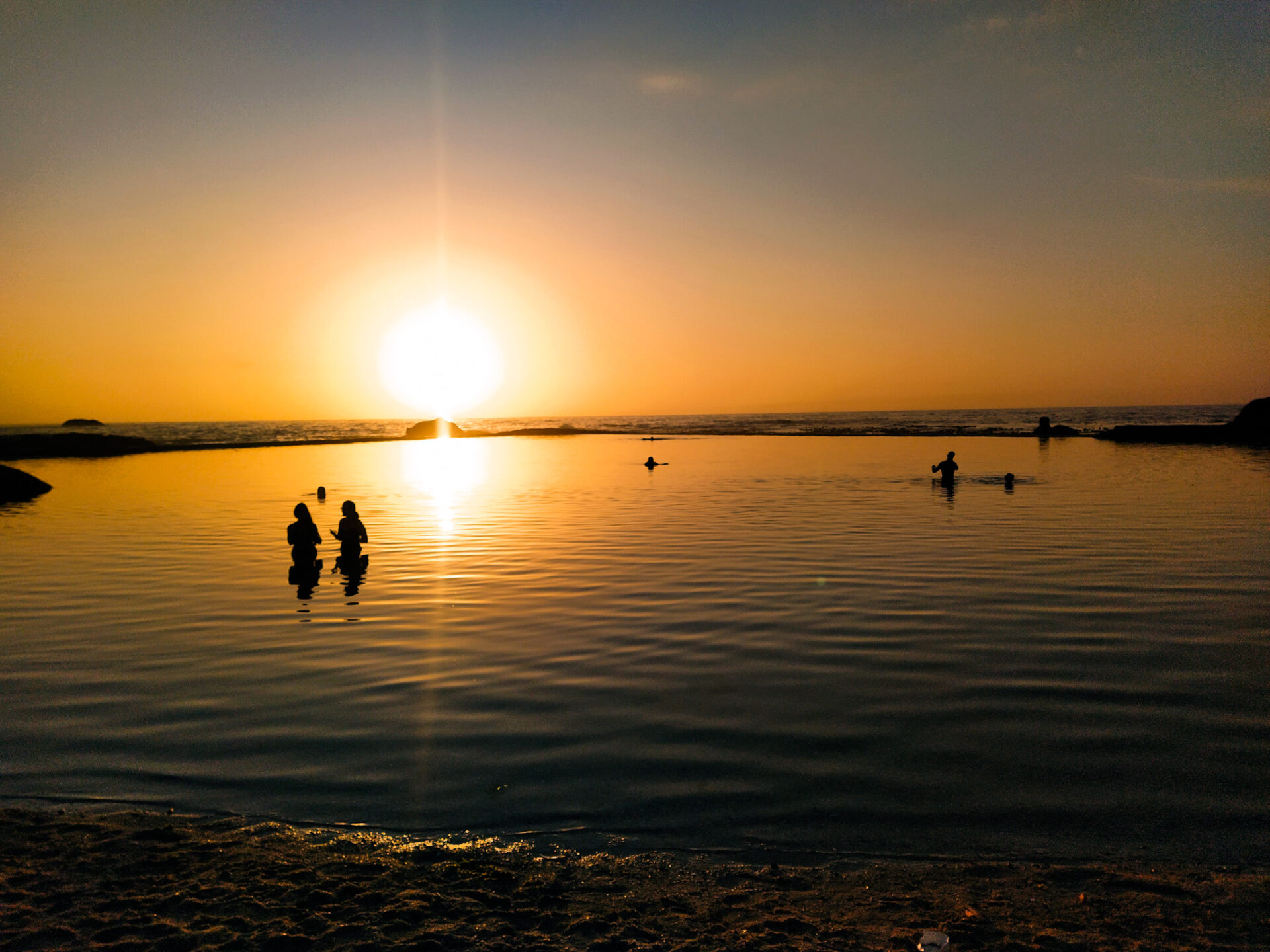
– Watch the sunset from Camps Bay and go to some trendy bars.
Camps Bay is a town close to Cape Town that is trendy among the richest people of the area. Full of luxurious residences, expensive restaurants and bars, people with Ferraris on the streets… it has a beautiful beach and a natural pool by the sea that are worth visiting.
We are not too much of this atmosphere, but we believe that it is also necessary to understand the social differences that exist in the country, and specifically with the different neighborhoods of Cape Town. We went to the beach where there were people swimming, sunbathing, taking pictures with the new model of dress they had bought… full of people so as not to get bored! In addition, we saw a sunset in the natural pool that fills up with the water of the sea at high tide. It’s completely free.
We also recommend that you go for a drink at one of the trendy beaches’ bars, which on Sunday afternoon was full of people dancing!
As you can see, this one-day route is very complete and can be extended depending on the days you have. This peninsula with a great history behind it, has a special charm and many different places that you will not get tired of discovering! A must visit if you are in Cape Town.
0 Comments